Link to:
Photos & Coordinates | Sources
This Winnipeg bridge spanning the Red River is properly identified as the Kildonan Settlers Bridge, or in short, as the Kildonan Bridge. Commonly referred to, incorrectly, as the Chief Peguis Trail Bridge (or simply the Chief Peguis Bridge), it commemorates the pioneers recruited by Lord Selkirk to immigrate in the 1810s to what would become the Parish and eventually Rural Municipality of Kildonan.
Before the construction of this bridge, a ferry enabled local residents to cross the river during the late 1800s and early 1900s. (The ferry was commemorated by the original naming of nearby Ferry Lane, now Whellams Lane.) During the planning of the inner beltway for the City of Winnipeg, consideration was given to using the Canadian Pacific Railway Bergen Cutoff Bridge, but these plans were ultimately abandoned in favour of this more suitable location.
The bridge, initial trail segment, and monument were completed at a cost of $33.5 million. Plans were initiated by the Winnipeg City Council in 1973-1974, with planning and engineering studies continuing in the early 1980s. Construction began on 25 July 1982 and both bridge spans were complete when they were opened officially by Mayor Bill Norrie on 19 October 1990. The roadway, known initially as Route 17, was named for Chief Peguis. The Chief Peguis Trail plaques commemorate the official opening and dedication of the Chief Peguis Trail, originally spanning the distance between Main Street and Henderson Highway, on 1 November 1991.
A drainage outlet included in the project design plans, located at N49.94854 W97.09072, was built in 1988. The former Windmill Creek (later McLeod Creek, now defunct) once led south and east near the Rossmere Golf and Country Club before splitting in two, with one stream heading east through the golf course, East Kildonan Centennial Park, and into the far eastern flank of East Kildonan near Keenleyside Park. A second stream headed further south, running past Lord Wolseley School. Most remnants of the creek are since filled in, though the landscape elevation is still observable in many areas.
Two large commemorative signs flank each end of the bridge, along with smaller signs attached to light standards along both bridge spans, the latter which show the eleven surnames of families who accompanied the 1817 Lord Selkirk expedition: Bannerman, Flett, Jordan, McBeth, McKay, McLean, Matheson, Murray, Polson, Ross, and Sutherland. A plaque on the history of river crossing at this location is situated along the southern pedestrian corridor of the bridge. It lists the names of Winnipeg city council at the time of the October 1990 dedication ceremony: Bill Norrie, Rick Boychuk, David Brown, Bill Clement, Doreen Demare, Bob Douglas, Terry Duguid, Jae Eadie, Larry Fleisher, George Fraser, Ernie Gilroy, Allan Golden, Peter Kaufmann, Harry Lazarenko, Chris Lorence, Christine McKee, Gloria Mendelson, Don Mitchelson, Glen Murray, Mike O’Shaughnessy, John Prystanski, Evelyne Reese, Greg Selinger, Lillian Thomas, Shirley Timm-Rudolph, Donovan Timmers, Alan Wade, Roger Young, and Joseph Yuen.
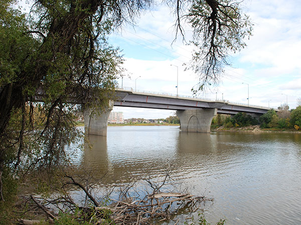
Kildonan Settlers Bridge (September 2015)
Source: Nathan Kramer
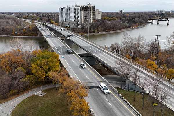
Aerial view of Kildonan Settlers Bridge (October 2024)
Source: George Penner
Kildonan Settlers Bridge commemorative sign (May 2015)
Source: Nathan KramerSite Location (lat/long): N49.95056, W97.09712
denoted by symbol on the map above
“Route named after Chief Peguis,” Winnipeg Free Press Weekly Southwest Edition, 24 February 1991, page 2.
“Councillors lashed for opposing tribute,” Winnipeg Free Press, 10 May 1991, page 9.
“Name game has just begun,” Winnipeg Free Press Weekly Northeast Edition, 21 July 1991, page 5.
“Notice,” Winnipeg Free Press, 5 September 1991, page 9.
“Answers,” Winnipeg Free Press, 5 November 1991, page C24.
“Answers,” Winnipeg Free Press, 15 February 1993, page B5.
We thank John Whiteway and George Penner for providing additional information used here.
This page was prepared by Nathan Kramer.
Page revised: 23 December 2024
Historic Sites of Manitoba
This is a collection of historic sites in Manitoba compiled by the Manitoba Historical Society. The information is offered for historical interest only.
Browse lists of:
Museums/Archives | Buildings | Monuments | Cemeteries | Locations | OtherInclusion in this collection does not confer special status or protection. Official heritage designation may only come from municipal, provincial, or federal governments. Some sites are on private property and permission to visit must be secured from the owner.
Site information is provided by the Manitoba Historical Society as a free public service only for non-commercial purposes.
Send corrections and additions to this page
to the MHS Webmaster at webmaster@mhs.mb.ca.Help us keep history alive!