Timeline...
1880 - 1889

The
World
1882: Thomas Edison builds the first power plant in New York.
1885: Karl Benz patents his first automobile.
1889: The Eiffel Tower opens in Paris.
Canada
In 1885, after long-standing grievances remain unaddressed, Louise Riel
and Gabriel Dumont lead an uprising of Metis in the Saskatchewan River
Valley communities in the Prince Albert - Battleford regions.
Subsequent actions by native groups lead by Big Bear and Poundmaker
create concern in Manitoba communities but relations between settlers
and native people remain peaceful.
Manitoba
On March 2, 1881 – The Manitoba Boundaries Act was passed in
Parliament, providing for an extension of the province’s borders.
The town of Brandon was created in May of 1881 when the site was
selected over Grand Valley as a crossing and divisional point on the
C.P.R. Within a month it is a busy centre and many homesteaders passed
through it on their way into the southwest region.
|
|
Homestead
Regulations are eased to attract more settlers. Three options
existed:
1. Three year’s cultivation and residence – with the settler not absent
for more than six months in any one year.
2. Taking up residence for two years and nine months within two miles
of the homestead and then afterwards residing in a habitable house on
homestead for three months at any time prior to applying for the
patent. With 10 acres to be broken in the first year, 15 in the second,
and 15 in the third.
3. A five year system that allowed the settler to live anywhere for the
first two years as long as he began to cultivate the land within six
months and build a habitable house.
1883:
An act of the legislature set up 4 municipalities within the
County of Souris River, including Arthur.
Arthur included Ranges 27,28 & 29; townships 1,2, and 3.
Powers given allowed municipalities to bonus industries and railways by
cash donation and by tax exemptions for a number of years.
1884 : In 1884 the Province was divided and organized into separate
Municipalities.
|
Turtle Mountain
& the Souris Plains
1880
A group from Ontario settled near where Boissevain would later be
located. Among these early settlers was George Morton.
In 1880 Mr. Bolton established a sawmill on the shore of Lake Max. The
next year, entrepreneur George Morton bought the sawmill and used it to
produce lumber for nearly every building in the then thriving village
of Whitewater. Morton also built a planer where logs could be cut into
boards.
A Dominion Land Office opened on the Commission Trail.
Turtle Mountain Land District was the first administrative unit for the
southwestern Manitoba. It was administered from the Turtle Mountain
Land Office with George F. Newcombe as agent, and a Mr. W.H. Wood as
assistant. The site, southeast of Deloraine became known as Newcombe’s
Hollow.
A group of Ontario settlers started the settlement now known as Old
Deloraine just north of the Dominion Land Office.
Alfred Gould arrived at Sourisford in May of 1880. He later built and
operated a store.
The site the pioneers refer to as Old Desford was one of the first
stopping places on the Boundary Commission Trail. It started as general
store and post office owned by E. Nichol and Son. For some time, along
with Wakopa and (Old) Deloriane, it was one of the few places for
pioneers to get supplies.
It was also the site of one the first sawmills. Lumber from Fox’s mill
was used to build the first houses and business places in Boissevain.
1881
In June of 1881 John Fee & Samuel Long were the first settlers to
reach the Hartney district. They were able to break some land before
winter when they left to find work, John in Brandon and Sam in Winnipeg.
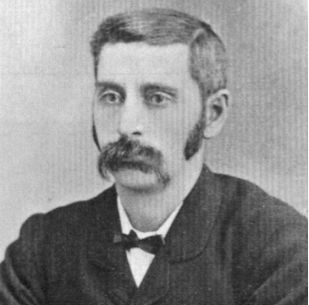 Samuel Long
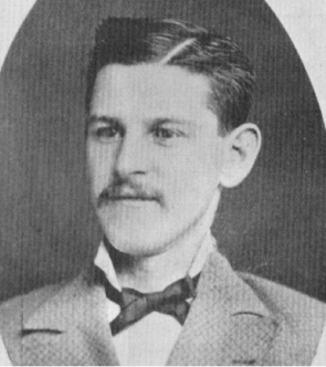 John Fee
1881
William Roper, with sons Benjamin & James are the first to
spend winter in the Hartney area.
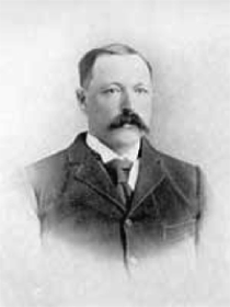 James
Hartney
James
Hartney
James Hartney purchased a farm from the CPR (9-6-23) in
1881.
In June of 1881 the Reverend L. O. Armstrong from Emerson, Manitoba,
put up a store and stopping place where the Boiler Trail fords Waubeesh
Creek just south of Whitewater Lake. In 1882 the Turtle Mountain City
post office was established on this site.
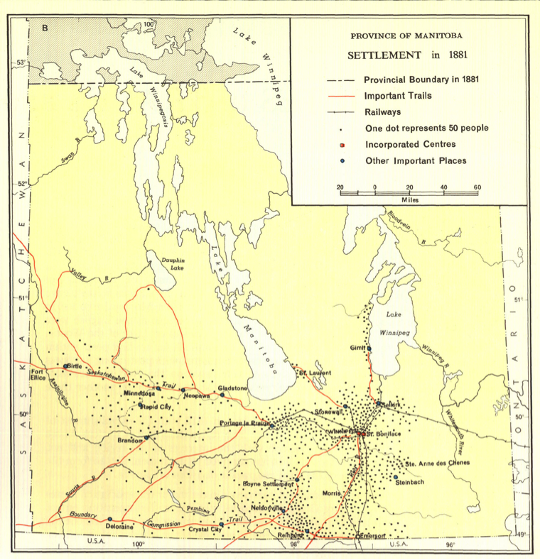
This 1881 map shows that the
region was just beginning to attract
settlement in 1881.
Weir,
Thomas R. [Settlement 1870-1921] [map]. 1:3,041,280. In: Thomas
R. Weir. Economic Atlas of Manitoba. Winnipeg: Manitoba Dept. of
Industry and Commerce, 1960, pate 13.
(Warkentin
and Ruggles. Historical Atlas of Manitoba. map 153, p. 332
Homesteaders in the Melita area
included Edward Sterling, John Dobbyn
with son Richard John.
A large
display ad in the Winnipeg Daily Sun offered lots for sale in
Manchester (Melita), the “Great Manufacturing Town of the North-West”
1882
By July of 1882 George Morton had begun operations at his Dairy Farm on
the northeast corner of Whitewater Lake and his sawmill at Max Lake
In 1882 the federal government, without notice, withdrew even numbered
sections south of the main CPR line from eligibility for homesteads and
preemptions. This surprised many who arrived at the Turtle Mountain
Land Office, and caused many to go south into the U.S.
Rev. A.D. Wheeler conducted the first Church Service in the Melita
district in Alf Gould’s house on the first Sunday in August, 1882.
A Post Office established at Sourisford in 1882 remained operational
until the railway arrived at Coulter in 1903.
The first Sourisford Pioneer Picnic was held.
Dobbyn City, a bit east of the current town at (32-3-26), was promoted
by owner John Dobbyn, and lots are offered to speculators. It was one
of dozens of speculative townsites in Manitoba during the Manitoba Boom
of 1881-82. Ads offering lots appeared in Winnipeg papers in
March of 1882.
The Manchester Town plan was registered. Plan #2 – Souris River
Registry, March 28, 1882. It had to be re-named as that name was taken,
then moved about two kilometres to be on the new rail line. We know it
as Melita.
In 1882 Sam Heaslip received a contract for mail delivery from Brandon,
to points south in the Turtle Mountain region. His home became the site
of a stopping house and store with
post office named after him.
1883
Most of the desirable sections in the Hartney are were taken
R. Graham opened a store and Post Office in Manchester.
An act of the legislature set up 4 municipalities within the County of
Souris River, including Arthur.
Powers were given allowed municipalities to bonus industries and
railways by cash donation and by tax exemptions for a number of years.
The Land Office moved from Deloraine to “Souris” a would-be town
located on NW 26-2-27. The Office was later moved to NW 34-2-27
and then to Melita in 1891
1884
James Hartney made an application for a Post Office at his farm. A
separate building was put up which soon housed a store as well.
His farm became the centre of the community. Hartney became the name
for district long before a village was established..
The Butterfield Post Office and Stopping House house on the Boundary
Commission Trail southwest of Pierson, was operated by the Dann family.
1885
In 1885 when the Manitoba and North Western Railway approached Cherry
Creek and announced that they would erect a station at that point, a
town site appeared almost literally overnight.
George Morton moved his general store from the earlier location of
Wabeesh, in the Whitewater area, to the new town site of Boissevain,
where other buildings, both commercial and residential were springing
up.
1886
The Pembina Branch of the C.P.R. reached Deloraine.
Several prairie fires marked the fall season
A large buffalo was spotted near Menota (Melita area) and chased by
would be hunters.
The Village of Whitewater was established
1887
Deloraine was established on the CPR line. Buildings from the previous
settlement were moved to the new location.
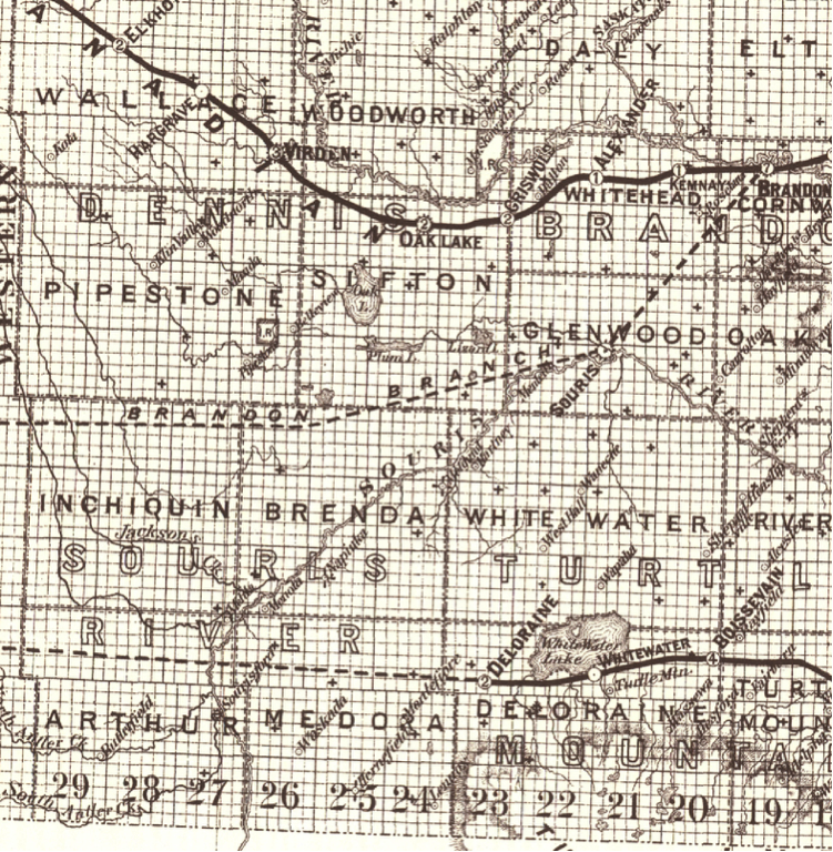
This maps showing actual and proposed rail lines illustrated the
situation in 1887. Settlers in the Hartney region have been promised a
rail line and are waiting patiently. Note that in the 1887 map
Hartney is to be bypassed..
H'damani and a few followers refused to move to the Oak Lake Reserve
when it opened in 1877, so the government finally gave in and the
Turtle Mountain Reserve (#60) was established. It was the
smallest reserve in Canada, measuring only one square mile.
1888
A.M. Campbell, a photographer, was elected Member of Legislature for
the Arthur area.
The Livingston Ferry was established on Dr. Livingston’s farm just east
of Melita
The Parrish of Grande Clairiere wasestablished bt Father Gaire.
1889
In Boissevain Preston and McKay built a substantial four-storey Flour
Mill of local limestone which proved to be an important boost to the
local economy.
A Pioneer Association was formed at Sourisford with Alfred Gould as
President.
Mr. Ducker of the CPR visited Melita to examine the site for a new town.
|
|
