by William Barr
Arctic Institute, University of Calgary
Number 38, Autumn / Winter 1999-2000
|
The name of Dr. John Rae will always be remembered for his discovery in the Arctic of the first oral accounts and the first tangible evidence of the fate of the missing Franklin expedition, for his reputation as an incomparable walker, on snow shoes or on foot, and for his explorations of Melville Peninsula, Committee Bay, Pelly Bay and the southern and eastern coasts of Victoria Island. Less well known, however, is his impressive journey across what would later be Canada in 1864 for the purpose of surveying a telegraph line from St. Paul, Minnesota north to Fort Garry and west to the Pacific.
This survey was the end product of a chain of events initiated in 1861 by the appointment of Sir Edward Watkin, an English railway promoter, by the directors of the Grand Trunk Railway of Canada to reorganize that faltering enterprise. [1] Even prior to this appointment in February 1861, he had published in the Illustrated London News an article promoting the advantages of a rail link from Canada to British Columbia. Watkin travelled to Canada in the summer of 1861 to assess the situation of the Grand Trunk Railway; prior to departing he had established a sound working relationship with the Colonial Secretary, the Duke of Newcastle. On his return to England in the fall the two men agreed that the building of a Pacific railway should be achieved as quickly as possible, but that in the interim a road and telegraph line should be built across the continent. [2]
Inevitably, of course, such a scheme involved negotiations with the Hudson’s Bay Company. The western boundary of Upper Canada lay just west of the Lakehead, and everything from there to west of the Rockies was still Rupert’s Land, nominally the territory of the Company. Initially the negotiations with the Company’s representatives concerned only the sale of a right of way for a railway and a telegraph line, but by November 1862 the concept of an outright purchase of the entire Company was being seriously considered; the figure being discussed was $1,500,000. This quickly led to the purchase of the Hudson’s Bay Company by the International Financial Society on 15 June 1863; [3] and in its new form the Hudson’s Bay Company was reorganized under the governorship of Sir Edmund Head.
Watkin was now able to proceed unhindered with his plans for a railway and telegraph line. As to the latter topic he consulted extensively with Mr. O. S. Wood, superintendent of the Montreal Telegraph Company, [4] and reputed to be one of the most knowledgeable men in the field in North America. In August 1863, however, Sir Edmund Head and the Committee of the Hudson’s Bay Company made it very clear to Watkin that they felt he was proceeding at an unacceptably reckless pace. On 26 August, Watkin submitted his letter of resignation to Sir Edmund Head. [5]
Nonetheless, Sir Edmund and the Committee of the Hudson’s Bay Company could see that there were clear advantages to be gained from controlling a telegraph line from Canada to British Columbia, which would link, at the same time, all the Company’s major posts, and they therefore decided to proceed with construction, but at their own pace. The first prerequisite was a survey of an appropriate route, and for this task they called on Dr. John Rae. He had resigned from the Company on 14 April 1856, [6] but in the interim he had not been idle. On 23 February 1857 he appeared before a Select Committee of the House of Commons to give evidence at an enquiry into the activities of the Hudson’s Bay Company, whose licence was due to expire in 1859. His evidence was staunchly supportive of the Company. [7] Later in 1857 Rae settled in Hamilton, Ontario, which was his base for the following three years. In January 1860 he married Catherine (Kate) Thompson in Toronto, [8] but as a married man he still managed to make some extensive trips.
In 1859 the Atlantic Telegraph Company was established with a view to laying a trans-Atlantic cable from Britain to America which would leap-frog across the Atlantic from the Orkneys to the Shetlands, Faeroes, Iceland, Greenland and on to Labrador. The Hudson’s Bay Company was involved in this enterprise and Rae was engaged to survey the overland sections of the route. Travelling in the yacht, Fox, he and some companions investigated the routes across the Faeroes and Iceland. Reaching Greenland in October Rae and a companion made a short foray onto the ice cap from the Julianehab (Qaqortoq) area while a survey of the fiord was being made from the yacht. No attempt was made at crossing the ice cap, however. [9]
Dr. Rae’s 1864 route from St. Paul to Fort Carleton via Fort Garry
In the following year Rae made another extensive trip. He accompanied Henry (later Viscount) Chaplin and Sir Frederick Johnstone on a hunting trip to the prairies of what is now southern Saskatchewan. [10] Starting from Fort Garry they ranged as far west as Old Wives and Chaplin lakes and the confluence of Swift Current Creek with the South Saskatchewan River. The sportsmen shot bison, elk, and pronghorns.
Dr. Rae and his wife, Kate, left Liverpool on board the steamer Persia on 7 May 1864 and reached New York on 19 May. [11] In New York Rae called at the offices of Maitland, Phelps & Co, agents for the Hudson’s Bay Company, and took delivery of $250 ($200 in notes and $50 in gold) to cover the expenses of their trip as far as St. Paul. [12] This transaction had previously been arranged by Thomas Fraser, the Company’s London secretary. [13]
The Raes next travelled north to Montreal to consult with Mr. O. S. Wood, [14] since the Company’s officers were neophytes when it came to things telegraphic. Wood had received plenty of warning, since Thomas Fraser, Sir Edmund Head, and Edward Hopkins, the Chief Factor at Montrealhad all communicated with him on the matter. [15] The main points on which Rae was to consult with Wood were:
1st - the kind of timber to be selected for poles; 2nd - the length, strength, size, etc. of the poles; 3rd - the period of the year at which they ought to be cut; 4th - the number of poles per mile to be provided; 5th - such general instructions as Mr. Wood may think desirable with a view to the preparation beforehand of the materials necessary for the construction of the telegraph. [16]
He was also to consult with Mr. Wood on the matter of insulators. The Board had heard that the insulators used in Canada were of a special type “made to resist the rigours of the Climate in high latitudes” and were made in Canada. [17] If this were the case, a quantity of these insulators was to be purchased and forwarded during the autumn to Mr. Norman Kittson in St. Paul, to be forwarded to Red River in the spring.
The Board, in the meantime, had placed an order in Britain for a quantity “of the very best charcoal or homogeneous wire,—galvanized but of a soft or pliable kind—Gauge No. 10 for the telegraph.” [18] Some of it was to be sent out via the Company’s ships to York Factory on Hudson Bay, to be forwarded inland from there by York boat to Norway House and Fort Garry; some was to be sent to Montreal to be forwarded via Lake Superior to St. Cloud on the Upper Mississippi.
Among the advice which Rae received from Mr. Wood was a recommendation which nowadays seems rather strange, namely that, where convenient, the wire should be hung on live trees:
that growing timber (Poplar in particular) may be made available for telegraph poles, and that wherever this is practicable by making a circuit that increases the distance a mile or a mile and a half in ten, this plan shall be carried out. [19]
Upper Fort Garry, 1872.
Source: Hudson’s Bay Company Archives
Accompanied by his wife and his assistant, Mr. A. W. Schwieger—a gentleman with great experience with railway surveys who had been highly recommended, and who had now joined him—Rae left Montreal by train on the evening of 23 May for Toronto, Detroit, Chicago and La Crosse, Wisconsin on the Upper Mississippi. From there they took a stern-wheeler upriver to St. Paul, Minnesota. They reached St Paul on 29 May, a few days later than Rae had anticipated, in part due to delays at Toronto, in part to the slow progress up the Mississippi due to low water. [20] Governor Alexander Dallas, the Governor of Rupert’s Land, arrived from Fort Garry the following day; it had been anticipated that Rae and party could use his horses for the trip north to Fort Garry, but the animals were worn out and hence Rae abandoned this idea. Instead he bought new animals (at an average price of £18). In this he was partly guided by the news that horses were scarce and expensive at Red River. He also bought two wagons and two Red River carts.
The carts and wagons were sent on ahead via Crow Wing. Meanwhile, Rae, Mrs. Rae and Schwieger made final arrangements at St. Paul, then took the stage north to Crow Wing. On 8 June the little cavalcade of wagons and carts started west from Crow Wing on the Mississippi. [21] The trail they used followed approximately the line of present-day US Highway 10, through Wadena and Detroit Lakes, then down the Red River valley to Pembina and Fort Garry, where they arrived on 15 June. Rae stressed that this was very rapid progress, the normal time for the trip from Crow Wing to Fort Garry being 10 days, but that he had been forced to hurry by circumstances.
It had not been my intention to push on so rapidly, but the state of the country in consequence of the extreme dryness of the season and the prairie fires was such, that we had difficulty in finding pasture for our horses. The small quantity of grass that had escaped the fire was either consumed or in process of being consumed by the grasshoppers which were extremely numerous.
I had passed by the same road some years ago but the country was now so changed in appearance by the want of rain that I would not have known it for the same. Lakes that had been miles in extent were now perfectly dried up. Rivers that had been almost too deep to ford contained now only a few inches of water. The soil was parched up and cracked in every direction, and for 100 miles before reaching Pembina we rode through a desert of burnt and burning prairie over which clouds of smoke, dust and ashes were carried before a brisk gale in such dense masses that frequently it was impossible to see the horse I was driving in the waggon. [22]
In keeping with his instructions Rae kept a fairly detailed record of the nature of the vegetation along the route, with an eye to possible sources of telegraph poles. Typical of this “forest survey” is the following:
On the 11th June our road for 16 Miles passed through a very fine prairie with clumps of small poplars and stunted oaks in the distance. We then passed through 11 Miles of well timbered country—oak, elms, ironwood and maple of a good growth being abundant. This piece of fine rich land ends at Detroit Lakes. [23]
Rae summarized the vegetation on the section of the route in a table, ending with his estimate that the 417 miles from St. Cloud to Fort Garry would necessitate 9908 poles at 24 poles per mile to support No. 10 wire.
Although it was apparently peripheral to his mandate Rae enclosed with his report to Thomas Fraser in London, notes summarizing Schwieger’s survey of the requirements for building a railway over the same route. He itemized the amount of earth to be excavated on each section (in yards per mile), the number and lengths of bridges required, and the availability of stone, timber and materials for building such a railroad line. Of interest, in view of the recent history of floods on the Red River, is Schwieger’s assessment that due to the frequent floods, bridging the Red River would be exorbitantly expensive: “It would appear to me most advisable to cross the River by means of a ferry,” he wrote. [24]
Rae and his party spent a week at Fort Garry making final preparations for their trip westwards, with the ready assistance of Chief Factor William Mactavish. Rae hired six men: George McKay, John Ross, Kenneth Mackenzie, Joseph McDonald, William Monckman and George Morrison. [25] The first three were to go only as far as the Rockies, from where they would return with Schwieger. The remaining three would accompany Rae for as long as he needed them. At Fort Garry Rae replaced the horses he had brought north from the States for local animals since he thought the former might not be hardy enough for the task ahead.
One of the more intriguing aspects of Rae’s sojourn in Fort Garry was his interaction with the local Indians. He first received a letter from the three most influential men among the local Saulteaux, asking him to meet with them. This meeting occurred next day at the Court House and was attended by about 60 Indians led by Panaasay (“the Orator”). The latter asked for an explanation of the purpose of Rae’s survey. The latter informed them
that we were about to examine their lands as to their fitness for a telegraph route, and that if found suitable for the purpose a telegraph would be put up. That I had no authority to make any treaty with them on the business, but that I had no doubt but that as long as the wires were left uninjured some presents or payments would be annually made to them, the amount of which I could not specify. That the Telegraph was not meant to injure them, and that it was better for their friends the English to put it up, than for the Big Knives (Americans) to come into the country and do so. [26]
Fort Ellice, 1859. Rae reached the post on 3 July 1864.
Source: Hudson’s Bay Company Archives
The Orator responded with a lengthy speech, and the meeting ended with the distribution of presents of provisions, ammunition and tobacco, on the advice of Mr. Mactavish.
Rae and Kate parted company at Fort Garry. The latter headed north by the usual route to York Factory, and sailed from there for England on board the Company’s ship, Ocean Nymph on 20 September. [27] She reached London on 22 October.
Rae and his party, which totalled eight men, left Fort Garry with one wagon, three Red River carts and fourteen horses on the morning of 25 June. [28] The first day’s leg took them to the Company’s farm at Lane’s post on White Horse Plains (a distance of 23½ miles). By noon the third day they were within one and a half miles of the post at Portage la Prairie (fifty-nine and a half miles from Fort Garry). To this point timber for poles posed no problem:
Poles of oak, elm or ash can be easily obtained at the several bends of the [Assiniboine] river, and the distance that these will have to be hauled or carried should in no instance exceed 2½ or 3 miles. [29]
From Portage la Prairie, Rae had the option of two routes: the one followed by the Red River buffalo hunters west to the rapids on the Assiniboine at Brandon, then north along the left bank of the river to Fort Ellice, or the more direct route via the White Mud River and across the Little Saskatchewan to Fort Ellice. Leaving the latter route to be examined by Schwieger on his return trip Rae took the longer route, more closely following the Assiniboine. As far as Pine Creek (which the party probably crossed in the vicinity of the present settlement of Melbourne, Manitoba) Rae found adequate timber in the “numerous bluffs of Poplar to the south or left of the track, Oak on the Rat River, and some pines among sand hills near Pine Creek.” [30] Beyond Pine Creek, in part due to the sandy soils and in part to numerous recent fires, there was little useful timber. All Rae could find was burned timber and stunted poplar (aspen).
Even when he reached the Assiniboine again, Rae found that little useful timber had survived recent fires. Hence he abandoned the idea of bringing the telegraph line by this route and to save time, after crossing the Little Saskatchewan, Rae cut straight across country over the prairies to Fort Ellice, opposite which he camped on 3 July.
From Fort Ellice he continued north to Fort Pelly, following the usual cart track on the right bank of the Assiniboine. Here the local timber was not particularly suitable: Rae estimated it at five suitable growing poplars per mile. On the other hand he found abundant spruce (or pine, as he called it) and larch along the Assiniboine both above and below Fort Pelly, which could be cut and rafted south down river. Good spruce was similarly available on the upper Birdtail and Little Saskatchewan rivers on Riding Mountain, and could similarly be rafted south to the line of the telegraph.
The survey party spent the night at Fort Pelly, where Rae commented on the fine, deep black loam, the luxuriant vegetation, and the fine crops of barley and potatoes. On the 8th he and his men headed west towards the Old Fort in the Touchwood Hills. For the first twenty miles there were both spruce and poplar available for poles, but thereafter the spruce disappeared and the poplar (aspen) became fewer and smaller.
Following the Carlton Trail, Rae and his men next headed northwest to Fort Carlton. Rae was quite dismayed at what he saw on this stretch of the proposed route, some parts of which—for example, southwest of the Quill Lakes are still discouragingly desolate:
From Touchwood Hills to Carlton is the worst part of the road we have yet travelled over for Telegraphic purposes. There is little timber, and for 30 miles none of any kind except a few small poplars and willows (much of them burnt); water is scarce and bad, and the soil is thin, light and poor, over gravel, mud and clay. I am at a loss to say where poles could be most easily obtained for this part of the route. The nearest pines I could hear of, are on the North Saskatchewan 7 miles below Carlton which would be available for the 18 miles of way between the South Branch Ferry [at Batoche] and Carlton but it would be great labour and expense to haul wood from thence to the prairies 40 or 50 miles distant. [31]
The party reached Fort Carlton on the evening of Saturday, 16 July. They rested on the Sunday, then crossed the North Saskatchewan and continued their march on 18 July. The section from here to Fort Pitt was almost as bad as the previous section in terms of potential telegraph poles; only along the last eight or nine miles before Fort Pitt were there a few small groves of spruce near the North Saskatchewan River.
At Fort Pitt Rae divided his party into two. Schwieger with the wagon and carts and four men took the usual cart trail south of the river to Fort Edmonton while Rae with two men and pack-horses stayed on the north bank of the North Saskatchewan. [32] In contrast to the previous section Rae found the section from Fort Pitt to Fort Edmonton to be
the most favorable I have yet seen for the construction of a Telegraph. Throughout the whole distance the soil is both rich and deep, bearing a crop of the most luxuriant grass and flowering plants I have ever seen. In many places these attain a height of 2 to 4 feet and the wild pea or vetch is very abundant. [33]
Fort Pelly, undated.
Source: Hudson’s Bay Company Archives
From Fort Pitt to Victoria Mission (south of the present town of Smoky Lake) there were numerous clumps of spruce and larch along the river, with abundant aspen bluffs between. Rae found Victoria Mission (a Protestant establishment founded the previous year by Mr. McDougall) to be a flourishing enterprise: “the crops of wheat, barley, potatoes and turnips look as well as the finest crops I have ever seen anywhere and some small plots of ground planted and sown by the Indians will produce a fair crop.” [34]
The timber situation continued to be promising for a further fifty miles to the west, “growing trees either of pine or poplar at an average of 18 or 20 to the mile may be found near the track, so that only from 4 to 6 poles per mile will have to be cut and set up.” [35] Thereafter, for the last thirty miles to Edmonton, the situation was less favourable, with only three or four suitable trees per mile. Schwieger’s report of his route farther south was generally not very favourable. The first half of the distance from Fort Pitt to Edmonton was devoid of trees; for the next half there were some spruce and larch but nowhere in large numbers.
Rae and his men reached Fort Edmonton on the morning of 28 July, as did Schwieger and his party that evening. In his letter to Fraser, Rae took the opportunity to summarize his recommendations as to the route up to this point, as seen in reverse. From Fort Edmonton to Fort Pitt the route should follow the north or left bank of the North Saskatchewan, although for the first half this would require some improvement of the trail which was still just a packhorse trail. From Pitt to Carlton the telegraph should follow the river bank of the North Saskatchewan all the way:
as there is abundance of Pine and Larch both above and below Fort Pitt that could be cut, floated downstream, and landed in small rafts of 25 or 50 poles as might be required. The going by the River could, as far as I can judge, increase the distance fully a third but this disadvantage would be made up by the greater convenience of the river transport, particularly if steamers come into use. [36]
To avoid what he perceived as the worst part of the whole route, from Carlton to Fort Pelly, Rae recommended that the telegraph line should follow the north bank of the North Saskatchewan all the way from Carlton to Fort a la Come, cross the river there, then head southeast across country to Fort Pelly since this latter route was “known to be better wooded and watered than the road from Carlton to Touchwood Hills.” [37] From Fort Pelly Rae proposed running the line “along the south foot of the Duck and Rising Mountains, keeping to the north of the Little Saskatchewan and White Mud rivers until it is requisite to cross the latter near to where it falls into Manitoba Lake.” [38]
At Fort Edmonton Rae made a number of arrangements for his future progress westwards: the horses had to be changed and pack saddles had to be acquired, since carts could be used for only a further two days’ travel westwards. And finally he had to wait until 1 August to consult with Chief Factor William J. Christie who was away from the post until then.
Rae was favourably impressed by the appearance and potential of the area around Fort Edmonton:
Viewing this District as an agricultural and grazing Country I have no hesitation in saying that nothing can be much finer than its present appearance. Where ever I turn there is a thick and beautiful crop of high grass, and flowering plants several feet in height, and the Vetch or Wild Pea in many places so thickly matted together that it is difficult to make way through it. The wheat, barley, peas and potatoes look nearly as well here as they did at the [Victoria] Mission already mentioned, and about 1000 bushels or more are expected from this year’s crop of wheat. [39]
On the basis of this assessment he recommended that the Company increase its wheat production at Fort Edmonton in order to be able to provide Company personnel with a mixed ration of flour and meat instead of the solely meat ration of eight pounds per day.
For the next section of the route Rae hired a Métis guide, Louis Campbell, who usually spent the winter hunting and trapping in the Rockies, and was about to head westwards with his family. [40] Schwieger set off with the cart and wagons on 1 August; Rae followed next day having waited in vain for Christie to arrive. He overtook the rest of the party at Lac Ste. Anne. Along the way he stopped at St. Albert to visit Father Lacombe’s new mission. There he was,
most hospitably received by that gentleman, who seems remarkably well fitted for the work he is employed upon. St. Albert is a new settlement along the Sturgeon River, having been begun only 3 years ago, yet a considerably large farm has been broken out, and is under cultivation, on which very fine crops of wheat, barley, rye, buck wheat, Turnips, potatoes, cabbages, beet and other vegetables were growing. Pigs were also reared and appear to thrive wel1. [41]
Rae was also impressed by the crops at the Hudson’s Bay Company post at Lac Ste. Anne and the person in charge reported that the crops had been destroyed by frost only twice in twenty years. Another useful resource of the area was the excellent whitefish that could be taken from the lake, although the catch had recently decreased, the result of the resource needs of both the Company and the settlers in the area.
The wagon and carts were left at Lac Ste. Anne. In the light of reports of the poor state of the trail ahead, Rae had increased the number of horses to twenty; the party’s baggage was now broken down into appropriate loads to fit on pack saddles. The cavalcade of horses got under way on the 3rd. Immediately Rae discovered what was to be a most irritating feature of the trail from here onwards: “...the path was most unnecessarily crooked, as every obstruction was passed around instead of being removed.” [42] For this first part of the trail towards the mountains the party was accompanied by several Metis and Iroquois families heading west to their winter quarters in the mountains. [43] That night the party camped about halfway along the north shore of Isle Lake, and next day passed Round Lake, crossing the divide between the Hudson Bay (North Saskatchewan) and Arctic Ocean (Athabasca) drainage. Another six and a half miles brought them down to the Pembina River, “a very beautiful clear-water stream about 100 yards wide and 18 inches deep where we crossed it.” [44] Throughout the journey Rae kept his eyes open for potential sites for self-supporting telegraph stations. Based on his assessment of the soil potential, Rae felt the southwest end of Isle Lake and this crossing point on the Pembina would be suitable for such a purpose.
After crossing the Pembina their route lay northwest “among pines and poplar with a few miles of burnt wood (near which there were pines however) ... Much of the pine we now see is Norway or Red Pine of small size chiefly, but large enough for poles.” [45] The party now headed up the Chip (or Buffalo Dung) River and encamped some three and a half miles up this river, a little east of Chip Lake. Over the next three days (5-7 August) they continued westwards through “good pine and poplar either on or near the road.” [46] They reached the McLeod River on the evening of 7 August, crossed it, and camped on the left bank. On 8 August, they headed southwest up the McLeod; much of the left bank was burned over, but there was “fine timber” on the opposite bank. That evening Louis Campbell’s family fell sick and as a result Louis decided that he could not act as guide after all, and his place was taken by his half-brother Paulette Finlay. On 9 August, camp was made after only six miles, since this was where the survey party was to part company from the Métis and Iroquois band, and Finlay needed some time to prepare.
That afternoon Rae seized the opportunity for some fishing and caught five fine trout (one of them over 2 feet long) in half an hour. He also spotted traces of gold although the water was too high for any serious prospecting. Next day (10 August ) heavy rain and a violent thunderstorm forced postponement of the continuation of the journey. Some excitement was caused when “the lightning struck a tree within 50 yds. of the tents and splintered it into shreds in the most remarkable manner.” [47] On 11 August, they cut across a loop which the McLeod makes to the south, and part way along which it is joined by the Embarras, and on 12 August cut northwest overland across the divide to the Athabasca.
Fort Carleton, 1871. Rae rested here for two days in July of 1864.
Source: Hudson’s Bay Company Archives
For the next two days they headed southwest up the right bank of the Athabasca; at noon on 14 August they stopped for lunch almost opposite Jasper House. Rae succeeded in obtaining a noon reading from the sun which gave a latitude of 53° 10' N. [48] Strangely Rae did not stop at, or even visit, Jasper House, but continued up the right (southeast) bank of the Athabasca, crossing some twenty kilometers above Jasper House. After this crossing they headed “to the SW for 3 miles over a pretty prairie, then through burnt woods towards the Miette River within two miles of which we encamped.” [49] The only difficulty encountered here was the numerous deadfalls in the burn, all of which had to be cut away to allow the horses to proceed. On 17 August, the route up the Miette proved particularly difficult; indeed Rae characterized it as “the worst part of the whole road” since “the valley is so narrow that the path for most of the way is in the river bed if the water were high, and we crossed the stream 5 times, but there is no doubt but a road may be cleared on either side by keeping close to the hills.” [50]
They crossed the height of land, or the Continental Divide, at Yellowhead Pass at noon on 18 August. Rae correctly noted that the climb to it from the east was scarcely perceptible. The route now lay downhill past Cowdung (Yellowhead) and Orignal (Moose) lakes. Rae anticipated no serious route-making problems here, the only difficulties being “fallen timber and one or two steep slopes where the pick, crowbar and shovel would require to be used.” [51]
Rae and his party reached Tete Jaune Cache (at the confluence of the Fraser and the McLennan rivers) on the evening of 22 August. Here Rae took the opportunity to summarize his views on the route from Fort Edmonton to Tete Jaune, a distance of 401½ miles:
On the whole I consider the country from this to Edmonton very favorable for a telegraph nor do I think it will be requisite to cut poles for more than 20 or 25 miles of the whole distance and good timber is always near. The great difficulty and danger are falling trees and fires, against which it will be difficult to protect the wire and poles ... I write of the country as it now is; an extensive fire would wholly change its appearance. [52]
On reaching the confluence at Tete Jaune Cache Rae and his men spotted the tents of some Shuswap Indians and two dugout canoes across the river, but they surmised that the men were away since nobody came across immediately. But on the evening of 23 August, six men came across to Rae’s camp, among them two who had been recommended as guides for the trip down the Fraser to Fort George. They declined this responsibility, however, as they were about to depart with their families for the Fort Colvile area, to settle as farmers.
Rae set his men to making the frame for a skin canoe in which to run down the Fraser; they had almost finished it when the Shuswaps offered to sell them two of their dugout canoes, hollowed from poplar logs, one large and one small, for fifteen made beaver. In fact Rae bartered one blanket, some ammunition and some tobacco, which were deemed to amount to this value. In a private letter to Fraser Rae described the canoes as “long narrow things; one of them, the smallest, is just wide enough to sit in; the other is a little broader, but our friend Smith [53] ... would be about too broad for either.” [54]
Also in this private letter Rae provided some description of his progress from Lac Ste Anne:
The report I have to make of the country is as you see favorable as regards the Telegraph but most abominable in its present state to travel over. With the exception of a very few miles I have walked all the way from Lake St. Anne, and generally went ahead picking up a partridge now arid then to eke out Mr. Schwieger’s and my own pemmican diet. When there have been rain or heavy dew I got soaked quite through from the long grass and willows but then I soon walked myself dry again if the sun came out or got before the fire when we stopped for dinner or to encamp. I have not been in such good working condition for some years, as I have brought myself to. [55]
On the day before he left Tete Jaune Cache Rae climbed one of the nearby mountains to the tree line, which coincided with the snow line. His aneroid indicated a climb of 4330 feet, or 7170 feet above sea level. “Here I found the Adromeda tetragona (the plant I used for fuel when wintering at Repulse Bay) and other arctic plants attaining the same size as they did on the Arctic Circle on the west side of Hudson’s Bay.” [56] Rae estimated that even at the highest point that he reached, some of the adjacent peaks still rose another 4000 feet, making these mountains in excess of 11,000 feet in height.
On 27 August the party split up; Schwieger and three men started back east over the Yellowhead Pass with the horses. Rae and the other four men started down the Fraser without a guide. Rae had been told that the trip to Fort George would take four to five days, although the trip in the reverse direction normally took eighteen to twenty days due to the strong current. The run downriver to Fort George in fact took seven days. Rae’s description is quite matter-of-fact:
We found the current generally speaking very swift and the river extremely crooked, the bends or reaches being from ½ a mile to 1½ miles in length. The course of the valley itself is, however, very straight, in a N.W. by W. direction, for the first three days, with no bad rapids, each day’s journey averaging more than 70 miles. Early on the 30th (the fourth day) we came to the first dangerous rapid, at which there are two short portages, the canoes being run down the other parts of it. After passing this rapid the stream takes a more westerly direction, and the current is faster, from 4 to 5 miles an hour in some places; in others not more than two. On the 31st we ran a long and dangerous rapid in which several persons have been drowned within the past few years, and in the afternoon arrived at Fort George, where we were very kindly received by the Gentleman-in-charge, Mr. Charles, C.T. [57]
Fort George did not make much of an impression: “The houses at Fort George are in a most wretched state, there being no other windows but parchment, and the look of the place is a disgrace to the Company.” [58]
Rae allowed his men to rest for a day then on 2 September sent three of them back upriver; five horses had been left for them at Tete Jaune Cache and Rae had “no doubt but they will reach Fort Garry before the setting in of winter.” [59] He himself stayed another day at Fort George to rate his chronometer, then on 3 September set off down the river again, with one man and a guide hired to take them as far as Quesnel, since there were serious rapids on this next section. They made the one hundred-mile run to Quesnel in one day—and found themselves back in “civilization” even though it was the frantic civilization of the Cariboo Gold Rush. Quesnel was
a village of about 100 houses and a resident population of 220 to 250 persons and there are occasionally upwards of 1000 persons collected there. The principal hotel is the Occidental (Brown’s) where the meals are pretty good and the charges rather high. The price of breakfast, dinner or tea is one and a half dollars. [60]
Rae sent his Indian guide back from Quesnel to Fort George and on 4 September he and his other companion paddled on down the Fraser to Fort Alexandria. Here Rae had reached the Cariboo Road from Yale to Barkerville, opened earlier that year. He reported that from Tete Jaune Cache to Fort Alexandria timber for poles was abundant: pine, poplar (which were particularly large), birch and cypress [cedar], except around Quesnel where it had deliberately been burned.
As was by now his custom, Rae also reported on the farming potential with a view to the possibility of the telegraph/trading stations being partly self-supporting: “At Fort George and Alexandria wheat, barley, oats, Indian corn (which does not always ripen), potatoes, turnips, cabbages, also pumpkins, beet, onion and other vegetables grow and ripen well.” [61]
Dr. Rae’s route, Fort Carleton to Victoria.
Source: Hudson’s Bay Company Archives
Rae’s next task was to reconnoiter the more direct route from Tete Jaune Cache to Fort Alexandria via the Cariboo goldfields. He obtained three horses (two of which were in poor condition) from Mr. Manson, the clerk-in-charge at Fort Alexandria, and on 7 September, with two men, crossed by the Company’s ferry to the left bank of the Fraser. [62] Rae first retraced his route north to Quesnel, which he reached on 9 September, then struck east for the Cariboo. When one of the horses was incapacitated with a sore back Rae had to walk the rest of the way. The Cottonwood or Swift River, normally fordable, was so swollen by heavy rains that the party had to be ferried across. From here on the “road” was very bad, full of holes of mud and water, but fortunately the footing under the water was good and the horses were able to negotiate these hazards without too much difficulty. Not surprisingly, prices for food and accommodation were quite exorbitant as a result of the gold rush. Rae and his men avoided these exorbitant prices by carrying and cooking their own food, camping out, and grazing their horses.
On 12 September, despite frequent rains, they arrived at Richfield on Williams Creek and here Rae enjoyed the hospitality of Mr. O’Reilly, the local Justice of the Peace and Gold Commissioner. Along with Judge Begbie, O’Reilly gave him much sound information about the area.
Rae pushed on eastwards some five miles to where the road to Antler Creek passed over Bald Mountain; here new snow was lying to a depth of fifteen to twenty feet inches and the landscape farther east looked decidedly wintry. Atypically, Rae was suffering from a bad cold and generally felt unwell and hence he decided to turn back. First, however, he elicited a promise from Judge Begbie to climb Bald Mountain on the first clear day and get a view and take bearings on the passes farther east. The Judge faithfully did so, reassuring Rae that “a road may be made from Ritchfield to Tete Jaune Cache and that the distance between those places does not exceed 75 or 80 statute miles, if so much.” [63]
The return trip from Richfield to Fort Alexandria took four days. Then, through the good offices of Mr. Cox, J.P., Rae was able to get three government horses and hence decided to ride south to Yale, rather than taking the stage, and thereby saved the fare of eighty dollars. His route was via the newly completed Cariboo Road through the Fraser Canyon of which, in typical understatement he remarked, “the construction in many places must have required great skill and perseverance.” [64] From Yale he took a sternwheeler downriver to New Westminster and the side-paddle steamer Enterprise from there to Victoria, arriving on the evening of 28 September. [65] From there he took a steamer to Panama, crossed the isthmus by rail, then continued to England by steamer.
As reported by William Christie, Chief Factor at Fort Edmonton, Mr. Schwieger and his men arrived back there safely on 13 September. [66] Christie planned to send them on east to Carlton by boat the following day. He also made arrangements for Mr. Pruden at Carlton to provide Schwieger with horses, carts and provisions for the journey onwards to Fort Ellice and Fort Garry.
Schwieger and his party reached Fort Garry on 20 October, having travelled by boat Fort Edmonton to Fort Carlton, as planned. [67] On 25 October Schwieger headed south for St. Paul, homeward-bound to Toronto. On 30 November he submitted a detailed report to Thomas Fraser, [68] complete with a map of the entire route from Fort Garry to Quesnel, still preserved in the Hudson’s Bay Company Archives. [69] He divided the route from Tete Jaune Cache to Fort Garry into a number of sections and taking each in turn, described in detail the availability of growing timber for telegraph poles, and the nearest source of trees to supply additional poles. As in Rae’s report, Schwieger addressed the topics of agricultural potential and water supply. He also made some suggestions as to the hazard to the telegraph line which fire would represent; he felt that this was not a serious danger on the prairies, but that in the forested areas it would be a real threat. His proposed solution was:
to clear the entire line to such a width that no timber could fall upon the wire nor injure the Poles by communicating the fire to them. In other places it would perhaps be necessary to cut down the grass and weeds, in fact leaving the poles to stand entirely free from any combustable (sic) material, and keeping Men to clear the ground at least once in any season. [70]
Finally Schwieger also suggested the rather novel idea of planting poplars (aspens) in proximity to the telegraph line, in areas where there was little existing timber so that in future poles would be available for replacements within a short distance of the line, thus obviating the need to haul poles long distances. [71]
As Rae and his party were making there way westwards, the necessary supplies for the telegraph line were being assembled and forwarded to where they would be required. About the time the survey party set out westwards from Fort Garry a consignment of 559 bundles of telegraph wire was shipped from London via the Company’s vessel Ocean Nymph to York Factory on Hudson Bay. A further consignment of seventy-seven tons of wire (1429 bundles) left London for Montreal on board the screw steamer Thames on 1 July, [72] and yet a further consignment for the same destination via the steamer Hector on 30 July. [73] By a special arrangement with the Grand Trunk Railway these consignments were to be shipped free of charge to Sarnia, and forwarded at cost by screw steamer to Superior City and from there they would travel by the water route to Fort Garry. Simultaneously the other important non-local component of the telegraph line, namely the insulators, supplied by Mr. Bartlett of Montreal, were on their way to Mr. Kittson in St. Paul, with appropriate cautionary instructions concerning careful packing to avoid breakages.
On the Pacific coast William Tolmie of the Company’s post at Victoria had been alerted as to what was in the wind. On 16 May 1864 Fraser had written to inform him that telegraph wire and other materials would be sent out to New Westminster in 1864, with a view to the telegraph line being erected eastwards from there to meet the line coming from the east, during the season of 1865. [74] Later, in a letter dated 23 July Tolmie and the Board of Management of the Western District were asked for suggestions “as to the line of Country through which the Telegraph should be carried and as to the positions along the line of telegraph at which trading stations should be erected.” [75]
Overall, Rae concluded that there were no serious obstacles to the construction of a telegraph line along the route he had surveyed. With the wire and insulators either on their way, or already delivered to York Factory, Red River and New Westminster, construction could easily have started in the spring of 1865. But it was not to be.
Even before Rae had started from England the precarious cabinet of John Sandfield Macdonald and Antoine Dorion had withdrawn their support for the projected telegraph. But even worse, from the point of view of the Hudson’s Bay Company’s plans was the fact that a strong competitor had reached New Westminster before them. The Western Union Telegraph Company, under the guidance of Perry McDonough Collins, had started on the monumental task of an overland telegraph from San Francisco to St. Petersburg and Western Europe via Alaska, Bering Strait and Siberia. On its way north from San Francisco the Western Union line reached New Westminster on 18 April 1865 [76] and Quesnel on 14 September 14. Even then, however, the Hudson’s Bay Company did not immediately abandon its plans for building a transcontinental telegraph line. In April, May and June, at the behest of the Western Board of Management, another surveyor, Joseph W. Mckay, was searching for the best route from Tete Jaune Cache to the middle course of the Fraser. He surveyed not only the route from Kamloops via the North Thompson and Canoe rivers, but also a route along the line which Rae had suggested, from Richfield east to Tete Jaune Cache through the Cariboo Mountains. [77] McKay concluded that the North Thompson/ Canoe route was preferable, being both shorter and less prone to disruption by avalanches. [78] A link from New Westminster to Victoria was completed by 25 April 1866. The wire and other materials which the Hudson’s Bay Company had shipped to Victoria were sold to the Western Union.
Fort Garry had to wait a little longer for a telegraph link with the rest of the world. It was not until 20 November 1871 that a line south to link with the Northwestern Telegraph Company’s network at Breckenridge, Minnesota, was completed. Once again the wire and insulators imported by the Hudson’s Bay Company were finally put to use. These telegraph materials had even been specifically named in the assets to be transferred from the Hudson’s Bay Company to Canada on the occasion of the transfer of Rupert’s Land from the Company to Canada in 1869. They were bought from the Hudson’s Bay Company for the sum of £11,779.
Even when a telegraph line was completed across the prairies a decade later, it did not follow the route which Rae had recommended. The Dominion government let two contracts for a telegraph line from Winnipeg (or more accurately Selkirk) to Edmonton in October 1874. The first was for the section from Selkirk to Livingstone (about twenty kilometres north of Fort Petty, on the Swan River), and the second for the section from Livingstone west to Edmonton. [79] Both sections were in operation by July 1876. The line from Selkirk to Livingstone ran northwest from Selkirk through the Interlake, across the Narrows of Lake Manitoba, then northwest and west around the north end of Duck Mountain to Livingstone. The line lay well north of Rae’s proposed route. From Livingstone the telegraph line as built in 1875-6, ran straight west through Humboldt, crossed the South Saskatchewan at Clark’s Crossing, some 20 km downstream from the site of Saskatoon, then followed the south bank of the North Saskatchewan River all the way to Battleford. From there it ran west up the valley of the Battle River and across country to Fort Edmonton.
A contract was also let in November 1874 for a line from Cache Creek (west of Kamloops) east to Fort Edmonton via the North Thompson River and the Yellowhead Pass, in part along the route surveyed by Rae. But work on this section was abandoned when only some 125 kilometres of line had been erected eastward from Cache Creek, slightly beyond Kamloops. Thus, it was not until the building of the Grand Trunk Pacific Railway just before World War I that a telegraph line was built along the route surveyed by Rae westwards from Fort Edmonton through the Yellowhead Pass.
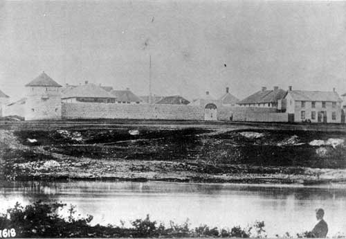
Fort Edmonton, 1872. Rae and his men reached the HBC post on the North Saskatchewan on 28 July 1864.
Source: Hudson’s Bay Company Archives
There is no record of what Rae may have thought of his survey having been rendered redundant, and in the long run, not even used. It is unfortunate, however, that his reports, in the form of a series of letters to Thomas Fraser in London, which are preserved in the Archives of the Hudson’s Bay Company, has not previously been publicized in any detail. These letters contain an informative description of a transect across Western Canada at a crucial stage in its history, with useful information about the vegetation, the agricultural potential, and the terrain. Rae’s survey preceded by one or two years, the widely publicized journey along essentially the same route by William Fitzwilliam, Viscount Milton, and Dr. Walter B. Cheadle, although the latter gentlemen wintered en route, to the northwest of Prince Albert, Saskatchewan. A comparison of Rae’s report, and of Cheadle’s well-known narrative [80] is extremely enlightening. Rae, the consummate traveler, described his workmanlike trip—a journey that involved no serious mishaps or accidents—in a straight-forward, matter-of-fact manner. There were no dramatic accidents or even incidents, and certainly nothing remotely comparable to Milton and Cheadle’s nightmare journey from Tete Jaune Cache south to Kamloops during which the entire party came close to starving.
In short, Rae’s journey was precisely what one would have expected of him. And, as one would also expect of him, he maintained his reputation as a traveler sans pareil. Travelling with wagons and Red River carts he covered the distance from Fort Garry to Fort Edmonton (some 1320 km) in thirty-four days, including stops, for an average daily distance of thirty-nine kilometres per day. He travelled the section from Lake Ste. Anne to Tete Jaune Cache, almost entirely on foot, by his own statement, in nineteen days of travelling, for an average daily distance of thirty-one and a half kilometres. And finally, he travelled a minimum distance of 450 kilometers down the Fraser River, from Tete Jaune Cache to Fort Alexandria by canoe in eight days (including a rest day at Quesnel). The contrast between his apparently effortless progress and the histrionics of Dr. Cheadle’s account of his trip with Viscount Milton along basically the same route the following year, could scarcely be greater.
1. A. Robb. “Edward Watkin and the Pacific Telegraph, 1861-1865.” Ontario History 65(4) (1973), 191.
6. Richards, R. L. Dr. John Rae. (Whitby: Caedmon of Whitby, 1985), 132, note 1.
9. J. Rae. “Explorations of the Faeroes and Iceland etc.” Proceedings of the Royal Geographical Society 5 (1861), 80-90.
10. I. M. Spry. “A visit to Red River and Saskatchewan, 1861, by Dr. John Rae, F.R.G.S.” Geographical Journal 140 (1974, 1-17.
11 . John Rae to Thomas Fraser, New York, 19 May 1864, HBCA A.6/39, fo. 3.
12. John Rae to Thomas Fraser, New York, HBCA A.6/39, fo. 3.
13. Thomas Fraser to Messrs. Maitland Phelps & Co., 7 May 1864. HBCA A.6/39. fo. 142.
14. John Rae to Thomas Fraser, 23 May 1864. HBCA E 15/13, fo. 7.
15. Thomas Fraser to Edward Hopkins, 12 May 1864. HBCA A.6/39, fo. 150.
19. John Rae to Thomas Fraser, 23 May 1864. HBCA E.15/13, fo. 7.
20. John Rae to Thomas Fraser, Llune 1864] St. Paul. HBCA E 15/13, fo. 9.
21. John Rae to Thomas Fraser, 17 June 1864, Fort Garry. HBCA E 15/13, fo. 11.
25. John Rae to Thomas Fraser, 24 June 1864, Fort Garry. HBCA E 15/13, fo. 15.
27. H. Brietzcke, Journal of Dr. Henry Brietzcke on a voyage to Hudson Bay, 1864. SPRI, MS 1341.
28. John Rae to Thomas Fraser, 29 July 1864, Fort Edmonton. HBCA E 15 / 13, fo. 18.
38. John Rae to Thomas Fraser, 29 July 1864, Fort Edmonton. HBCA E 15 / 13, fo. 18.
40. John Rae to Thomas Fraser, 23 August 1864, Tete Jaune Cache. HBCA E 15/13, fo. 24.
43. Iroquois from the Montreal area had been extensively employed, first by the Northwest Company and later by the Hudson’s Bay Company, not only as canoemen, but also as trappers. Particularly in the Columbia and Snake basins, both companies relied heavily on trapping parties, mainly of Iroquois, who ranged the country for furs. See, for example: R. S. Mackie. Trading beyond the mountains. The British fur trade in the Pacific 1793-1843 (Vancouver, University of British Columbia Press 1997). Many of these men, on expiry of their contracts, remained and settled in the West where their descendants are still to be found.
48. The location of the present town of Jasper is 52° 53’N; 118° 05’W.
49. John Rae to Thomas Finlay, 23 August 1864, Tete Jaune Cache. HBCA E 15/13, fo. 24.
53. This is probably a reference to William Gregory Smith, Secretary to the Hudson’s Bay Company in London, and hence well known to Fraser. There is no known picture of Smith and hence we cannot judge how “broad” he was. I am indebted to an anonymous reviewer for this suggestion.
54. John Rae to Thomas Fraser, 25 August 1864, Tete Jaune Cache. HBCA. E 15/13, fo. 28.
56. John Rae to Thomas Fraser, 5 September 1864, Fort Alexandria. HBCA E 15/13, fo. 29.
57. Ibid. The Chief Trader in charge at Fort George was William Charles.
62. John Rae to Thomas Fraser, 29 September, Victoria. HBCA E 15/13, fo. 73.
66. William Christie to John Rae, Fort Edmonton, 13 September 1864. HBCA E 15/13, fo.78.
67. A. W. Schwieger to Thomas Fraser, 24 October 1864, Fort Garry. HBCA. A 10/60, fo. 101.
68. A. W. Schwieger to Thomas Fraser, 30 November 1864,Toron to. HBCA A 10/60, fos. 322-331d.
69. HBCA G.1/327. This map is reproduced as Plate 64 in: R. I. Ruggles. A country so interesting. The Hudson’s Bay Company and two centuries of mapping, 1670-1870 (Montreal and Kingston, McGill-Queen’s University Press 1991).
72. Thomas Fraser to E. M. Hopkins, 29 June 1864. HBCA A 6/39, fo. 221.
73. Thomas Fraser to E. M. Hopkins, 30 July 1864. HBCA A 6/39, fo. 258; Thomas Fraser to Alexander Dallas, 30 July 1864. HBCA A 6/39, fo. 224.
74. Thomas Fraser to William F. Tohnie, 16 May 1864. HBCA A 6/39, fo. 160.
75. Thomas Fraser to William F. Tohnie, 23 July 1864. HBCA A 6/39, fo. 225.
76. Rosemary Neering. Continental Dash. The Russian-American Telegraph. (Ganges, B.C.: Horsdal and Schubart), 43.
77. J. W. McKay to the Board of Management, Western Department, Hudson’s Bay Company, 24 July 1865, Victoria. HBCA B.226/c/2, fos. 361-4.
78. J. W. McKay to Board of Management, Western Department, Hudson’s Bay Company, 29 July 1865, Victoria. HBCA B.226/ c /2, fos. 369-372.
79. J. S. Macdonald. “The Dominion telegraph.” Canadian North-West Historical Society Publications 1(1), (1930), 16; Neil E. A. Ronaghan. The Pioneer Telegraph in Western Canada. M.A. Thesis, Department of History, University of Saskatchewan, 1976, 37-8.
80. Milton, William Fitzwilliam, Viscount. The North-West Passage by Land. (London: Cassell, Petter and Galpin, 1865); A. G. Doughty, and G. Lanctot, eds., Cheadle’s Journal of Trip across Canada, 1862-1863. (Rutland, VT: C. E. Tuttle Co., 1971).
Page revised: 8 April 2021