
|
|
|
Tracing
the
Manitoba Section of the Route
Crystal
City
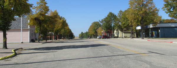 Crystal City was established by Thomas Greenway who later became the Premier of Manitoba in 1888. He is generally credited with the expansion of railway lines throughout south western Manitoba. 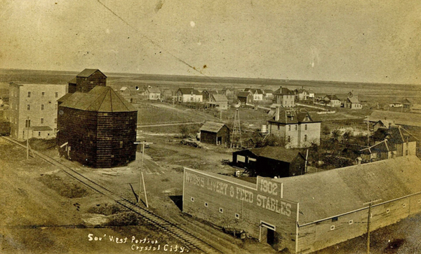 The town has many attractions including the Crystal City Printing Museum. The Museum is housed in the original print shop built around 1880 and home to the Rock Lake Herald, which later became the Crystal City Courier. It features a fully operational press. 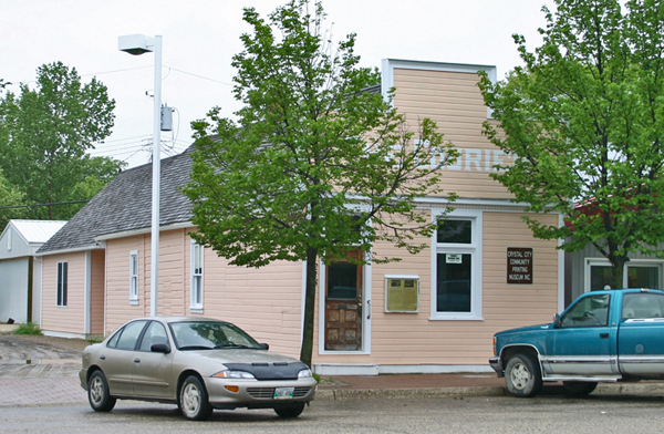 The route from Crystal City to the former Avery Resort at Rock Lake and passes close by Clearwater. It is a small attractive village in a pleasing valley setting. Like so many towns these days, its importance as a service / commercial centre has declined, but its community spirit and initiative continue to thrive. It is home to the annual Harvest Moon Festival. History displays and an attractive mural are prominent. The only railway water tower on an original site is nearby. The former railway bridge is a scenic walkway. It is a great example of what a small village can be. From the Clearwater corner the road twists and turns it way to the former site of Avery’s Resort on the north east tip of Rock Lake. II’s a quiet road today as paved alternatives are available. But it is a pleasant drive, now, as it was then.  The pioneers were quick to recognize the beauty of the place and to see its potential as a tourist attraction. 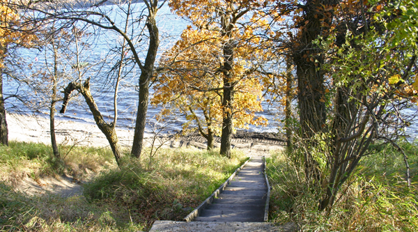 For many Sunshine Highway travellers it would be a scenic highlight of the trip. From the turn off near Rock Lake it is a short hop to Glenora. Glenora 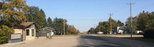 Glenora never was a very big village, and that hasn’t changed much since this 1949 aerial photo was taken. 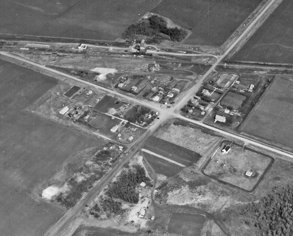 It may not have much of a business district, but you can get nearly everything from whiskey to motor oil at the Glenora Mall. A noted historical attraction is the United Church, built in 1889 in the nearby Marringhurst and moved here in 1926. It is lovingly maintained and a display on the attractive grounds included a the millstone from the Glenora Flour Mill, one of the first in the region. 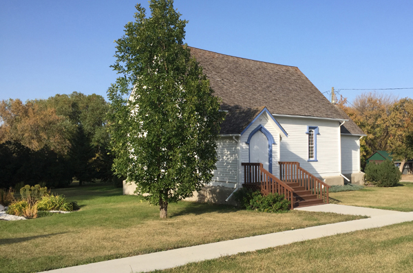 The route from Glenora to Baldur is still a well used road, west to the to the “9 Mile Corner” and straight north to Baldur Baldur 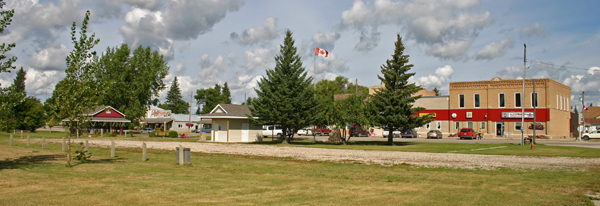 Baldur was a thriving town in 1920, and today it remains a service centre for the immediate area. A K-12 School, Hotel, General Store, and other businesses are available. The Argyle Historical Museum is on Elizabeth Avenue, (the main drag) and the former CN Station grounds are now home to now an attractive park with a carefully maintained all-season washroom. 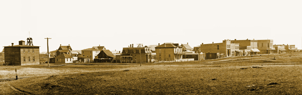 A few of the buildings seen in thei 1905 photo still stand today. Baldur was a Norse God, and the name reflects its close ties to the Grund district to the north of town. Before Highway 5 (Then 258) was upgraded and paved, the path from Baldur to Glenboro twisted northwards through scenic hilly country, dotted with small lakes. 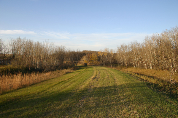 This was once part of th Sunshine Highway, curving around a slough. The road was later straightened leaving this remenant maintained by the landowner. The region was home to Grund, the largest Manitoba Icelandic community outside of the Interlake. That legacy is kept alive by descendants of those first settlers by way of Frelsis Lutheran Church. 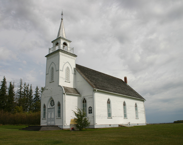 By 1920 the well established route was a natural choice as part of the Sunshine Highway. A bit south of Frelsis Church the road passes through a slough. It used to bypass that body of water and parts of the original trail still exist. Glenboro 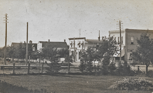 Glenboro was also a thriving town when the idea of the Sunshine Highway was presented and they readily signed on. It remains a busy place today. 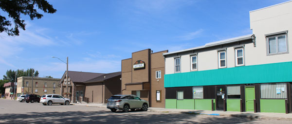 There are good places to eat (or just have ice cream) and a great bakery. Check The Burrough of the Gleann Museum and Sarah the Camel. 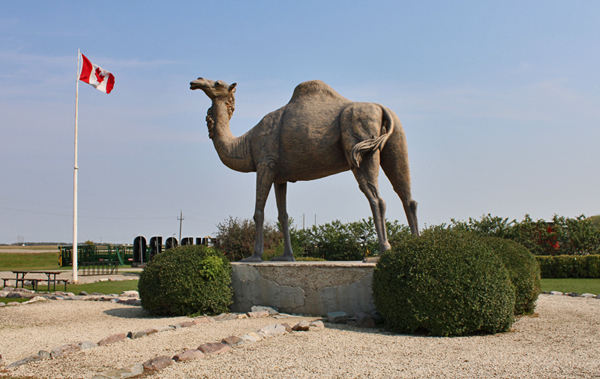 If you have time for a side trip, Spruce Woods Provincial Park close by and well worth the detour. Ashdown. Early plans for the Sunshine Highway list Ashdown as a stop. Today it takes a careful look at old maps to locate Ashdown, it was never more than a station and two elevators. When railway’s were established in farming country the goal was to have an elevator every 8-12 kilometres to provide reasonable access to farmers who, at the time were using horse drawn wagons to deliver grain, and to haul supplies back to the farm. Cars and trucks changed all that, and by 1920 some locations grew as towns while others were just not necessary. Ashdown was on the map, as railway locations generally were. It had two grain elevators for a time, but and never did have a store. With Wawanesa nearby, it wasn’t needed as a commercial centre. 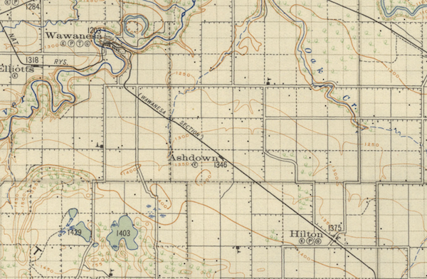 One can still locate the rail bed where it passed through Ashdown but that’s about all there is to see. Except in its very early inception the highway probably passed north of Ashdown along what is now Highway #2. For a few miles it may well have been a mile north along the road to Northfield School. The original school was rebuilt but this is the same schoolyard Nellie (Mooney) McClung walked to every morning. You can see it, one mile to the north as you approach the Hiway 18 intersection. Here it is worth noting that as early as 1921 an account of a trip in the Brandon Sun (July 25) only mentions stops at Crystal City, Baldur, Glenboro, Rock Lake, Glenboro and Wawanesa. A few other accounts in that era mention Rounthwaite. Wawanesa 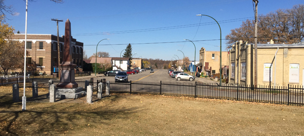 The next stop is Wawanesa, birthplace of the Wawanesa Insurance Company. The history of the village is well represented in the Sipeweski Museum, housed in the original head office building of the Company. 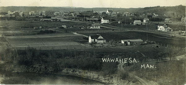 There is lots to see in Wawanesa. The spectacular riverside location is certainly one of the attractions. Be sure to drive along Cliff Avenue and stop at the overlook. 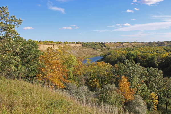 Methven Moving southward you come to the former village of Methven, established with the arrival of the long-promised CPR branch line that ran from Glenboro to Souris.  Methven is mentioned as a location on the route in the very early accounts. The road did pass right through it, but by 1920 to was apparent that nearby Wawanesa was the more appropriate place to stop. 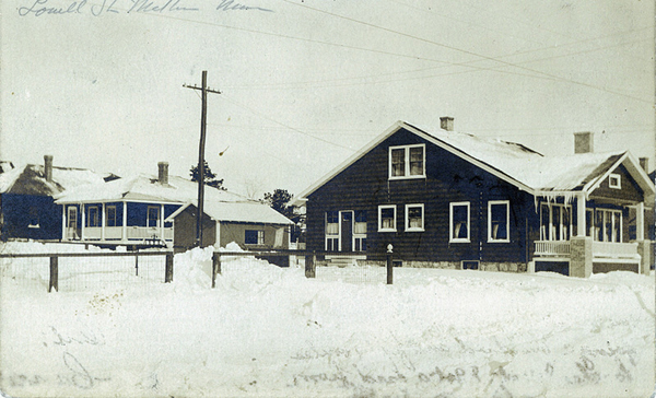 Methven was just too close to develop many businesses, but places like Methven were still important, as communities. Having elevators and train stations nearby was always important to farmer families, who in those days made up the bulk of the population. Rounthwaite 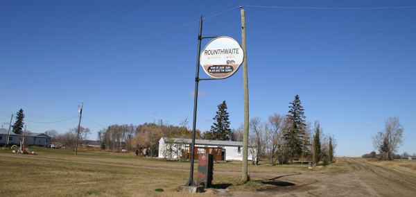 In 1889 the Northern Pacific and Manitoba Railway built a line from Morris to Brandon. This resulted in big changes to the map of the region. The railway decided where to build stations and that’s where the towns would be. At the time, on what would later become the the Sunshine Highway Route, there were only two examples of settlements that were towns. Glenora, was close to Rock Lake, a bit to the southwest of where the namesake railway village would later be located, had a store, flour mill and sawmill was developing into a commercial centre. Souris City was in the big loop of the Souris Rover that you can see south of Highway 2 as you cross it near Wawanesa. It had services and appeared to be in a position to grow into a busy place. In some cases towns appeared where most previous entries on the maps denoted Post Offices. Greenway appeared in the vicinity of the Dry River region. Baldur replaced the Post Office community of Otenaw. The small but important village of Souris City was replaced by Wawanesa. In 1884 the Rounthwaite community was well established although it only consisted consisted of a Church, and a Post Office. When the rails arrived in 1890 it passed a about 3 kilometres to the east of the Church. The Rounthwaite name was applied to the new site. The same thing happed with Glenora and Crystal City. 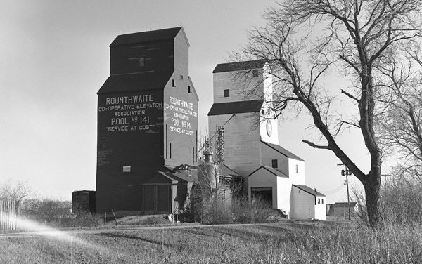 Rounthwaite had by 1920 become a busy little village. It is quiet now, but still standing as they say. Note that the approach to the village has changed since the 1920's when this map was published. 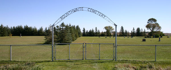 After passing through the village, one might take a slight detour to visit Rounthwaite Cemetery, the original site of St. John’s Anglican Church built alongside the cemetery in 1884, later moved to the village. It now sits alongside the Sipiweske Museum in Wawanesa. 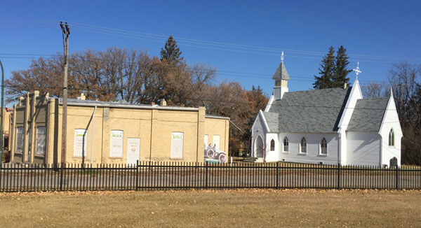 Check it out. It’s oldest standing Anglican Church west of Portage La Prairie. Brandon Hills As you proceed from Rounthwaite, the road follows the grid road pattern west, then north, you then pass along the east flank of the Brandon Hills. The route offers excellent views of those substantial remnants of the last Ice Age.  If you check an old map you will find Martinville, another stop on the Morris - Brandon line. One might have expected the Sunshine Highway to proceed a bit to the east to included Martinville, but although the elevator at Martinville was important to farmers in the area, no other service were available. Instead, you pass closer to the hills and through the Brandon Hills district, one of the first settler communities in the region. A Church, a Cemetery and School, were the heart of this settlement that never became a town, The second post office created south of the Assiniboine was located nearby. Brandon After zigging and zagging around the northwest corner of the Brandon Hills the route follows Road # 108 West which soon becomes 17th Street East, and the entrance to Brandon. At least one old map shows a road angling NW 17th Street East to the corner of 1St and Richmond. An article from Nov. 20, 1920 in the Brandon Sun notes that the new Sunshine Highway route began at City Hall and the Prince Edward Hotel, (9th and Princess Avenue) proceeded south on 9th Street to Victoria Avenue, east to First Street, then 1 mile south to what was then the city limits. Interestingly enough, that was also the terminus of the Northern Pacific and Manitoba Railway which conveniently ran right up to the Prince Eddy. |