Chapter 9: Mennonite and Hutterite Settlements
Mennonite Settlements
“The Mennonites refused to bear arms and…fled from one country to another in the
“In sharp contrast to homesteaders from
They were not…able to ignore the survey system entirely but they were able initially to modify the rectangular grid to satisfy their own requirements. And from 1876 onwards they did so legally, since in that year the government amended the Dominion Lands Act to allow both Icelanders and Mennonites to settle in villages, relieving them of the normal legislative requirement that every homesteader live in a house on his own quarter section and improve the land grant he himself had received from the Crown.”[ii]
“Each homesteader signed the village’s agreement to share the land, even though the official title for each quarter section belonged to an individual. A village was established in which each settler was allocated a narrow plot of land running back from the main village street. The plot was to provide space for a house, barns, and a garden, and overnight space for cattle. The remainder of the homestead land belonging to villagers was divided into three equal parcels plus a slightly larger one for pasturage.
Each villager was given a strip of land in each of the three fields for his personal use, so that all the land in each field was allocated. This not only preserved the old village pattern of land use but also helped assure equal land quality for all settlers. In the early years, neither pasture nor fields were fenced. …Some of the villages began to disintegrate almost at once, and the majority of them disappeared”[iii] but in 1995, 17 were still in existence in the west reserve. Also the field system soon broke down and “the last of the old field systems was abandoned in the nineteen twenties.”[iv]
Because of the land division system the remaining villages have a very definite linear form that contrasts markedly with the T-type railway-based villages and the angular grid of villages based on the DLS system.
Notes
[i] Tyman, J. and D. Where on Earth: Mid Latitude Grasslands (Library Edition). Brisbane, Atham Educational, 1978, 18.
[ii] Tyman, J. and D. op. cit., 1978, 18 and 35.
[iii] See Richtik, J. T. “Mennonite Reserves” in The Geography of
[iv] Richtik op. cit., 1996, 105-106.
9.1: Villages in the West Mennonite Reserve
The photo shows all or part of nine Mennonite villages in the west reserve: Gnadenthal 1, Neuenberg 2, Hochfeld 3, Friedensfeld 4, Blumenfeld 5, Reinland 6, Schoenwiese 7, Rosengart 8, and Haskett 9. The villages have been superimposed on the square grid pattern of the DLS. In the case of Neuenberg and the eastern part of Reinland 10, the village road runs along a section line, and in most other cases the village streets harmonize with the DLS system in that they run north/south or east/west. However, the streets do not coincide with section or quarter section lines, and in the case of Gnadenthal and the western part of Reinland 11, the street is at an angle to the DLS lines. Houses within the villages are closely spaced along the streets resulting in linear villages. The narrow fields running back from the houses in the old field system have been mainly obliterated by field amalgamation, but remnants can be seen in the western part of Reinland 12. It is noticeable that the scattered farmsteads—two, three, or four per section—so common in other parts of agricultural Manitoba are largely absent here, although a few examples do exist 13, possibly owned by farmers who moved out from the villages years after they were established.
The land shown here is part of the
The southern part of the photo lies within the
Transport routes include north/south PTH 32 23 and east/west PR 201 24, as well as several gravel roads along section lines. The faint light-toned line in the northeast is a buried oil pipeline 25. The absence of railway lines is noticeable, in contrast to other rural areas in
[[fig.9.1]]
9.2: Villages in the West Mennonite Reserve
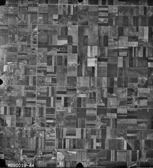
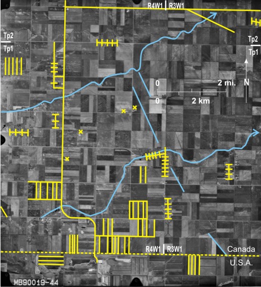
This very flat area is part of the
Section lines and quarter section lines of the DLS are clearly visible. In this intensively farmed area most fields are divided into narrow north/south 12 or east/west 13 trending strips. Field shelterbelts planted mainly to protect against wind erosion trend east/west 14 or north/south 15.
PTH 32 9 is the main highway, and the faint light-toned line in the northeast 16 is a buried oil pipeline. As with figure 9.1there is no railway line in this area.
[[fig. 9.2]]
9.3: Rosetown and Kronsthal in the West Mennonite Reserve
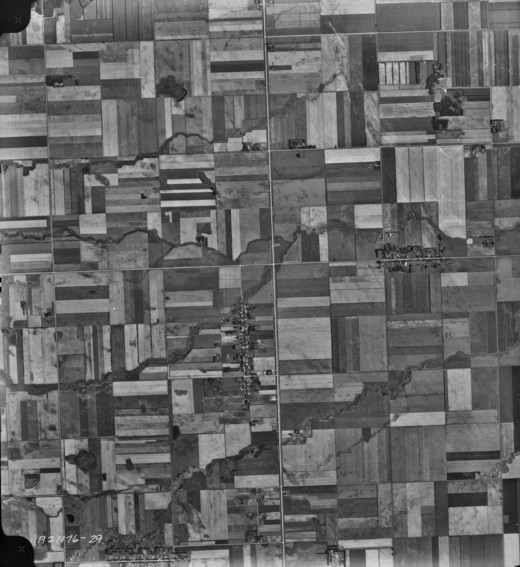
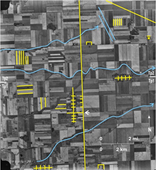
Rosetown 1 (originally called Rosenort) and Kronsthal 2 are located in the central part of the west Mennonite reserve. Rosetown still exists but “Kronsthal” is a good example of a fossilized settlement, abandoned in the twenties in favour of a new home in
Rosetown still exists as a village. Numerous long narrow buildings 3 exist on either side of the street 4 producing a linear village similar to the strassendorf (street village) found in many ports of
In this rich agricultural region sections and quarter section lines can be seen, but the land is divided into many long narrow fields trending east/west 6 or north/south 7. Outside the village there is little evidence of settlement, except one farmstead in the northeast surrounded by shelterbelts 8.
Two poorly defined
[[fig.9.3]]
9.4: The Springhill Hutterite Colony, Northwest of Neepawa
Hutterite Colonies
“Hutterite farming communities are found throughout most of southern
“Factors influencing the location of colonies are availability of good agricultural land, well-removed from villages and towns; a water supply source; and access to the provincial road system, although they are not usually related to the railway system. There is really no pattern to settlements, but they usually follow a basic layout, with some variations depending on terrain and group choice. In many colonies the family homes encircle a central park, while the barns and other facilities form an outer circle or ring… The communal kitchen/dining hall is centrally located; on most colonies church services are conducted in part of the complex. Each colony has a kindergarten and a school.”[ii] In the past, formal education finished at grade 8, but there has been a recent push for further education including university.
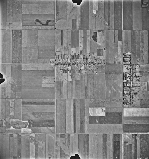
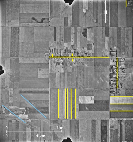
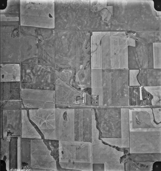
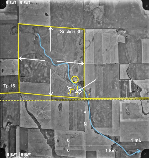
The colony 1, five miles northwest of Neepawa, is located by a creek 2 that drains eventually to the
The scale of the photo is too small for definite identification of buildings, but some deductions can be made. The people’s houses are probably located in the southwest, protected by a large shelterbelt of trees to north and west 6. Springhill is known locally as a hog-producing colony; the two long buildings east of the residences 7 are probably hog barns. A group of buildings to the north 8 probably include animal houses and machinery sheds.
The photo shows part of township 15 range 15WI where the DLS was not accurate. In particular, section 30, township 15, range 15WI 9 is a parallelogram rather than a square; its southern boundary is followed by a gravel road 10 which is far from the usual east/west alignment.
[[fig.9.4]]
9.5: The Spring Valley Hutterite Colony at Glen Souris
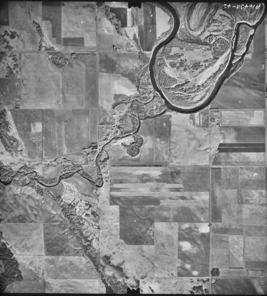
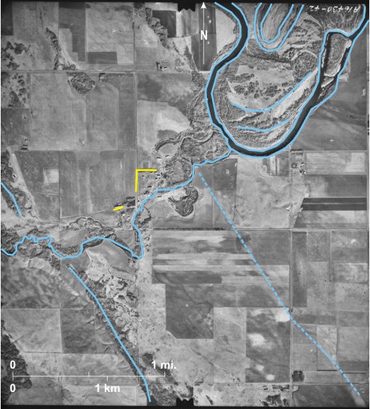
The colony 1 is located near the junction of the Assiniboine River 2 and the Little Souris River 3 that supplies the colony’s water. The area is located on the upper part of the Assiniboine Delta with two
The colony that is served by a provincial gravel road is located on both sides of the Little Souris River. The human residences are probably located north of the river, protected by a still growing shelterbelt 9. The long narrow buildings, especially the eastern-most one 10, are probably animal barns.
[[fig.9.5]]
9.6: The Maple Grove Hutterite Colony Northwest of Lauder
9.6a: The Situation in 1968
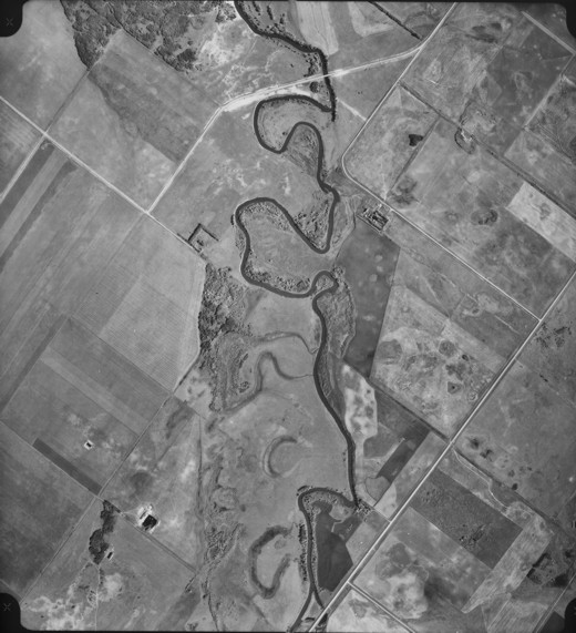
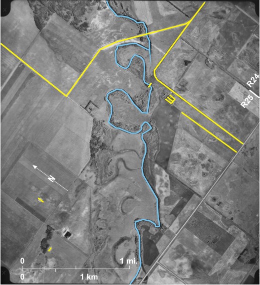
A gravel road 1 that links up with newly constructed PR 254 2 serves a group of buildings 3 located south of the northeast-flowing Souris River 4. Some of the buildings are protected by trees 5. Surprisingly, the gravel road is not located on a quarter section line 6 but about 500 feet (152 m) to the east. At one stage a weir 7 was built across the
9.6b: The Situation in 2007
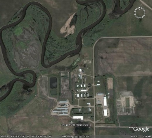
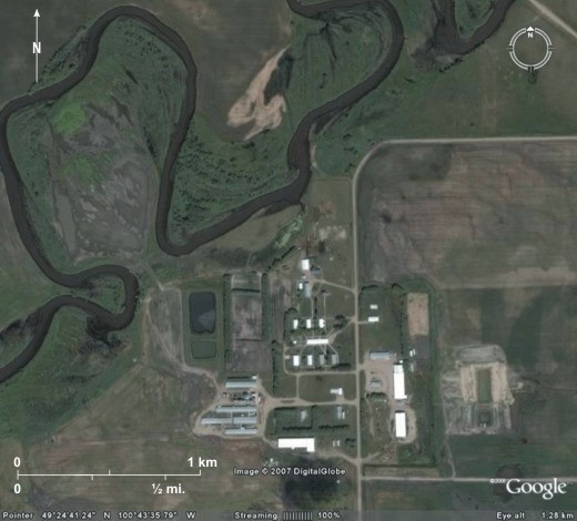
The Maple Grove Hutterite Colony, an offshoot of Richland Colony near Anola, east of
[[fig.9.6.a]]
[[fig.9.6.b]]


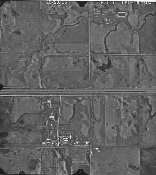
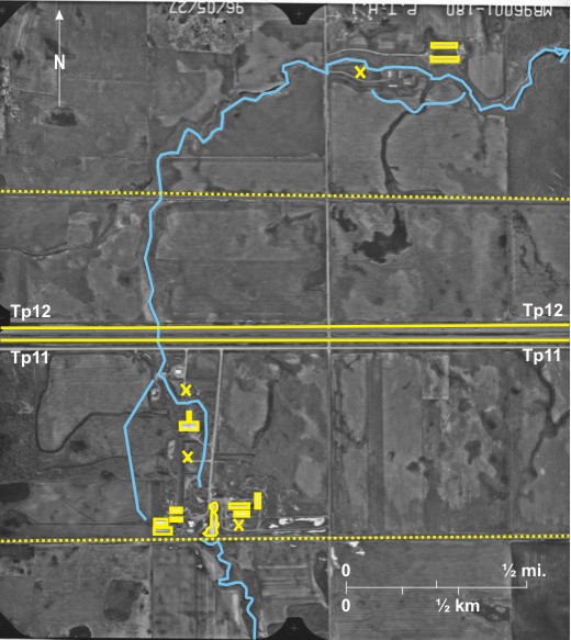
9.7: Mennonite Family Farm and a Chicken Farm East of MacGregor
The twinned Trans-Canada Highway 1 passes through the centre of the area shown with the CP railway line to the south 2 and the CN line to the north 3. A group of buildings between the
At the date the photo was taken (May 27) fields were still drying out from the spring melt, so that wet patches 14 are visible in most fields.
[[fig. 9.7]]