Land holdings in most of southern Manitoba have been determined using one of two systems. The older long-lot system, derived from the St. Lawrence lowlands in Quebec, is found along the Red River, along the AssiniboineRiver west to Portage la Prairie, as well as in several other isolated areas. Lots were laid out at right angles to the river, resulting in a distinctive pattern easily observed on remotely sensed images. The DSL system, which divided land into one square mile sections, was applied to virtually all other areas. The resulting squared pattern is a prominent feature on remotely sensed images. Interesting situations occur where the two systems come into contact. The DLS system was amended several times, but in Manitoba there is evidence of only the first and third systems. Careful interpretation of air photos can reveal the differences between the two systems.
7.1: Long Lots Along the Red River Plain South of Winnipeg
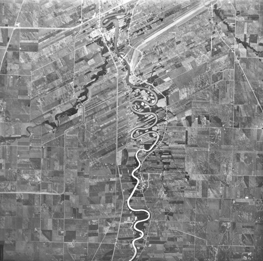
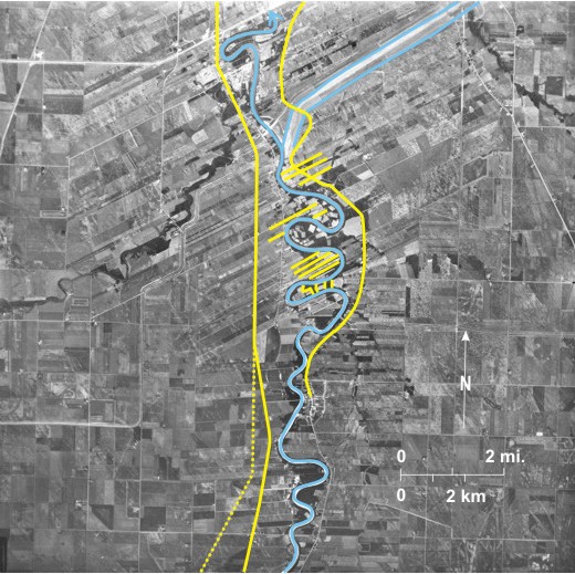
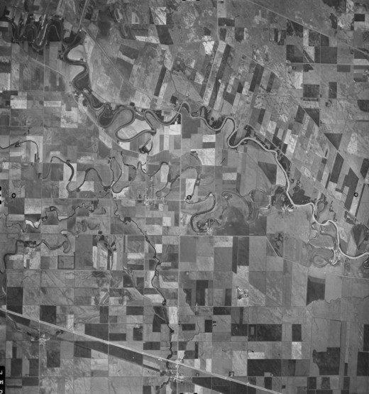
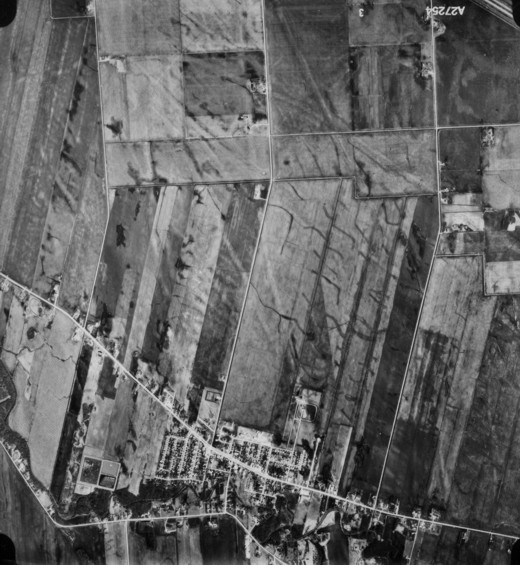
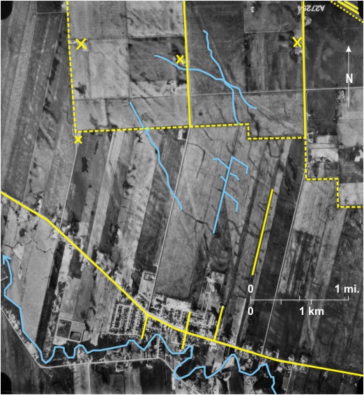
This high level, small-scale photo shows the Red River Plain south of Winnipeg. Here the Red River is etched into LakeAgassiz lacustrine clays. It 1 meanders, but there is no clear evidence of meander scrolls or abandoned channels so obvious on the freely meandering Assiniboine (figures 3.24-3.30). The channel is clearly defined and uniform in width about 500 feet (152 m).
Although the scale is small and not much detail can be seen, the long lots characteristic of the Red River Plain are obvious 2. “The first lots surveyed were on the west side of the Forks [between the Red and AssiniboineRivers], north of Point Douglas…. Similar lots were laid out along other sections of the Red and later along the AssiniboineRiver. By 1870 river lots extended along the Red from about 11 miles (17.7 km) south of the Forks to north of Selkirk. Long strip lots also lined the Assiniboine as far west as Portage la Prairie.”[i] As far as possible they were oriented at right angles to the riverfront 3, but with a meandering river this was not always possible 4.
Most of the land has been cleared for agriculture, but some woodland—dark-toned—remains 5. The francophone village of St. Adolphe6 is located in the south and in the north is St. Norbert 7, now a part of metropolitan Winnipeg.[ii] Also in the north is the south end of the Red River Floodway 8 (without water at this date) designed to carry water around Winnipeg at times of potential flood. PTH 75 9, the main road from the United States to Winnipeg, is located west of the river. Also in the west—paralleling PTH 75 in places—is the CN Railway line 10. East of the river PR 200 11 runs between St. Adolphe and Winnipeg.
[[fig. 7.1]]
Figure 7.1: Long Lots Along the Red River Plain South of Winnipeg
7.2: Long Lots at St. Francois Xavier on the Assiniboine River
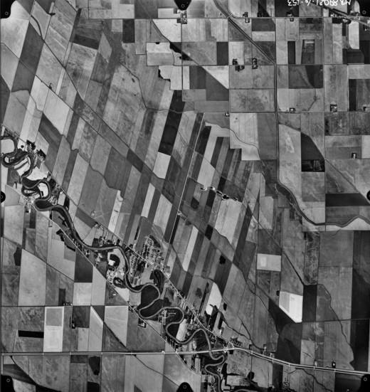
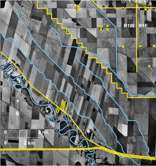
The photograph shows the Assiniboine River 1 flowing across the Lake Agassiz Plain west of Winnipeg. The river meanders and has left six abandoned channels 2 of various ages. Several small drainage channels flow roughly parallel to the Assiniboine: First Creek 3, Second Creek 4, Third Creek 5, and Fourth Creek 6. The latter joins Sturgeon Creek 7 that has a straightened channel between embankments. All the other creeks have been straightened in some stretches 8. Most of the land is devoted to crop growing but patches of woodland—dark-toned—remain along the Assiniboine9.
Long lots extend back from the Assiniboine both northeast 10 and southwest 11 of the river. North of the river are “four-mile deep river lots first occupied at St. Francois Xavier by the Métis about 1824.”[i] In the southwest, amalgamation has taken place so the fields are larger. The hamlet of St. Francois Xavier—now a Winnipeg dormitory community—shows linear development along PTH 26 12. Minor roads back from the highway follow the trend of the long lots 13. Settlement along some of these has produced a more nucleated settlement 14.
In the northeast, the strips of the long lot system impinge on the squares of the DLS, with a saw-toothed boundary between the two 15. This is also the northern boundary of the RM of St. Francois Xavier (with Rosser RM) that has the most distinctive shape of any of Manitoba’s 116 RMs. The principal meridian of the DLS system 16 runs just west of the hamlet of Rosser 17 located in the extreme northeast. Rosser is located on PR 221 18 as well as on the Canadian Pacific railway line 19. It is noticeable that in the area covered by the DLS system, one or two farms per section are located on road allowances at the edges of the sections 20 resulting in a very dispersed settlement pattern. The greatest concentration occurs where farmhouses are located in the adjacent corner of adjoining sections 21.
The twinned Trans-Canada Highway crosses the area in the south 22. Twinning is an important safety factor in difficult winter driving conditions. Crossings can be seen in several locations 23.
[[fig. 7.2]]
Figure 7.2: Long Lots at St. Francois Xavier on the Assiniboine River
7.3: Long Lots on the Assiniboine River North of St. Eustache
The Assiniboine River 1 meanders across the area from northwest to southeast with several abandoned channels 2 and one abandoned river stretch 3. In addition, Mill Creek 4, La Salle River 5, and the west branch of La Salle River 6 now occupy paleochannels. Land in the area is devoted mainly to growing crops, but a few dark-toned woodland patches can be seen along the Assiniboine7 and some of the paleochannels 8.
Long lots are most obvious north of the Assiniboine9. South of the river amalgamation has produced larger fields, although some are long and narrow with a north/south orientation 10. PTH 26 11 roughly parallels the river to the north with minor roads running between it and the river; settlements are located along the road and river producing a linear pattern. Unlike figure 7.2 the boundary between the linear long lot system and squared DLS system to the north (also the boundary between the RM of St. Francois Xavier and the RM of Rosser) is smooth 12.
The DLS system is used in the southwest where the sections 13 are clearly visible. Farms are located along section lines 14 resulting in a dispersed settlement pattern. Three hamlets are located in this area. In the centre is St. Eustache15 with roads running north/south back from a section line 16. Near the southern edge is Elie 17 in which road orientation is determined partly by the DLS system (i.e., they are north/south and east/west) and partly by the southeast/northwest trending Canadian National Railway line. Further west is Bénard 18; although it is close to the railway line, road directions are determined by the DLS system. There are also two Hutterite colonies in the area, one near the west branch of La Salle River 19 and the other near Bull Creek 20.
In addition to the transport lines already mentioned, the twinned Trans-Canada 21 parallels the CN line in the south 22, and the Canadian Pacific line 23 crosses the northeast corner. In the centre PR 424 24 from St. Eustache eventually joins the Trans-Canada Highway off the photo to the east. PR 248 25 runs north/south between St. Eustache and Elie.
[[fig. 7.3]]
Figure 7.3: Long Lots on the Assiniboine River North of St. Eustache
7.4: Long Lots at Ste. Anne
“Ste. Anne, located about thirty miles southeast of Winnipeg, was the site of an early Métis settlement…. The village was marked out in 1872, before the surrounding townships were surveyed. As a result the long lots of the parish stand out in sharp contrast to the rectangular grid of the surrounding “checkerboard.”[i] The dashed line 1 marks the boundary between the two systems. The basis for the long lots is the Seine River 2 that flows just south of the town of Ste. Anne3. Houses are located at the end of long lots on either side of PR 210 4 resulting in a linear settlement. Some roads in the settlement run back from the highway parallel to the long lots 5.
The DLS system can be seen west and south of Ste. Anne. Individual sections 6 are easily identified with farmsteads located along section lines 7. “Today, the advantages of long lots vis à vis sections are frequently debated in terms of their relative desirability in areas of pioneer settlement. On the one hand, the proximity of one’s neighbours, as well as economies in providing service infrastructures favour a long lot system but on the other hand, the greater ease of surveying and the resultant coordinated grid system provide a strong case for the township surveys.”[ii]
The Seine River Diversion 8, part of which can be seen on the photo, enters the Red River, off the photo to the west. It is intended to divert floodwater around Ste. Anne and to reduce the danger of flooding to the southeastern suburbs of Winnipeg, outside the Red River Floodway.
Ste. Anne is significant in that it was located on the Dawson Road 9 that is now followed in part by PR 207; in fact this route way to western Canada—entirely within Canada—was the original focus of the settlement. PTH 12 10, north from southeastern Manitoba and Steinbach, runs through the eastern part of this area and through Ste. Anne. Also in the east is the Canadian National Railway 11 line leading north to Winnipeg. A spur can be seen northwest of Ste. Anne 12 and a grain elevator 13—identified by its shadow—can be seen on the main line. The dark line in the north is an underground gas pipeline 14.
Most of the land is devoted to crop growing, but some woodland patches can be seen in the southeast 15, along the Seine River 16, and in one part-section south of the Seine River 17. Ste. Anne (2006 population 1,534) is a prosperous rural service centre within the Winnipeg hinterland and therefore serves as a dormitory settlement.
[[fig. 7.4]]
Figure 7.4: Long Lots at Ste. Anne
7.5: Long Lots at Lorette
When the DLS system was established in Manitoba “there was considerable debate about whether the river lots should be incorporated into, or replaced by township surveys [but] the reluctance or refusal of the Métis and French Canadians to conform to the sector survey resulted in the establishment of further long lots throughout Manitoba…The Lorette and Oak Island settlements between Ste. Anne and Winnipeg were surveyed into long lots in the 1880s.”[i]
At Lorette, as at Ste. Anne, the Seine1 is the reference stream with lots trending south-southwest/north-northeast. PR 501 2 runs north of the river; houses are located along it at the end of long lots with minor roads 3 running back from the highway parallel to the long axis of the lots, resulting in a linear settlement 4. The saw-toothed contact between the long lot system and the DLS system (indicated by a dashed line) is obvious 5. North of the junction parts of a few sections can be seen with farmsteads as usual dispersed along section lines 6. In the extreme northeast is the Trans-Canada Highway 7 paralleled by the Canadian National Railway line 8 that runs close to Ste. Anne on figure 7.4.
This area is part of the LakeAgassiz lake floor, which is very flat, and, in natural conditions, poorly drained. Dark-toned wet patches can be seen in several fields 9, and linear dark patches 10 are ditches excavated by farmers to take water off the fields to larger drainage channels 11. Also seen are haphazard light-toned lines 12. Their direction and the fact that they cross each other 13 indicates that they are not strandlines. Several possible explanations have been suggested. Without the benefit of stereovision it is hard to tell whether these are positive or negative features. However, at certain locations, they are dark due to high water content in the soil 14, suggesting that in these areas at least they are depressions, possibly ice gouge markings. “These ice scours were scribed on the lake bottom (of LakeAgassiz) by the submerged parts of icebergs and, quite possibly, the keels of pressure ridges in floes of drifting ice. Some of these furrows could have been formed as long as 12,000 years ago.”[ii]
[[fig. 7.5]]
Figure 7.5: Long Lots at Lorette
7.6: Long Lots at St. Malo
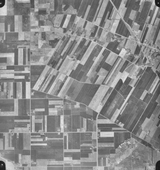
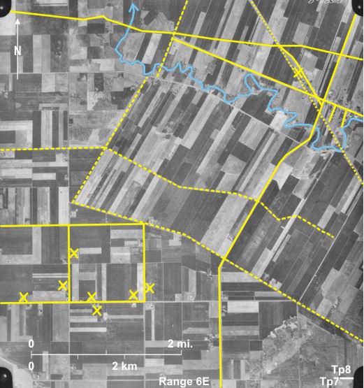
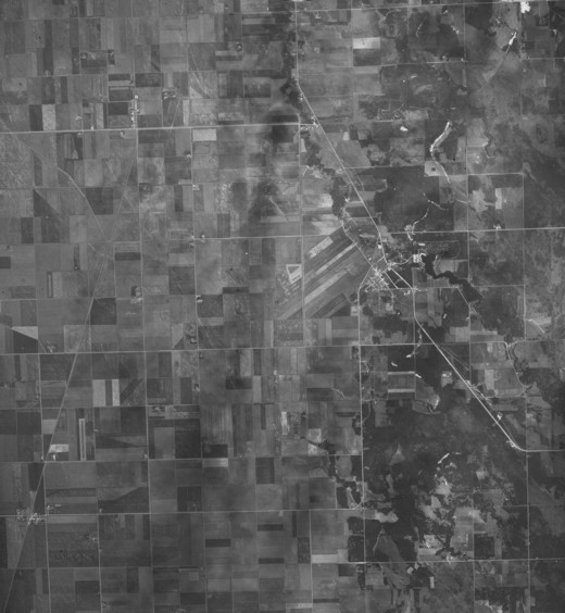
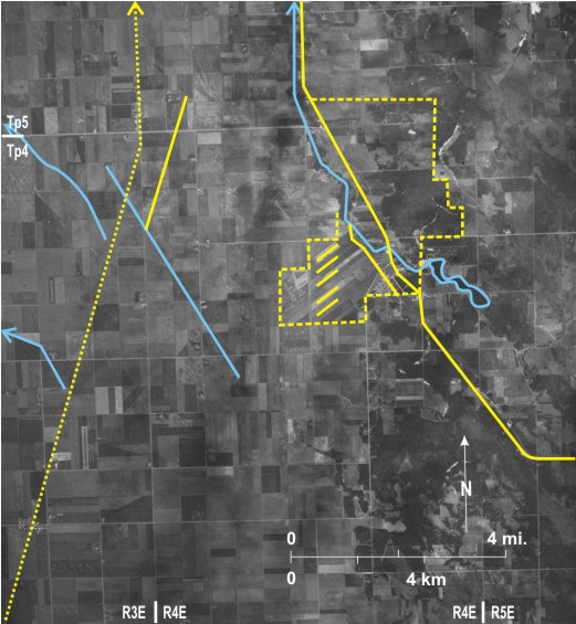
The St. Malo settlement was surveyed into long lots in the 1880s. In this high-level, small-scale air photo the long lots based on the Rat River 1 are visible. They are more noticeable southwest of the river 2 where a secondary road sub-parallel to the river 3 has houses located along it in a linear settlement 4. The settlement of St. Malo 5 is located along this road with secondary roads running back from it parallel to the long lots. PTH 59 6 bypasses St. Malo en route to Winnipeg further north. Northeast of the river most of the land is wooded (dark-toned) 7 so that long lots are not so obvious. The grid pattern of the DLS completely surrounds the long lot area, the boundary between the two being indicated by the dashed line 8. The grid is most noticeable in the west where most of the land is agricultural. In contrast the east is woodland or marsh.
A dam producing a reservoir 9 that is now the basis of St. Malo Provincial Park, blocks the RatRiver. Campsites can be seen north of the reservoir 10. The dam constructed by the PFRA also functions as flood control mechanism and for water supply.
The western half of the photo contains a number of faint linear features. The Canadian Pacific Railway line 11 runs through the small settlements of Arnaud 12 and Dufrost 13. Just to the east near Dufrost is a faint north-northeast/south-southwest trending line 14. This is the route of a gas pipeline; it continues south along section lines but cannot be seen as a separate item when this happens 15. West of the CP line are two angular lines 16; these are drainage channels that eventually join the MarshRiver off the photo to the west. Finally, a discontinuous faint line with a north-northwest/south-southeast trend 17 is a LakeAgassiz strandline.
[[fig. 7.6]]
Figure 7.6: Long Lots at St. Malo
7.7: The DLS System (First System) Near Moore Park North of Brandon
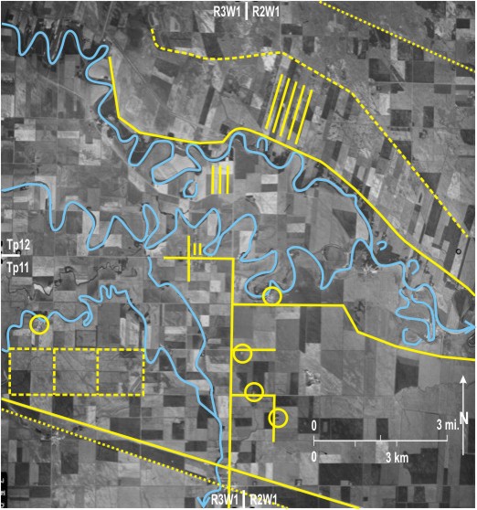
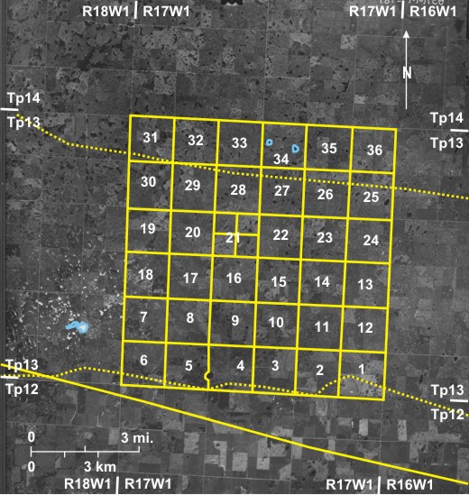
In the DLS system townships are numbered north from the 49th parallel. In Manitoba, ranges are numbered west and east from the Principal Meridian which is at 97º27'28.4” West,[i] just west of Winnipeg. Each township is divided into 36 sections, each of which is nominally 640 acres in size with 160-acre quarter sections. In the First System there are 99-foot road allowances around each section that are numbered consecutively from 1 to 36 beginning in the southeast corner.
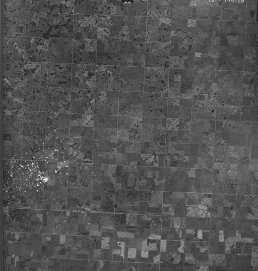
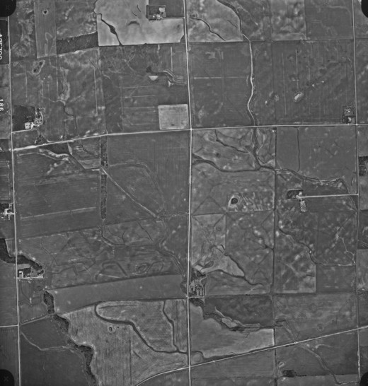
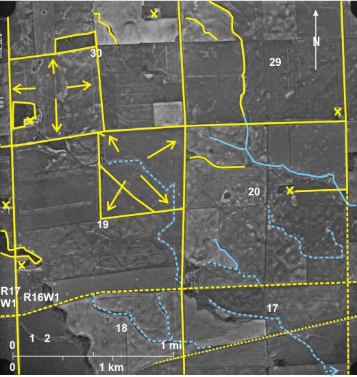
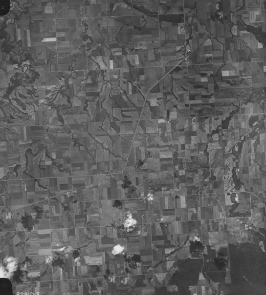
This high-level, small-scale photograph of part of the Minnedosa-Reston Till Plain shows all of township 13, range 17 WI and parts of surrounding townships. The overlay shows the section numbers. In this area the topography is such that little interferes with the regular arrangement of sections. Several sections are clearly divided into quarter sections, the clearest example being section 21 1. In most cases gravel roads (light-toned) have been constructed along section lines, the exceptions being indicated by dashed lines on the overlay. Between sections 4 and 5 the road deviates from the section line to avoid a slough 2. The whole area is dotted with small sloughs, some dark in tone 3 whereas others are almost white 4 due to specular reflection.
The only settlement in this sparsely populated agricultural area is Moore Park 5 located on the Canadian Pacific Railway line 6. Further north is the Canadian National Railway line 7 which causes a minor deflection of the road in section 32 8. In the south is a discontinuous light-toned line 9 that is probably an underground pipeline.
[[fig. 7.7]]
Figure 7.7: The DLS System (First System) Near Moore Park North of Brandon
7.8: The DLS System (Third System) East of Duck Mountain Southwest of Ethelbert
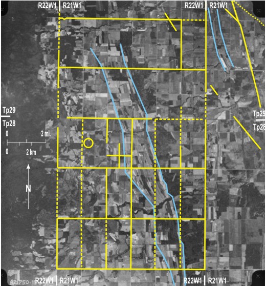
This small-scale photo shows a mainly agricultural area 1 east of DuckMountain that is mainly wooded and therefore dark-toned 2. Traversing the area from north-northwest to south-southeast are several LakeAgassiz strandlines 3 identified on the basis of tonal variations that reflect different land uses. Another group of strandlines 4 at a lower level can be seen in the northeast.
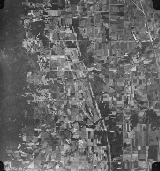
North of township 27, the Third System of the DLS is used. Under this new system, adopted in 1881, townships were 6 chains shorter measured north/south and 3 chains narrower measured east/west (along the base lines). Road allowances were reduced in width to 1 chain (66 feet) compared with 99 feet in the First System. Road allowances run north/south between all sections; but east/west road allowances occur every two sections. Most of these changes are not visible on air photos, but the existence of east/west road allowances every two sections is obvious, as light-toned gravel roads have been constructed along most of them 5 as indicated on the overlay. Quarter sections can be identified in agricultural areas as they are often marked by dark-toned hedges 6, whereas in wooded areas they are light-toned clearings 7.
PTH 10 8 in the east follows the trend of one of the LakeAgassiz ridges, departing from the usual north/south or east/west arrangement of roads. The CN railway line 9 clips the northeastern corner of the area, and an intermittent light-toned line 10 indicates the location of a power line.
[[fig. 7.8]]
Figure 7.8: The DLS System (Third System) East of Duck Mountain Southwest of Ethelbert
7.9: Irregular Sections in the DLS System (First System) Northeast of La Rivière
Although in the DLS system (First System) sections were supposed to be square and a uniform 640 acres in size, surveying mistakes were made resulting in sections varying in shape and size. This can be seen in township 4, range 9WI where section lines between sections 8 and 17 1, 20 and 21 2, 22 and 27 3, and 21 and 28 4 are crooked as shown on the overlay. The area shown includes the Pembina spillway in which flows the misfit Pembina River 5 flowing southeast to join the Red River (off the photo). Numerous small lakes 6 can be seen in the north occupying hollows in the Darlingford moraine covering PembinaMountain. Several have dried out 7 and have been partly reclaimed for agriculture 8. Steep-sided creek valleys 9 dissect the relatively flat land outside the spillway. Two of them determine the direction of the CP line 10 into and out of La Riviere 11 located on the spillway floor. East of La Riviere is Manitou 12, the two being joined by PTH 3 13 which loops its way down the spillway side into La Riviere 14. The only other settlement visible in the area is St. Leon15 located on the shore of one of the larger lakes with PTH 23 16 running just north of it. Also in the north is a light-toned line 17 indicating the location of a buried oil pipeline.
[[fig. 7.9]]
Figure 7.9: Irregular Sections in the DLS System (First System) Northeast of La Rivière
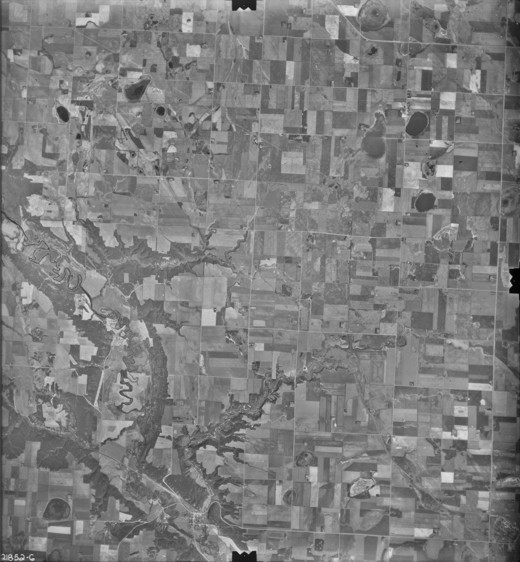
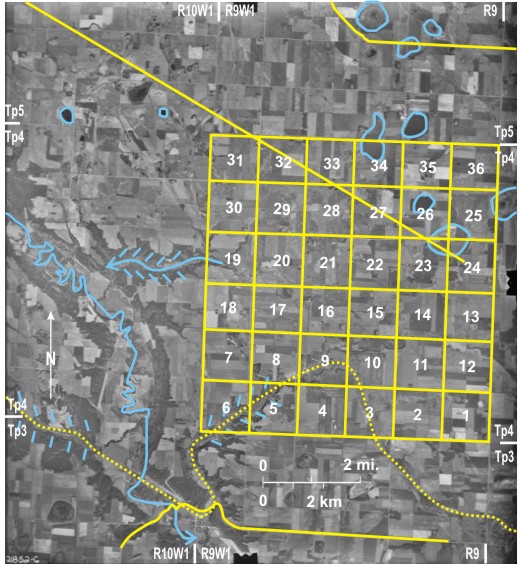
7.10: Irregular Sections Southeast of Riding Mountain National Park at Mountain Road
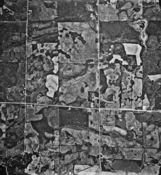
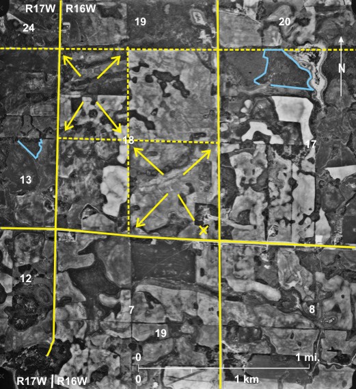
The photograph shows part of the southeast flank of RidingMountain including parts of township 17, ranges 16 and 17 WI. It is noticeable that sections and quarter sections are not the standard square shape covering 640 acres and 160 acres respectively. This is particularly true of section 18, township 17, range 16 WI in which boundary lines are skewed and the southeast quarter 1 is much larger than the northwest 2. This is due in part to the fact that within townships all sections are supposed to be the same size except those along the western edge of townships, where the differences caused by the convergence of meridians are all accommodated in the most westerly quarter sections. Sections 6, 7, 18, 19, 30, and 31 are located along the western edge of townships, and it is in these sections that the accommodation is made.
Much of the land was originally wooded (dark-toned), some of which remains 3. Although the land is marginal and not suited to large-scale grain farming, the original settlers cleared much of it 4. Severe soil erosion has resulted in this area in the upper parts of the Whitemud Watershed (although none is obvious on the photo) prompting reforestation in parts of the watershed.[i]
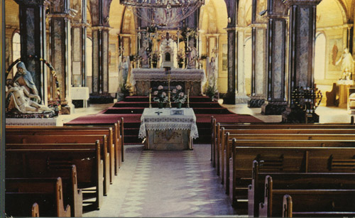
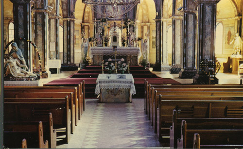
The area is sparsely populated, but the church at Mountain Road 5 has a large catchment along the fringe of RidingMountain. The original opulent wooden structure (figures 7.10a, 7.10b) was destroyed by fire in 1965 and replaced by a more modest building. PR 357, recently improved in one stretch 6, runs along the southern edge of RidingMountain.
[[fig. 7.10]]
[[fig.7.10.a]]
[[fig.7.10.b]]
Figure 7.10: Interior of Church at Mountain Road Figure 7.10: Church at Mountain Road Figure 7.10: Irregular Sections Southeast of Riding Mountain National Park at Mountain Road
7.11: Irregular Sections Northwest of Neepawa
The photo shows part of township 15 in ranges 16 and 17 WI located in the upper reaches of the Whitemud Watershed. Extreme variations in section shape can be seen; most of the section lines are not straight north/south or east/west lines, the extreme example being the boundary between sections 18 and 19 1. Quarter sections are not square; in fact, some are almost parallelograms 2.
In this area virtually all the land has been cleared for agriculture with just a few woodland patches 3. Intermittent streams flowing southeast drain much of the land 4. Soil erosion is a problem 5, and preventative measures have been taken: straightening stream courses 6 and grassing over waterways—dark-toned 7. The area is sparsely populated with farmsteads mainly along section lines 8, although one is more centrally located in its section with a long driveway leading to it 9. The CN line runs near the southern edge 10.
[[fig. 7.11]]
Figure 7.11: Irregular Sections Northwest of Neepawa
7.12: Correction Line Between Townships 2 and 3 Near Pilot Mound
“Because the eastern and western boundaries of townships are meridians (true north and south), they converge northwards, and the DLS system had to take this into account. At the 49th parallel, the southern edge of each township is six miles plus six 99-foot road allowances. The northern edge of the township is about 61 feet shorter, and the northern edge of the second township is an additional 61 feet shorter. To adjust for this convergence, a new base line was added at the northern edge of township 2 and the southern edge of township 3 was made approximately 112 feet longer than at the 49th parallel, and at the northern edge of township 6, it is once again 112 feet shorter.
This pattern was repeated every four townships north. Thus there are correction lines between townships 2 and 3 and between townships 6 and 7 where north/south roads jog westward by 224 feet at the western edge of range 1W. At the western edge of range 2W, the size of the jog is doubled, and it increases by about 224 feet every range westward. Thus at the Saskatchewan border the jog is well over a mile and is expressed in the stepped border between the two provinces. Within the townships, all sections are the same [or are supposed to be] except those along the western edge of the townships, where the differences are all accommodated in the most westerly quarter section”[i] (see figure7.10).
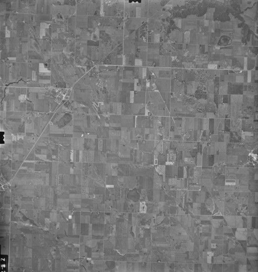
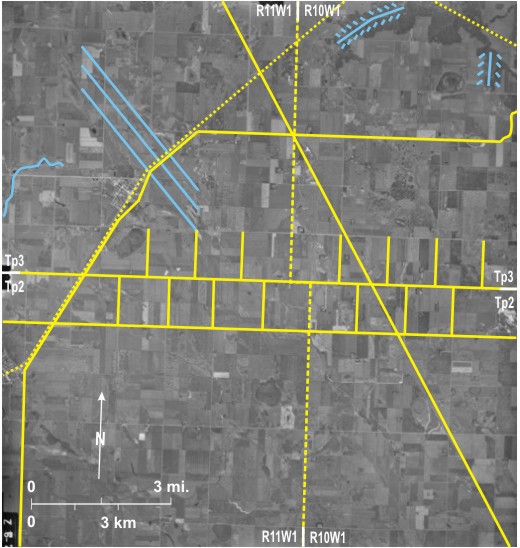
In this photo the correction line between townships 2 and 3 can be seen by tracing the boundary between ranges 10 and 11WI 1 north through township 2 to the boundary between townships 2 and 3. There it takes a jog (of about 2240 feet/ 682 m) westward 2 before continuing north. It can be seen that all the north/south section lines in the northern tier of township 2 end at the boundary between townships 2 and 3 3. North/south section lines in the southern tier of township 3 4 are located about 2240 feet west of those in township 2.
In this flat agricultural region, section lines can be easily identified, as can the town of Pilot Mound5 and the village of Crystal City 6. The settlements are joined by the CN railway line 7, and in both, roads are oriented parallel to and at right angles to the line—across the trend of the DLS system. PTH 34 8 also links the two, but it bypasses Pilot Mound 9 before continuing east. Another north-northwest/south-southeast linear feature 10 is probably the route of an abandoned railway line.
The area is mainly a flat ground moraine-covered plain, but in the northeast gullies 11 lead to the PembinaRiver (just off the photo to the northeast). Also, poorly defined Agassiz strandlines 12 trend northwest/southeast neat Pilot Mound, and a small stream draining west to the PembinaValley has been dammed to produce a reservoir 13.
[[fig. 7.12]]
Figure 7.12: Correction Line Between Townships 2 and 3 Near Pilot Mound
7.13: Correction Line Between Townships 6 and 7 Near Carman
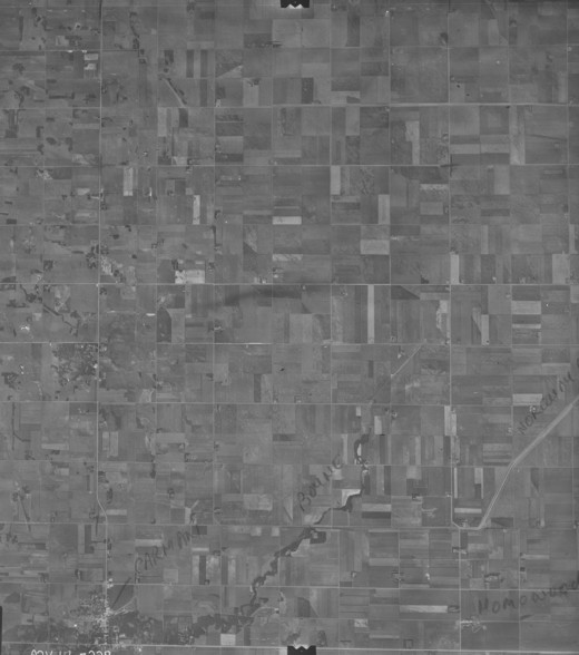
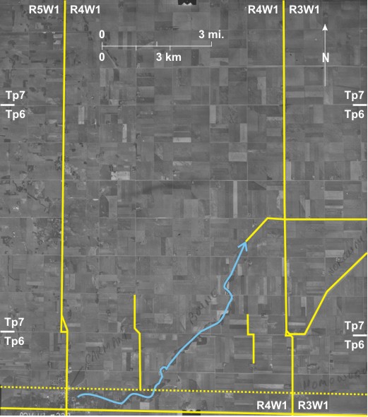
Correction lines occur every four townships; here, tracing the boundary between ranges 3 and 4WI 1 northward reveals the line between townships 6 and 7. At the township boundary there is a westward jog of about 672 feet (205m) 2. The jog is probably best seen one section further west 3 because it is not obscured by the existence of a road. The jog deflects the paths of three south to north roads: PTH 13 4 north of Carman 5; a gravel road two miles to the east 6; and another further east 7, running north from Homewood8.
The area is located on the flat LakeAgassiz plain. Carman and Homewood are connected by the CN line 9 and PTH 3 10. Drainage is from west to east with the Boyne River 11 flowing through Carman. Near the eastern edge of range 4WI it has been channelized 12 and eventually joins the Norquay Drain (off the photo) which can be seen between embankments in range 3WI 13.
[[fig. 7.13]]
Figure 7.13: Correction Line Between Townships 6 and 7 Near Carman
7.14: Correction Line Between Townships 6 and 7 Southwest of Souris
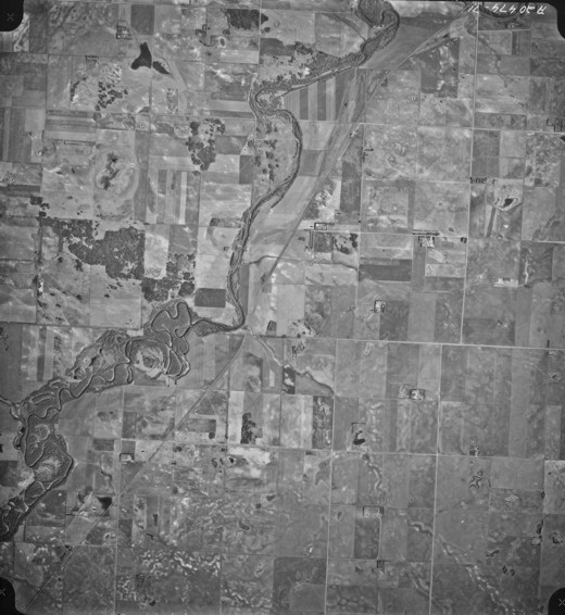
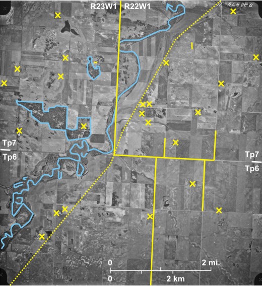
The boundary between ranges 22 and 23WI runs down the centre of this area 1, the southern half of which lies in township 6 and the northern half in township 7 between which there is a correction line. The size of the correction increases with each range west, so that here it is about 0.82 miles (4356 feet) compared with about 672 feet in figure 7.13 further east. The correction is best seen in the rows of sections, one to the east of the range line 2. The correction affects the direction of south/north gravel roads which tend to be deflected the 0.2 miles east rather than the longer distance west 3.
The northeastward-flowing Souris River 4 crosses the area. In the southwest it is a freely meandering river with several good examples of abandoned meanders; some, filled with water, are relatively recent 5, whereas others are older and have been unfilled by vegetation 6. Southeast of the river slight elevations in the ground moraine topography are light-toned due to rain splash erosion 7. Land northwest of the river is sandy and less suited to agriculture, hence several treed areas 8. In this dry area of southwestern Manitoba, dugouts—dark-toned oblong areas 9—are found in many sections.
The area is sparsely populated with only one or two farmsteads per section, often along section lines 10, producing a very dispersed population. The only major route way is the CN railway line 11 crossing the area diagonally. In the north an elevator 12—identified from its shadow—is located on a spur line at Menteith.
[[fig. 7.14]]
Figure 7.14: Correction Line Between Townships 6 and 7 Southwest of Souris
7.15: Correction Line Between Townships 10 and 11 Near Hargrave in Western Manitoba
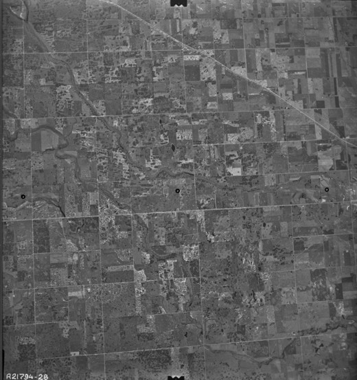
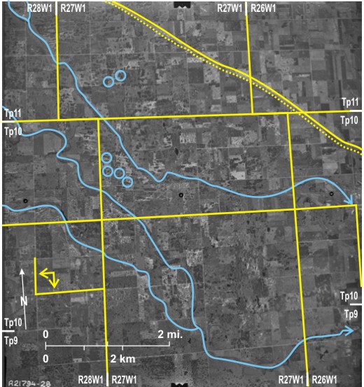
The size of the correction between townships increases every range west in Manitoba. Land in this photo lies within ranges 26, 27 WI, and 28 WI close to the Saskatchewan border. The correction can be seen by tracing the range line between ranges 26 and 27W11 north to the boundary between townships 10 and 11 2. Here it jogs well over a mile to the west 3. By doing the same with the range line between ranges 27 and 28 WI 4, it can be seen that there is a similar jog 5. Even though the photo is small-scale, it is clear that the latter jog is slightly larger. Just to the west of this area is the Manitoba/Saskatchewan border which lies along the range line between ranges 29 and 30 WI where the jog is about 1.25 miles (2 km).
Patterned ground covers the area, the pattern being emphasized by the distribution of tree patches 6 and bald crests due to rain splash 7. Drainage is to the southeast by a series of small creeks including Bosshill Creek 8 and Gopher Creek 9, both of which flow to the AssiniboineRiver (off the photo to the east).
Population in this agricultural area is sparse, reflected in the fact that gravel roads—light-toned 10—have been constructed along only some of the section lines, despite the fact that in the First System of the DLS road allowances occur along all section lines. One gravel road 11, runs east/west across the area. In the north is the CP line 12 with Hargrave 13—the only settlement on the area—located on it. Paralleling the line and north of it is the Trans-Canada Highway 14. PTH 83 15 is the main north/south route.
[[fig. 7.15]]
Figure 7.15: Correction Line Between Townships 10 and 11 Near Hargrave in Western Manitoba
7.16: Correction Line Between Townships 18 and 19 Southeast of McCreary
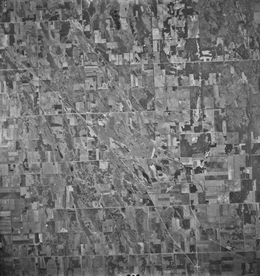
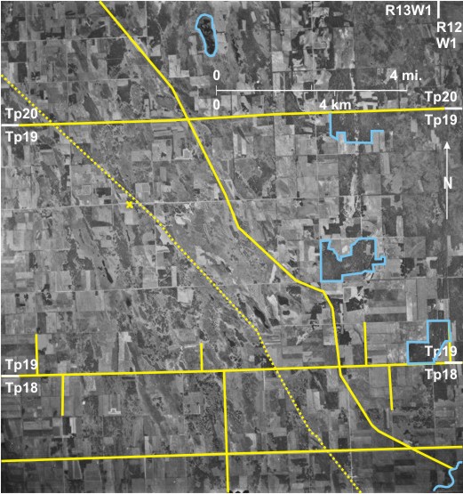
This area is located in ranges 12, 13 and 14 WI in the Interlake where much of the land is agriculturally marginal. A lot of woodland 1, scrub 2, marshland 3, and a partially dried up lake 4—PockettLake—can be seen. Few of the road allowances are used for gravel roads, making it difficult to identify the correction line. However, by tracing the township line between townships 18 and 19 5 west from the eastern edge of the photo, it can be seen that the north/south section lines do not coincide north and south of the township line; this is because of the correction which here is about 0.3 miles (0.5 km) 6.
This area has been recently—geologically speaking—uncovered by the eastward retreat of Lake Manitoba, leaving a general north-northwest/south-southeast alignment of landforms. Linear features of note are the CN line 7 from Glenella 8 (which, however, has a road system aligned with the DLS system) through Glencairn 9 to McCreary, which is off the photo to the northwest. Roughly parallel is a drainage ditch 10 that empties into Big Grass River 11 in the southeast. PR 261 12 runs east/west across the south.
[[fig. 7.16]]
Figure 7.16: Correction Line Between Townships 18 and 19 Southeast of McCreary
7.17: Correction Line Between Townships 34 and 35 South of Swan River
The photograph shows the wooded—dark-toned—northeast corner of Duck Mountain 1 with the fertile Swan River Plain to the north. The correction line between townships 34 and 35 can be seen by tracing the range line between ranges 27 and 28 WI 2 north until it reaches the township line where it jogs west about 1.25 miles (2 km) 3. The same can be done with the range line between ranges 28 and 29 WI 4 with the same result except that the jog is slightly larger 5.
This area was surveyed using the Third System of the DLS in which there is a north/south road allowance every section, but east/west allowances occur only every two sections. This is reflected in the predominance of north/south light-toned gravel roads 6. One road 7 is an oddity: it runs along a section line where there is no road allowance.
The drainage in this flat area is generally to the north. A series of small creeks—Lobstick Creek 8, Thomas Creek 9, Hay Creek 10, Ruby River 11, and Roaring River 12—with dark-toned wooded sides drain eventually into Swan River 13 that meanders across the northwest corner.
The main linear features include the CN railway line 14 that traverses the area linking the settlements of Durban15 and Kenville 16. In the former, the railway line determines the road direction, whereas in Kenville roads are oriented with respect to the DLS system. Part of the CN route is also followed by PTH 83 17 but it digresses from it in the north 18 and south 19. Rather unusually, several almost white clouds can be seen 20 casting dark-toned shadows to the north 21, indicating that the photo was taken near noon sun time.
[[fig. 7.17]]
Figure 7.17: Correction Line Between Townships 34 and 35 South of Swan River
7.18: Boundary of First and Third Systems of the DLS Near Sifton
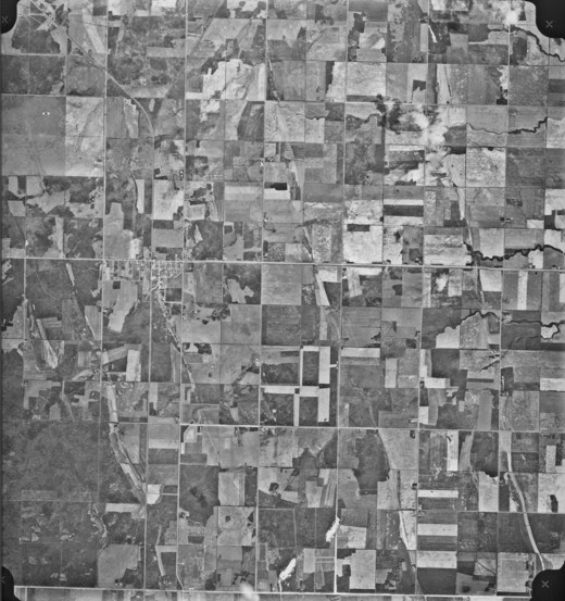
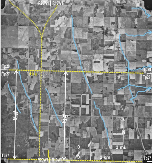
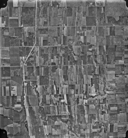
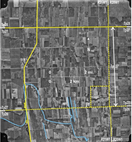
The photograph shows an agricultural area near Sifton 1 with dark-toned woodland 2 in the west. The boundary between the First and Third Systems of the DLS was set at the seventh correction line north of township 26 (or the eighth in the case of range 29). Fractional townships and ranges were required at the junction of the two systems; for example, township 27 shown here was only four sections from north to south. The township line between township 26 and 27 runs along the southern edge of the photo 3, and that between townships 27 and 28 4 runs just north of Sifton. There is a minor jog on the range line between ranges 19 and 20 WI at the crossing from township 26 to 27 5. This results from an imperfect contact between the First and Third Systems. A “normal” correction this far west would be almost a mile. Townships 27 and 28 were surveyed according to the Third System with east/west road allowances every two sections, hence the scarcity of light-toned east/west gravel roads, especially in township 28.
The land is flat with a gentle incline to the east towards DauphinLake. Several tree-fringed creeks 6 drain in that direction. At least five LakeAgassiz strandlines can be identified 7 on the basis of tonal variations reflecting land use differences.
The CN line 8 runs north/south through Sifton and bifurcates just to the north 9. The road system in Sifton has the unusual distinction of orientation parallel to and right angles to both the railway and the DLS. Finally PR 267 runs east/west through Sifton 10.
[[fig. 7.18]]
Figure 7.18: Boundary of First and Third Systems of the DLS Near Sifton
7.19: Township 27 West of Sifton
The photo shows the northern part of township 26, all of township 27, and the southern part of township 28 in ranges 20 and 21 WI. Township 26 was surveyed using the First System of the DLS, and for townships 27 and 28 the Third System was used. Township 27 is different from others in that it is only four sections deep. Also in the regular 36-section townships, the southeastern-most section is numbered 1, but in township 27 townships have only 24 sections, and the southeastern most is numbered 13 1, with the rest of the numbering continuing as normal. A small jog occurs in the range line between ranges 20 and 21 WI 2 where it crosses from township 26 to 27. This results from the imperfect contact between the two systems of the DLS.
The landscape in this area has a distinct north/south lineation resulting from LakeAgassiz strandlines. Areas of woodland 3 and marshy areas 4 follow this trend. Also PTH 10 5 in the west follows a strandline in the south. Several small gravel pits have been excavated into the strandline 6 as well as another one in a slightly lower strandline 7. Ground observation reveals that cemeteries are also located on strandlines because of ease of digging and dry conditions. Strandlines also influence the drainage; DriftingRiver flowing from the west 8 is deflected north before cutting through a strandline 9 to flow south about 2 miles 10 before continuing its eastward course 11.
The only numbered east/west road is PR 267 12 along the northern edge of township 27 leading to Sifton off the photo to the east.
[[fig. 7.19]]
Figure 7.19: Township 27 West of Sifton
7.20: Contact Between the First and Third Systems of the DLS North of Roblin
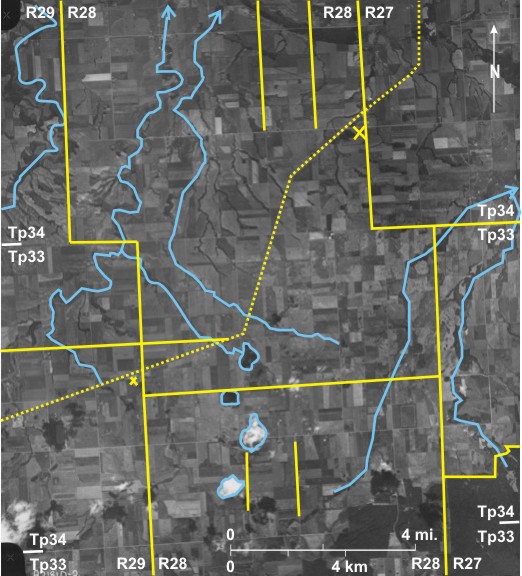
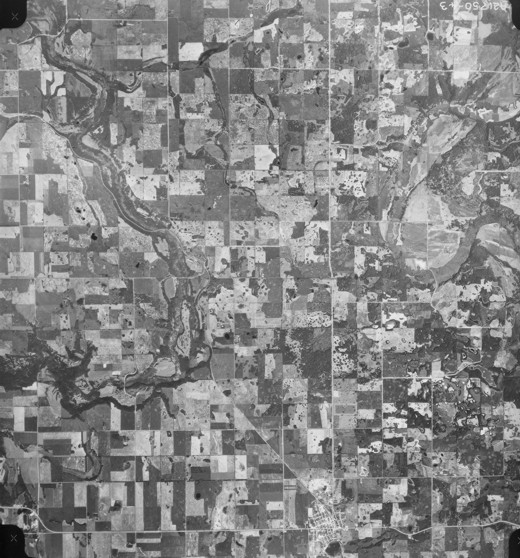
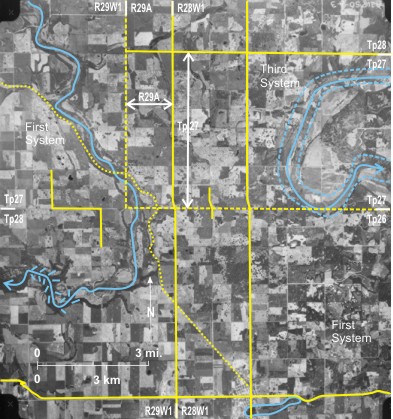
This photo shows the complicated contact between the First and Third Systems in western Manitoba. The dashed line on the overlay indicates the contact between the two. The southern half of the area is in township 26 and was therefore surveyed using the First System. The eastern boundary of range 29 WI 1 can be traced north to the township 26/27 line 2 where it jogs over a mile (1.6 km) to the west 3 before continuing north 4. Land in township 27, range 29 WI was also surveyed using the First System. East of range 29 WI, north of township 26, is range 29A which is just over one section wide 5; east of this is range 28 WI. In ranges 28 WI and 29A, township 27 is only four sections deep 6, and it and township 28 are surveyed using the Third System.
It is noticeable that there is a small jog between townships 26 and 27 in the east 7 (this is the contact between the First and Third Systems), whereas in the west in range 29 WI, which is all surveyed in the First System, the jog is well over a mile 8.
The area is covered by ground moraine dotted by lakes, for example, RoblinLakes in the south 9. Two misfit streams flow in large valleys created by melt water from ice on DuckMountain (off the photo to the north). In the east is the Shell River 10 which meanders inside a large valley, which itself has a meandering path 11 in harmony with its once large discharge. In the west is Big Boggy Creek 12 in a wooded, steep-sided valley 13 that flows to the Assiniboine in the west, just off the photo—or more correctly to Lake of the Prairies created by the damming of the Assiniboine River near Shellmouth.
Roblin 14 in the south is a transport hub. The CN line runs through it and then northward along the valley of Big Boggy Creek 15. Roads in Roblin are oriented with respect to the railway line. Also, PTH 83 runs north/south 16 and PTH 5 east/west 17, both passing through Roblin.
[[fig. 7.20]]
Figure 7.20: Contact Between the First and Third Systems of the DLS North of Roblin
7.21: Municipal Boundary at Ninette
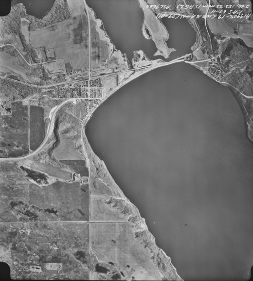
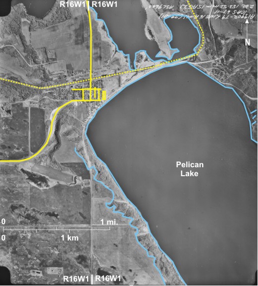
In southwestern Manitoba boundaries between RMs are along range lines and township lines. In most cases this administrative convenience works well, but not at Ninette where the boundary between Riverside 1 and Strathcona 2 lies along the range line between ranges 16 and 17 WI which runs along the main street of Ninette 3, placing the western part of the village in Riverside and the east in Strathcona. This arrangement was clearly inconvenient for such a small community, so from 1999 onwards all of Ninette was placed in the RM of Riverside.
Ninette lies on the floor of the Souris-Pembina Spillway occupied here by PelicanLake4 and GrassLake5. PelicanLake has played a large part in the settlement’s history. The steep sides of the spillway 6 made land travel along the lakeshore difficult, so early in the 20th Century boats carried passengers to beaches along the lake.[i] Trains on the CN line brought holiday-makers were from Brandon and Winnipeg 7. Cottages were developed, initially along the north shore 8 but later along the whole length of both sides of the lake including the development at Pelican Point 9. The cluster of buildings at the northeastern end of PelicanLake10 is the Manitoba Sanatorium to which patients were brought from all over Manitoba for treatment of tuberculosis.[ii] Later it became the Pelican Lake Training Centre for mentally handicapped people, but at last reports all but one of the buildings have been demolished.
PTH 18 11 runs through the centre of the community along the wide main street 3. Roads are aligned with the DLS system—east/west and north/south. The long building at the east side of the settlement is the local curling rink 12—a fixture in even the smallest Manitoba community.