Chapter 5: Vegetation
In southern and west central Individual animals are too small to appear on all except very large-scale images. However, some animals (e.g. beaver) profoundly affect drainage systems.
5.1: Broadleaf Deciduous Forest in Turtle Mountain
Areas of broadleaf deciduous forest are limited in
Figure 5.1 is a high-level, small-scale photo of the western part of
On the Canadian side of the border little forest has been cleared for agriculture within
In
5.2: Broadleaf Deciduous Forest in the Brandon Hills and Riverine Gallery Forest in the Assiniboine Valley
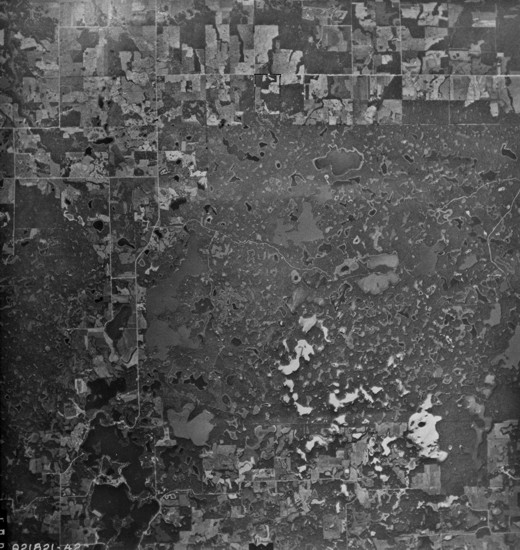
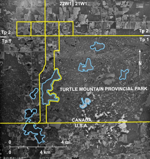
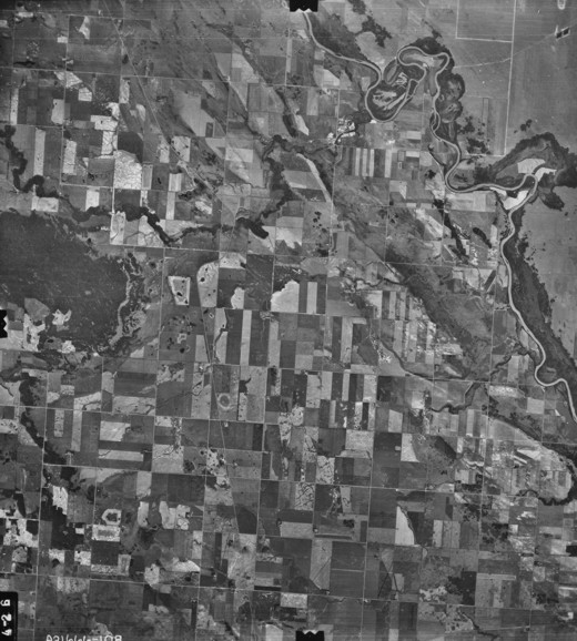
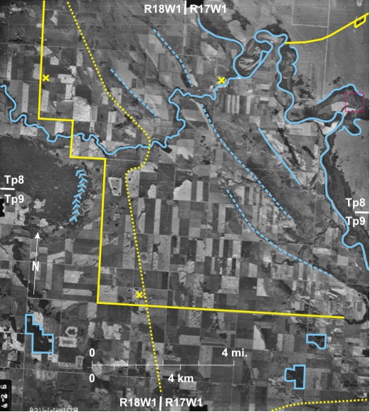
In this high-level, small-scale photo deciduous forest in the leaf-on stage appears as very dark grey tones. The
Most of the rest of the area is devoted to agriculture with the characteristic checkerboard pattern of the DLS. Occasional patches of deciduous trees interrupt the cropped landscape 9. Gravel roads follow most section lines. Their upkeep is a major drain on the financial resources of rural municipalities, and with the rural depopulation so representative of the area, many are likely to be abandoned.[i] PR 340 10, locally called “the Sunshine Highway” because it heads south from Brandon, runs east of the Brandon Hills, and with five right-angled bends on its route, clearly demonstrates the influence of the land division system on road directions in this area. Other transport lines include the north/south CN railway line 11 which used to terminate at the
The area is sparsely populated. The
5.3: Vegetation of the Assiniboine Valley and Assiniboine Delta in the Area of Spruce Woods Provincial Park
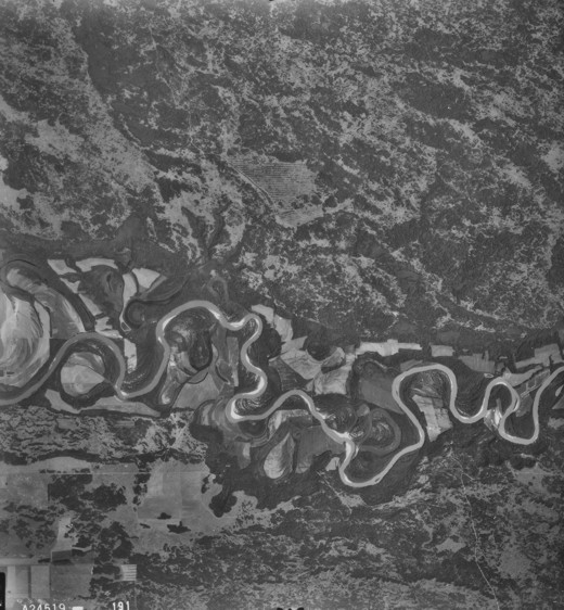
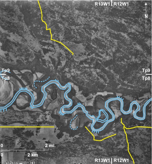
On panchromatic (black and white) air photographs the green leaves of deciduous trees produce a dark-grey tone. In this area the Assiniboine River 1 has incised itself into the sands of the Assiniboine Delta. River cliffs 2 and point bars 3 exist at several locations. Several abandoned channels 4 are also visible, one of which, known locally as
Riverine gallery forest—very dark-grey toned—is located along both sides of the
Most of this area lies within
5.4: Mixed Deciduous/Coniferous Woodland on the Assiniboine Delta North of Glenboro
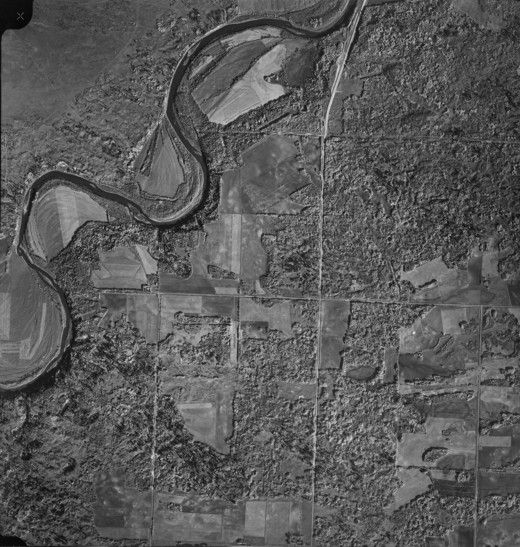
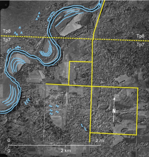
In figures 5.1, 5.2, and 5.3, all of which are photographs obtained during the summer, deciduous woodland was identified on the basis of its dark tone. Figure 5.4, a fall photograph of an area southeast of the Assiniboine River 1, north of Glenboro, illustrates the usefulness of fall photos in vegetation studies. At this time of year deciduous trees are changing colour; for example aspen (Populus tremuloides) leaves turn a delicate yellow and are imaged as a very light tone 2. Other deciduous trees are imaged as a darker grey 3 and coniferous trees—probably white spruce (Picea glauca)—are very dark-grey 4 and can also be identified from the triangular shadows they throw 5. Light-toned grasses 6 with occasional coniferous trees identified by their dark tone and triangular shadow 7 cover much of the land northwest of the
Land along the Assiniboine has been cleared for agriculture, revealing prominent meander scrolls 9 with river cliffs 10—slumped in one case 11—on the outside of meander bends. Section lines of the DLS system are visible 12 with PTH 5 between Glenboro and Carberry 13 following the system before bending in the north 14 to miss a meander of the
[[fig. 5.4]]
5.5: Riverine Gallery Forest in the Souris Valley Near the Elbow of Capture
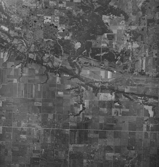
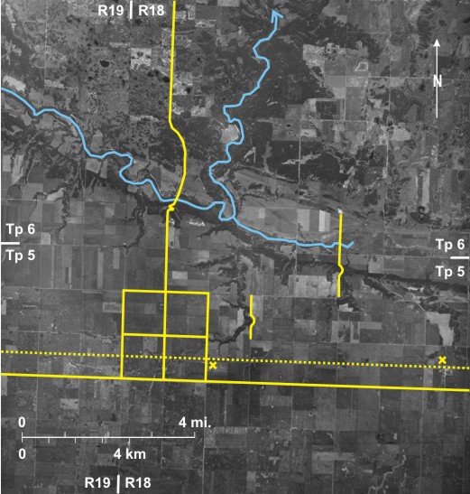
This high-level, small-scale photo shows the Souris River 1 where it runs through a 90° turn to change from flowing southeast to northeast and then cuts through the Tiger Hills 2, eventually joining the Assiniboine near the small settlement of Treesbank (off the photo to the north). West of the elbow of capture 3 the
Riverine gallery forest on both sides of the
In the agricultural area to the south the sections of the DLS system are obvious 13; gravel roads follow most section lines and PTH 23 14 is a more definite light tone than the gravel roads. In the
[[fig. 5.5]]
5.6: Riverine Gallery Forest in the Pembina Valley East of Snowflake
The misfit Pembina River 1 occupies the floor of a glacial spillway that carried water from glacial
Almost all the southwest side is covered by riverine gallery forest 5, including in this area cottonwood (Populus deltoides),
As in previous figures the main criterion for identifying forest is its dark tone, but in this case the scale is large enough that, using a magnifying lens with the original photo, the rounded crowns of the deciduous trees can be identified; they produce a mottled texture 9.
The
[[fig. 5.6]]
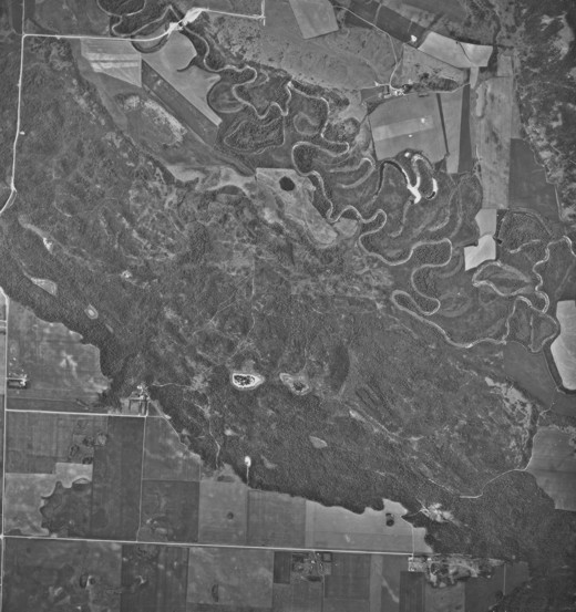
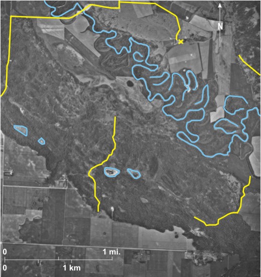
5.7: Riverine Gallery Forest in the Valley of the Little Saskatchewan River South of Rivers
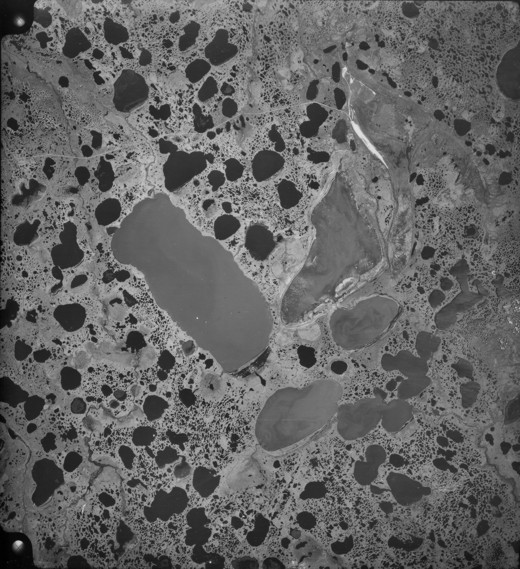
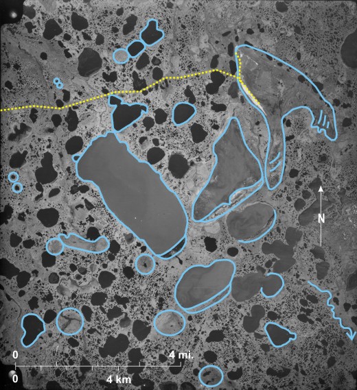
The Little Saskatchewan River 1 flows southward across the area, and at the time the photo was taken, the channel was full of water, but several boulder barriers across the stream can be identified 2.
The large scale of the photograph makes it possible to identify individual deciduous trees 3 and the rounded shadows they throw 4. Deciduous forest—here mainly aspen (Populus tremuloides) and bur oak (Quercus macrocarpa)—occupies wetter land on either side of the river channel 5 as well as small “draws” leading down to the river 6. Low-lying bushes—dark-toned but without obvious tree crowns— cover an area in the southwest 7, and patches of light-toned grass also occur 8. The latter should not be confused with land that has been cropped and which shows the linear patterns associated with cropping 9. A track leading down to the river 10 probably originates at a farm building off the photo to the east. Small dark spots in the northeast may be cattle 11.
[[fig. 5.7]]
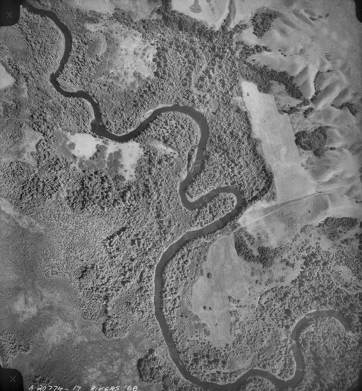
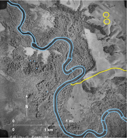
5.8: Riverine Gallery Forest on the East Side of Pelican Lake
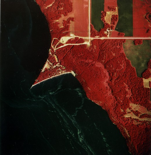
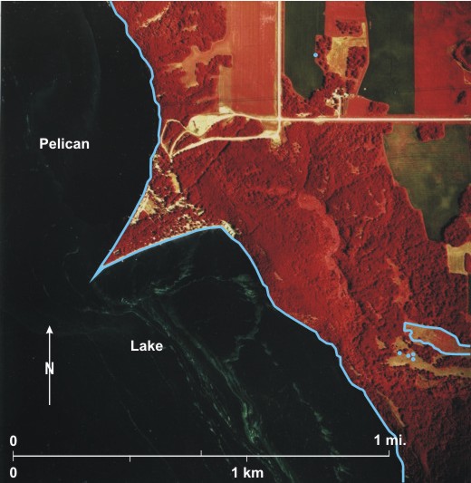
This infrared photograph shows part of the east
Here, along the east wall of the spillway, riverine gallery forest, mainly aspen (Populus tremuloides) and bur oak (Quercus macrocarpa), shows up in bright-red tones with mottled texture 2. The scale of the photograph is large enough that rounded shadows thrown by individual trees can be identified 3. A clearing within the forest contains low-lying bushes that are imaged as pink 4. Rounded patches 5 suggest that these are creeping juniper (Juniperus horizontalis).
In the north, crops are growing in five fields 6. In the western-most of these it can be seen that the crop is growing well in some areas 7 but not so well in others 8. Three fields that have been left fallow 9 are imaged as dark green, but in the southernmost field weed growth results in a pink tinge 10.
The v-shaped projection into
5.9: Natural Vegetation Surrounding the Red River Plain
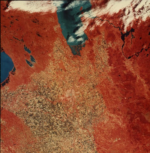
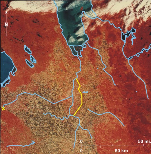
This Landsat image shows radiation from the earth’s surface in three wavelength bands: 0.5 to 0.6 micrometres (green), 0.6 to 0.7 micrometres (red), and 0.8 to 1.1 micrometres (infrared). Printing was done so that objects reflecting large amounts of infrared radiation were imaged as red. At the time the image was obtained (September 17, 1973) this applied to trees, shrubs, and grasses growing in the area. Water bodies range from very dark blue to light milky blue, the latter being the case where there is a large suspended sediment load. In the northeast, the Winnipeg River 1 flows through a series of expansions, the largest being Lac du Bonnet 2, before entering
Three main areas of natural vegetation can be identified. In the southeast, mainly on the
The second area is the Interlake region 14 between lakes
In the third area in the southwest on the Pembina Hills 16, the redness is less uniform because of agricultural clearing. In this area small patches of broadleaf forest occur on the higher ground with the rest being aspen parkland.[iii]
Delta marsh 17 at the south end of Lake Manitoba and Netley Marsh 18 at the south end of
There are, however, a few exceptions. In the north, Oak Hammock Marsh 22 “has been maintained as an important wetland and staging area for migratory waterfowl by regulating water levels and practicing periodic draw down.”[iv] It is imaged as red, but there is little indication of standing water. Another red area northeast of
The emphasis here is on interpretation of natural vegetation, but three cultural features should be mentioned: Winnipeg is located at the junction of the Red and the Assiniboine rivers 30; the white areas 31 northeast of Winnipeg are gravel pits into the Birds Hill esker; and the Red River Floodway which bypasses the city to the east 32 is red because of grasses growing on its banks.
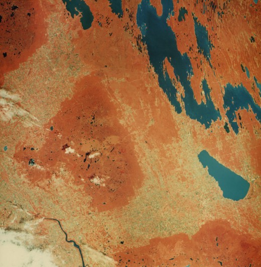
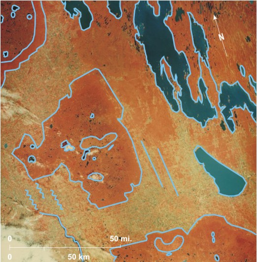
5.10: Distribution of Natural Vegetation in Central Manitoba
This Landsat colour composite was obtained on August 15, 1973 at which time the natural vegetation was reflecting large amounts of infrared radiation and therefore appears as red/orange in the image. Water bodies are imaged in various shades of blue: dark where there is little suspended sediment and pastel where there is a large suspended load.
In the northeast is Lake Winnipegosis 1 that drains from Long Island Bay 2 by the West Waterhen River 3 into Waterhen Lake 4 that in turn drains south via the Waterhen River 5 into the north end of Lake Manitoba 6.
Three highland areas—Riding Mountain 12, Duck Mountain 13, and the Porcupine Hills 14—are covered by thick moraine with numerous lake-occupied depressions. In
The red/orange tone of
Outside the three hilly areas most of the land west of Lake Winnipegosis is wooded, as is the
A few clouds are seen on the image mainly in the southwest 41 and west 42. Over
[[fig. 5.10]]
5.11: Vegetation in the Central Part of Duck Mountain
The photograph shows the lake-strewn central part of
Almost the whole area is covered by natural vegetation, in this area mixed woods consisting of coniferous trees on higher land and birch (Betula papyrifera) and aspen (Populus tremuloides) in better-drained lowlands. The dominant trees are probably white spruce (Picea glauca) and black spruce (Picea mariana). Wooded areas are dark-toned 11 with light-toned areas of aquatic vegetation surrounding some of the lakes 12. It is noticeable, however, that the northwest is lighter toned 13, the result of a forest fire. This is the same scar that can be seen on the LANDSAT image in figure 5.10.
The area is almost devoid of human occupation, but some recreational development is seen at the north end of
[[fig. 5.11]]
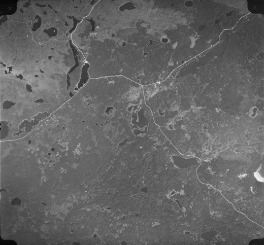
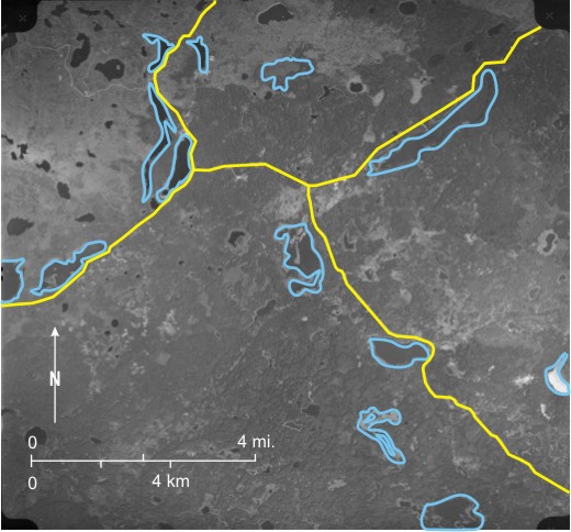
5.12: The Northern Edge of Riding Mountain National Park
The photo shows the sharp demarcation line between the essentially natural vegetation in Riding Mountain National Park 1 and the
South of the park boundary 3 the natural vegetation consists of mixed woods: coniferous trees, including white spruce (Picea glauca) on higher land and black spruce (Picea mariana) with birch (Betula papyrifera) and aspen (Populus tremuloides) on well-drained lowlands. The woodland is represented in very dark-grey tones 4 with lighter-toned areas of aquatic vegetation around small lakes 5. Two large areas of light tone in the southwest 6 and southeast 7 are the result of a forest fire. This area can also be identified on satellite images (figure 5.10).
Drainage from this part of
[[fig. 5.12]]
5.13: Vegetation on the Riding Mountain Escarpment
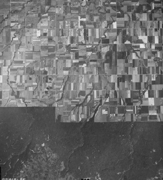
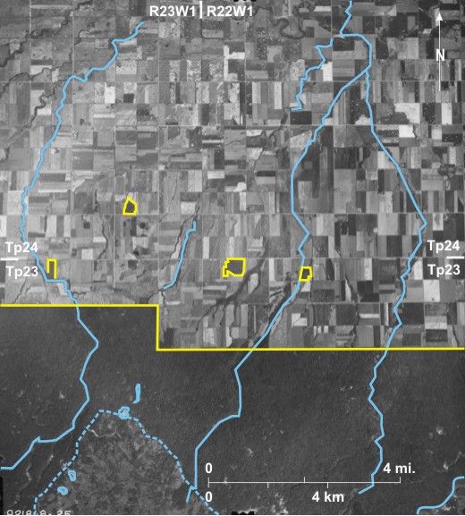
On this photo of the Riding Mountain Escarpment, drainage is to the east in a series of steep-sided valleys of which Dead Ox Creek 1 in the centre is the largest. The creeks have eroded down through a thick veneer of moraine to reveal the underlying Cretaceous shales—white-toned—in many locations 2. This is particularly noticeable on the outside of creek bends 3, and at one location, Bald Hill in the north 4, a sharp-crested ridge of shale is exposed.
The natural vegetation in this area is mixed woodland with deciduous trees: aspen (Populus tremuloides), balsam poplar (Populus balsamifera), and birch (Betula papyrifera) dominating. These produce a light-grey tone 5, and in some places the rounded crowns of trees can be seen 6 producing a mottled texture. Darker toned coniferous trees, white spruce (Picea glauca) and black spruce (Picea mariana), dominate in a few places 7, and isolated conifers can be identified on the basis of their dark tone and triangular shadow shapes 8.
The only indications of human impact on the area are PTH 19 9 that crosses Riding Mountain from west to east and one of the park’s walking trails 10.
[[fig. 5.13]]
5.14: Natural Vegetation in North Central Riding Mountain National Park
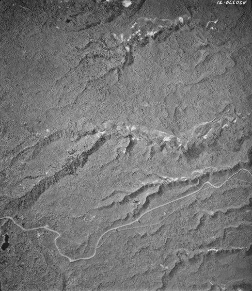
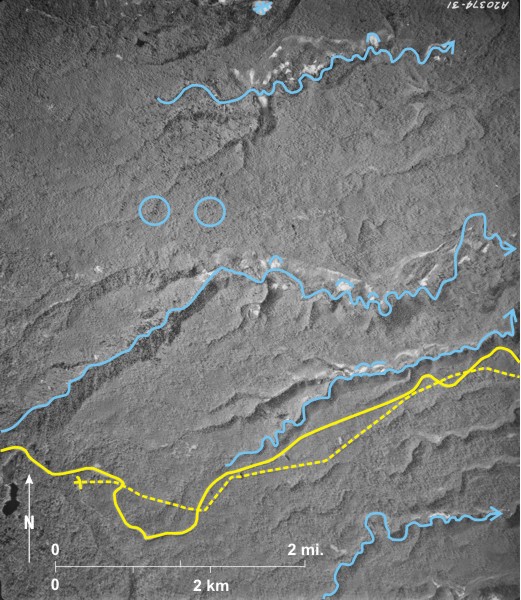
The Vermilion River 1 drains north and is joined by a right bank tributary 2 which is in turn joined by tributaries from the east (3 and 4). The landscape is covered by mixed-woods with light-toned deciduous trees: aspen (Populus tremuloides), balsam (Populus balsamifera), and birch (Betula papyrifera) in the west 5. Rounded crowns produce a mottled texture 6. In the south 7 dark-toned coniferous trees—black spruce (Picea mariana) and white spruce (Picea glauca)—are more common, and in the northeast many isolated coniferous trees are identified from their dark tone and triangular shadows 8. Along the
The only evidence of human influence is a trail (The Strathclair Trail) 12 trending north/south across the region. This is a warden patrol trail. A small star-shaped area 13 west of the Vermilion defies easy explanation.
[[fig. 5.14]]
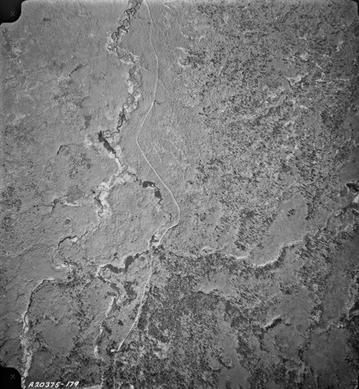
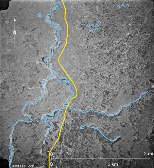
5.15: Natural Vegetation Near Moon Lake in the North Central Part of Riding Mountain National Park
PTH 10 9 between Minnedosa and Dauphin runs through the area with a forest access road leading to the west 10. A microwave tower with a long thin westward-falling shadow 11 is situated in a clearing along the road. A campground at the south end of
[[fig. 5.15]]
5.16: Colour Infrared Photo of Natural Vegetation in the Central Part of Riding Mountain National Park
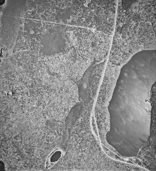
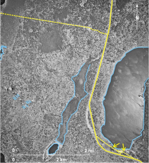
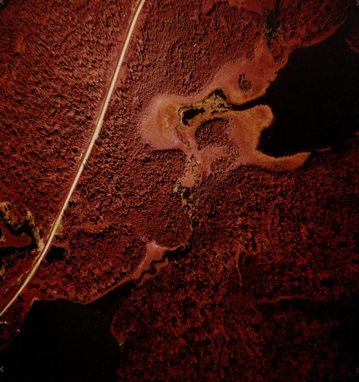
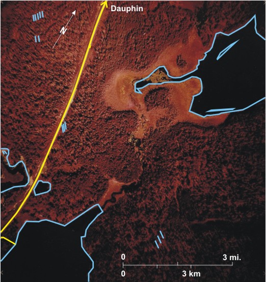
This low-level, large-scale colour infrared photo shows natural vegetation in the central part of
Three small lakes 5 that are almost black because they reflect little infrared exist in this area. The northernmost is ringed by low-lying aquatic vegetation 6 with some algae growth 7 offshore. Trees that are imaged as greenish-yellow have been killed by water in several locations 8.
The only indications of human influence are PTH 10 with a car traveling along it 9 and a small side road leading to a jetty 10.
[[fig. 5.16]]
5.17: Mixed Vegetation Near Lake Audy, Riding Mountain National Park
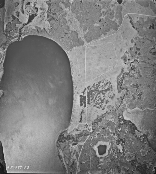
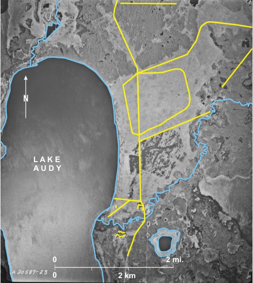
The photograph shows the northern part of Lake Audy 1 with the Little Saskatchewan River 2 draining into it from the north and Jackfish Creek draining to it from the east 3. Another small, unnamed lake 4 can be seen in the south. It was once considerably larger and is now ringed by emergent aquatic vegetation 5.
Vegetation includes deciduous woodland, coniferous woodland, and grassland. Deciduous woodland, light-toned with a mottled texture, is widespread 6, whereas dark-toned coniferous woodland 7 is more localized. Very light-toned grassland covers a large area east of the lake 8 and a smaller area to the north 9. Much of the vegetation is natural, but some coniferous trees have clearly been planted 10. The main grassed area is used as a compound for a buffalo herd, one of the few left on the prairies. Tourists are allowed to drive along a peripheral trail 11 in order to view the animals. Large though they are, they are not big enough to show up on this small-scale photo. A faint cut line through the deciduous woodland is probably the location of part of the fence around the compound 12.
Several trails lead into and out of the area 13, one leading to the campground 14 on the lakeshore.
[[fig. 5.17]]
5.18: Mixed Vegetation in the Area of Gunn Lake, Riding Mountain National Park
In the top left-hand side of the photo is
The only indications of human influence are two hiking/biking/cross country trails, the easternmost of which 10 crosses mainly woodland and appears to be flooded in the north 11. The other trail 12 is well known locally because it crosses the grassland, a colourful walk/ride in the spring as the flowers bloom.
[[fig. 5.18]]
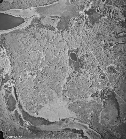
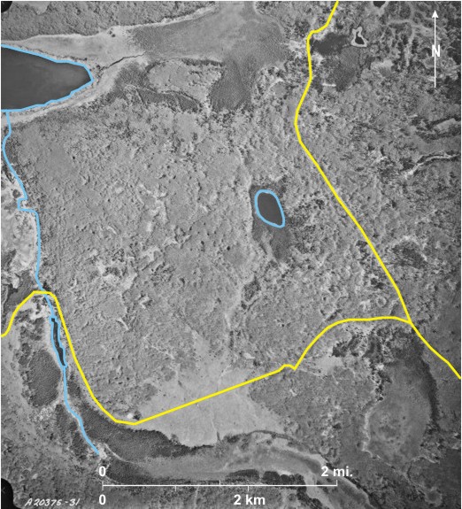
5.19: Colour Infrared Photo of Vegetation on the Assiniboine Delta Southeast of Shilo
Shown here is part of the Assiniboine Delta where the sands of the delta have been blown into dunes 1 and then stabilized by vegetation. The area, of little agricultural value, has been used as a military training ground for over 50 years. This large-scale colour infrared photo illustrates the usefulness of colour infrared images for identifying vegetation. At the time the photo was taken—late fall—all the deciduous trees had lost their leaves and were therefore not reflecting infrared radiation, but coniferous trees still had needles that reflect infrared and are imaged as red or orange.
Five vegetation types can be identified using the standard criteria for photo identification—tone—including in this case colour, texture, pattern, shape, size, and location. The most obvious vegetation zone is a thick red band trending northwest/southeast across the centre 2. Trees occur in rows indicating that they were planted, and their red colour and triangular shape and shadow indicate that they are coniferous. A field check revealed that they are Scots Pine (Pinus sylvestris L.) which are not native to this area. Near the southern edge of the photo are two small patches (3 and 4) of coniferous trees—red, with triangular shape and shadow. Given their location on the sand dunes, they are probably white spruce (Picea glauca). Isolated individual white spruce 5 can be seen scattered over the area south of the plantation. Also widespread over the whole area, but especially north of the plantation, are orange patches 6 often assuming a circular form 7. This vegetation throws no shadow, so it is not high off the ground. It is creeping juniper (Juniperis horizontalis) that, as its name suggests, spreads horizontally, especially over flat land. Much of the area is covered by vegetation imaged as pale green/almost white 8. Shadows indicate that we are dealing with trees, in this case aspen (Populus tremuloides) that have lost their leaves. Finally, there are extensive areas of pale green, smooth-textured grasslands 9.
The area is crossed by many tracks with a main one along the southern edge of the plantation 10 that leads from Shilo to the central part of the military reserve. Others are trails used by military vehicles. An indicator of how frequently they are used is given by whether they are covered by creeping juniper (as at 11). The only other indicator of human activity is a cluster of buildings north of the plantation 12 that is possibly a rifle range.
[[fig. 5.19]]
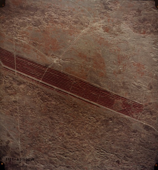
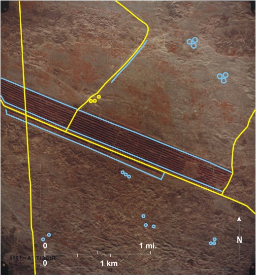
5.20: Vegetation Near Plum Lakes
The large shallow water area of
The southern third is quite different, being covered by sand dunes which result from lake deposited sands being blown into dunes. Some well-defined ridges 8 can be identified. There are a few bare sand patches 9 but almost all the dunes are stabilized by vegetation—mainly deciduous trees and grass. The deciduous trees had lost their leaves by the time the photo was taken; consequently their shadow shape 10, their medium-grey tone, and mottled texture can identify the trees. Grass, on the other hand, is light grey with a smooth texture 11. On the dune ridges, microclimate variations result in different vegetation covers: on wetter northeast-facing slopes, trees dominate, whereas drier southwest-facing slopes are grass-covered 12. Two dugouts 13, probably supply grazing cattle in the sand hills. Apart from some trails there is little evidence of human activity, other than farming.
[[fig.5.20]]
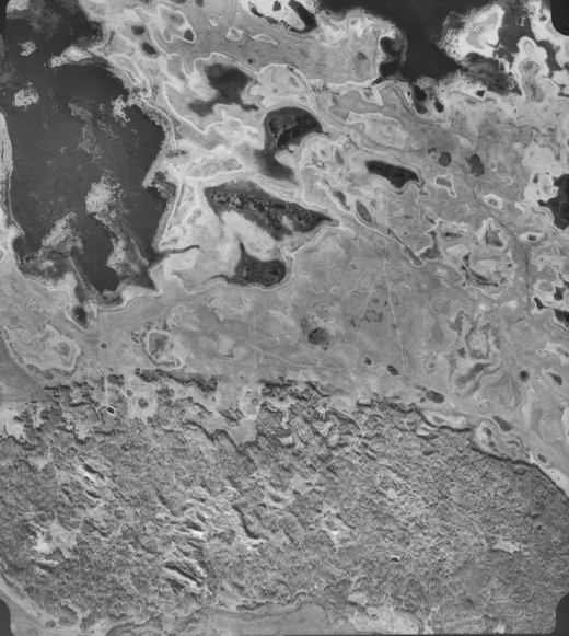
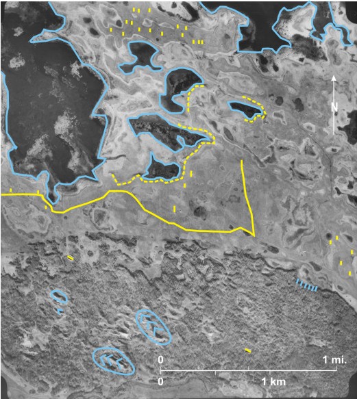
5.21: Beaver Dams in the Central Part of Riding Mountain National Park
The photo shows an area of mixed vegetation in the central part of
Several small streams 6 flow across the area. In some places they have been blocked by beaver dams 7 to produce lakes—very dark-toned—upstream 8. Usually the lakes are narrow occupying creek valleys 9, but in one instance water has spread over a wide area 10 killing trees. A lake that has since drained occupied another dark-toned area 11.
In this central part of the national park there is little evidence of human activity except a poorly defined trail 12 that has been flooded in two locations 13.
[[fig. 5.21]]
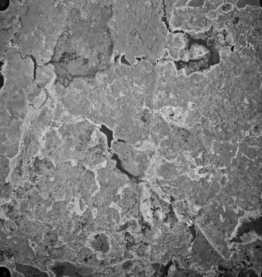
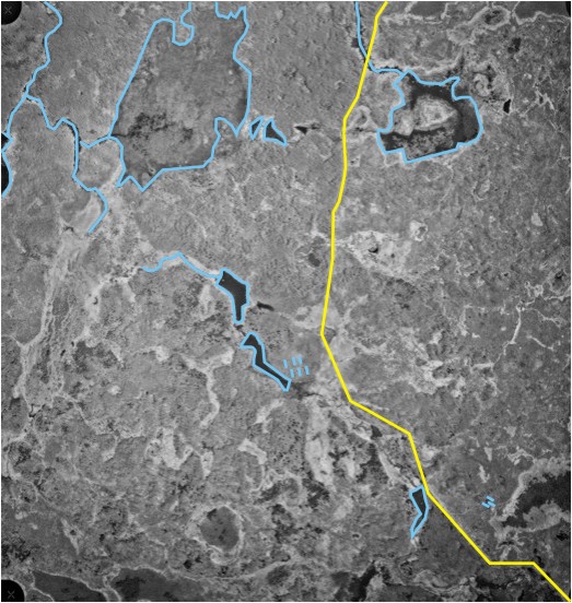
5.22: Part of Delta Marsh West of Delta Beach on the South Shore of Lake Manitoba
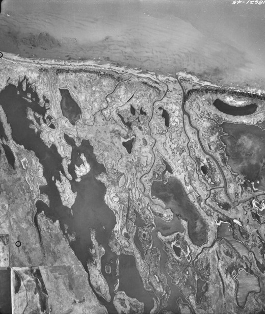
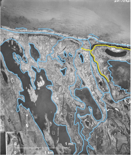
Delta Marsh extends for over 25 miles (40 km) along the south
The
[[fig. 5.22]]
5.23: Fen and Black Spruce Islands South of East Braintree
Teardrop-shaped islands 1 are surrounded by almost horizontal fen 2 covered by low-lying vegetation. The islands are covered by black spruce (Picea mariana), dark-toned, 3 and tamarack (Larix laricina), light-toned 4. The surface form of the islands is determined by surface and groundwater flow.[i] The terrain is very difficult to cross; hence the absence of any obvious human impact.
5.24: Spring Fens West of Dancing Point, West Shore of Lake Winnipeg
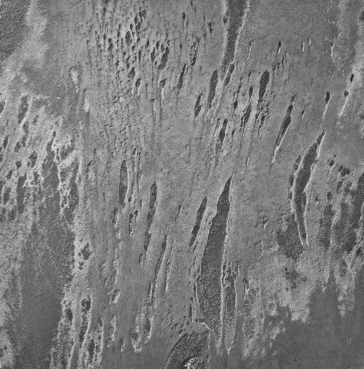
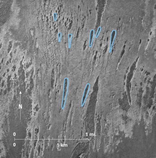
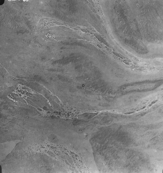
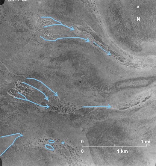
The location is close to the junction of Ordovician and Silurian bedrock. Rocks of both periods include dolomite with argillaceous bands, and springs develop at the contacts. In the photo light-toned drainage way can be seen running from springs in the north 1 and centre 2. These are “spring fens”. They usually occur directly over springs in places where springs are widespread. The peat in spring fens varies in depth from shallow to deep but is thinner than peat in plateaus.[i] Wooded islands, probably covered by black spruce (Picea mariana), can be seen in the south 3, and the outline of a recent burn is in the lower left 4.
5.25: Ribbed Fen East of Warren Landing, North End of Lake Winnipeg
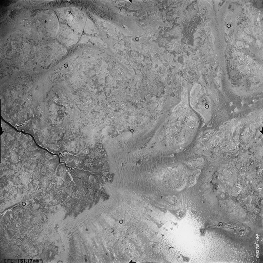
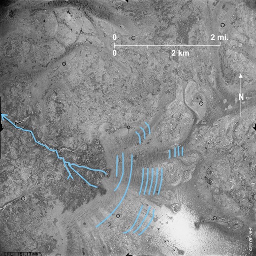
Ribbed fen with slightly elevated ridges of vegetation 1 at right angles to the direction of water movement occupies much of the centre of the photo. Ground water flowing to the west coalesces into drainage channels 2 that become Oscar Creek 3 that in turn drains into the upper reaches of the
[[fig. 5.25]]
5.26: Floating Fen in Shirley Lake West of North Moose Lake
The photograph shows the north end of
5.27: String Fens and Peat Plateaus West of Setting Lake
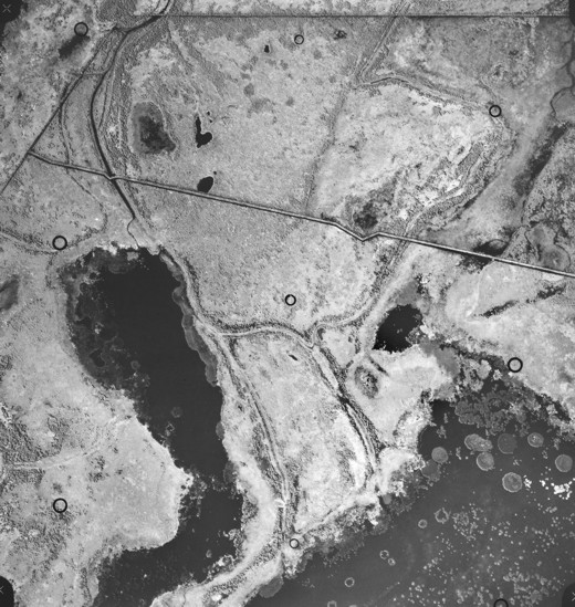
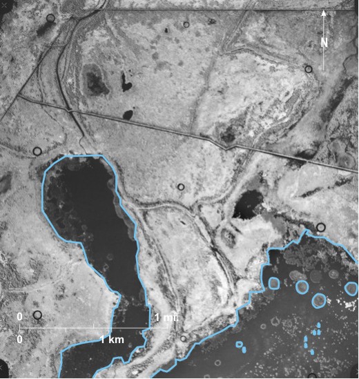
This area lies within the
5.28: String Fens and Peat Plateaus East of Kettle Rapids
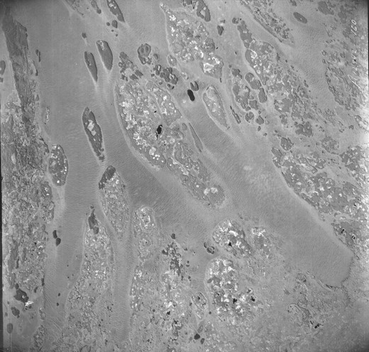
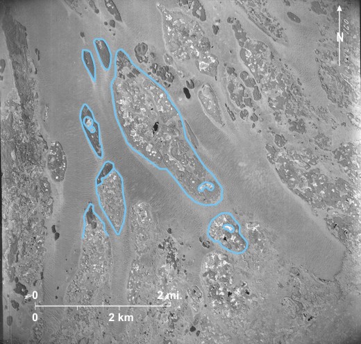
This is a good example “of string, net, and anastomosing fens as well as pancake-shaped, wooded peat plateaus with collapse scars. The area is situated in the northern part of the discontinuous (permafrost) zone where the mean annual temperature is -5°C and widespread permafrost is 25 metres thick. Permafrost is absent beneath both the flarks and strings at this location. The two dominant tones are related to the native vegetation: the dark tones are dominantly black spruce [Picea marina] and acid-tolerant shrubs, and the light tones are mainly tamarack [Larix laricina] and sedge with some sphagnum. Most of the peat plateaus have central depressions due to thawing of the permafrost and consequent settling of the ground. The sedge meadows in these collapse scars produce light tones. Peat thickness is predominantly 2 to 6 m. Stratified clayey silt and silty sand of glaciomarine origin underlie peat and overlie varved glaciolacustrine clay, which in turn rests on silty ablation till. Ground water running through these highly calcareous mineral sediments feeds nutrients to the fens.[i]
Fen ridges that are oriented parallel to the topographic contours are best observed along a line (1 to 2 to 3). Here the individual strings are mostly serpentine and sub-parallel, but at a few places they appear either closely interwoven or merged. They are spread apart at 4, and at 5 they are bunched together. This alternation of open and closed patterns suggests slight differences in gradient. On flatter areas the strings tend to form netlike patterns, whereas on gentle to moderate slopes they produce string patterns of variable spacing. Similar pattern variations are noticeable further west 6. Light-toned collapsed peat plateaus can be seen at several locations 7.
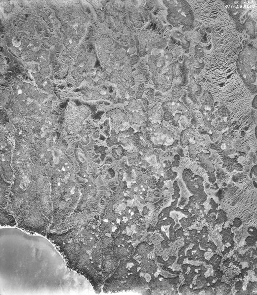
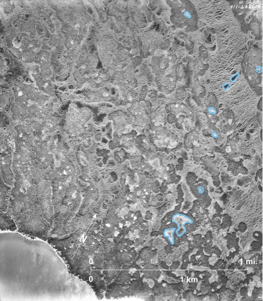
5.29: Peat Plateaus and Sloping Fens Near the Mouth of the Hayes River
In this area the coastal plain is being rapidly uplifted. Peat covers a discontinuous veneer of recent over- bank alluvial deposits over marine silt and clay or wave-modified till. The Hayes River 1, transporting a large sediment load, is braided with in-channel islands:
Oval peat plateaus are well-developed 6. The regular outlines of these plateaus suggest that they are actively expanding over the surrounding fens, many of them eventually coalescing (as at 7). Collapse scars can be detected on the centre of some of the plateaus 8. The streaked pattern 9 of the gently sloping fen is created by sheet runoff in the spring and by ground water flow. The light tones also reflect vegetation responses to water quality. Dark tones indicate fairly nutrient-rich fens, with tamarack (Larix laricina) and shrubs in the sedge. Light areas are located down- slope from peat plateaus 10 where these interrupt the regional flow and the water is coming off the peat plateau. Here the water is poor in nutrients and more acid. The poorer nutrient and oxygen status, as well as the low PH values, produces a poorer fen with fewer trees and shrubs.[i]
The north bank of the Hayes is retreating rapidly under the combination of thermal and fluvial erosion, and a pile of debris 11 can be seen at the base of a bank failure.
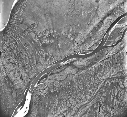
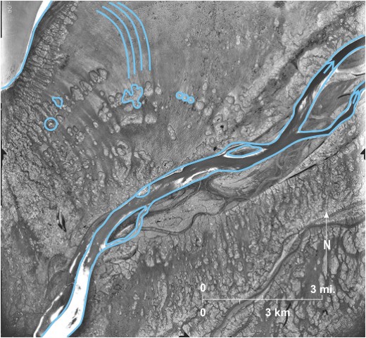
5.30: Palsas in Wet Fenland South of Churchill
In this area a surficial layer of marine silt overlies silty till.[i] It lies within the area of discontinuous permafrost; i.e., there are areas where water below ground is continually frozen. A series of creeks including Alston Creek 1 and Wakworth Creek 2 drain northward ultimately into the
The thin white line in the west 10 is the Hudson Bay Railway leading north to Churchill. The whistle point Bylot 11 is located at the bend in the line. Construction began at The Pas in 1910 and was completed on March 29, 1929. The total distance from The Pas to Churchill is 510 miles (816 km), much of it over spongy muskeg and discontinuous permafrost. The building of the line was a remarkable engineering feat, but maintenance costs over discontinuous permafrost have been high and in recent years the existence of the line has been constantly threatened. It is now owned and run by an American company.
5.31: Non-Oriented and Oriented Lakes South of Churchill
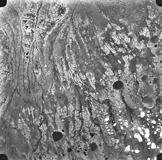
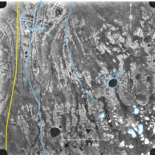
This area is within the northern part of the discontinuous permafrost zone near Cromarty on the Hudson Bay Railway line just off the photo to the west.
In this area peat that is typically about 2 metres thick overlies glaciomarine silt or silty till. The peat began to develop about 6500 years ago as the post-glacial
In the northeast is an elevated area—about 200 feet (61 m) a.s.l.—with spit-like ridges 8 which probably represents an old Tyrrell Sea shoreline. A spur from the Hudson Bay Railway line 9 runs to this area in a series of straight stretches avoiding lakes. Very light-tone areas 10 at the eastern end of the spur are probably sand and gravel pits exploiting the raw materials in the spit.