Chapter 18: Transport and Communications: Past and Present
By virtue of its coastline along
In the latter part of the 19th century and the early 20th century, numerous railway lines criss-crossed southern
Roads have to some extent replaced the railway lines. They have a general east/west alignment (the Trans-Canada Highway No. 1, The Yellowhead Route No. 16, PTH 2 and PTH 3) or north/south alignment (PTH 10 and PTH 5). The main sources of electricity are in the southeast and the north. Power lines carry electricity to most parts of the province. They can be seen on air photos especially where they cut through wooded land. Similarly the routes followed by oil and gas pipelines are identifiable because when they are buried the soil is disturbed to result in a different tone or colour than the surrounding land, a variation that is easily detected on air photos. The topography of southern
18.1: The Port of Churchill
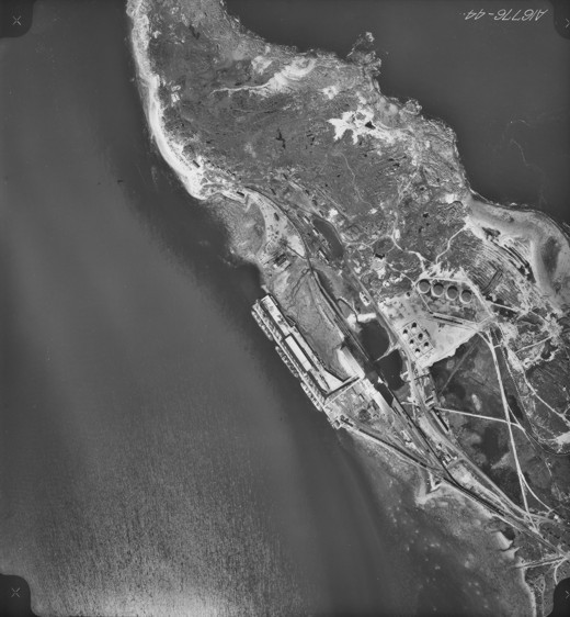
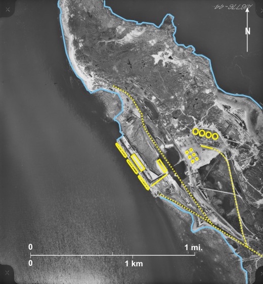
Seen here is the railway line 3 entering from the south. It runs northeast of massive grain silos 4. Branch lines lead to the dockside 5 and to four large fuel storage tanks 6; six smaller tanks can be seen further south 7. Many train cars can be seen on the tracks in several locations 8, those near the fuel storage tanks having the distinctive shadow of oil trucks 9. A conveyor system 10 leads from one of the silos to the dock where three large ships are visible 11.
[[fig. 18.1]]
18.2: Ferry on the Assiniboine River South of Rossendale
In the past there were several ferries across the
Here, south of Rossendale, a north/south ferry 1 crosses the eastward-flowing Assiniboine River 2. Careful inspection reveals a small ferry 3, big enough to carry perhaps four cars, near the south bank of the river.
In this area the
Note that shadows fall east 11, indicating that the photo was taken in the late afternoon.
[[fig. 18.2]]
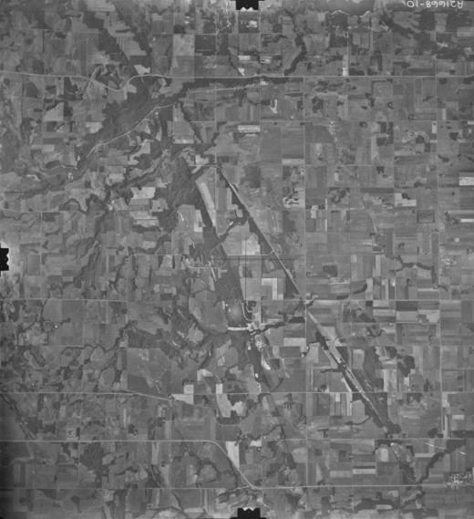
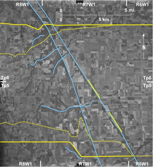
18.3: Topographic Influence on Railway and Road Directions Near Miami
Railway Lines
Following the building of the CP railway line through southern
Construction of railway lines at great speed and in straight lines was possible at only a few locations across the prairies. Railways are intolerant of steep slopes, and strategies were adopted to avoid these wherever possible.
Shown on this photo is the steep, wooded eastern edge of the Assiniboine Delta 1 that is dissected by several small eastward-flowing stream valleys 2. East of the delta edge is a prominent, northwest/southeast
Two major east/west roads can be seen; PR 245 is straight 13 except for a southward bend across the delta edge 14. In the south PTH 23 cuts diagonally across a section 15—possibly to avoid a small creek valley to the south 16. Northwest of
[[fig. 18.3]]
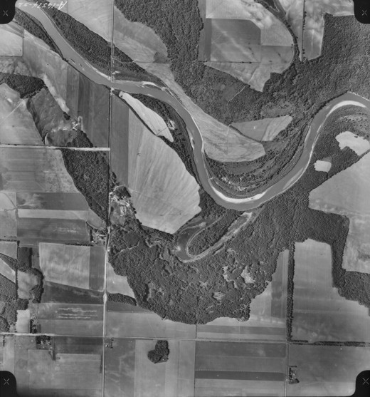
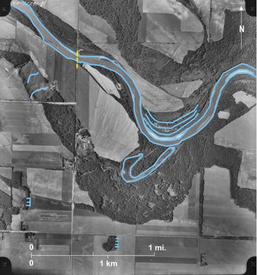
18.4: Railway Loop East of Deerwood
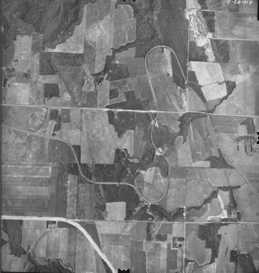
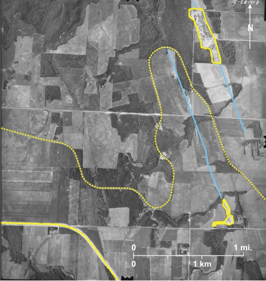
This low-level, large-scale photo shows detail of the railway loop 1 seen on figure 18.3. The line rises by 300 feet (91.5 m) between the eastern and western edges of the area shown without experiencing a steep gradient. This is not quite on a par with the spiral tunnels in the
[[fig. 18.4]]
18.5: Topographic Influence on Route Ways South of Shellmouth
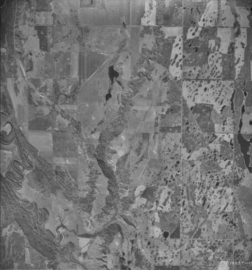
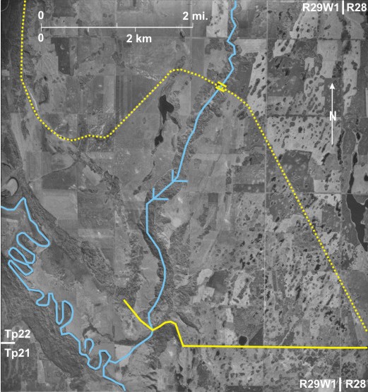
The photograph shows the south-flowing
A long-abandoned railway line ran from Endcliffe 6 in the southeast to Shellmouth (off the photo to the north). A direct route would have run directly northwest from Endcliffe, but there is a large northward loop 7 probably to avoid crossing the
[[fig. 18.5]]
18.6: Topographic Influence on Route Ways in the Binscarth/Millwood Area
In the west is seen the south-flowing Assiniboine River 1 with a deeply incised creek 2 flowing northwest to join it (off the photo). This creek backs toward another in the southeast 3 that flows towards Silver Creek—an
Also noticeable is the route of PR 478 8 that runs along the side of an Assiniboine tributary 9 valley in the west and follows a hairpin bend 10 down the side of another creek in the east.
[[fig. 18.6]]
18.7: Railway Line on a Glacial Lake Floor
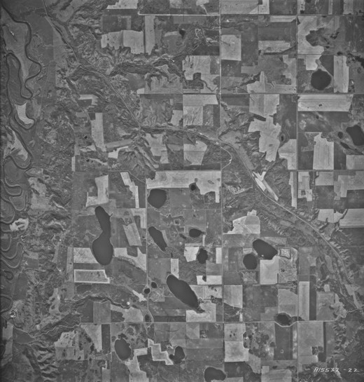
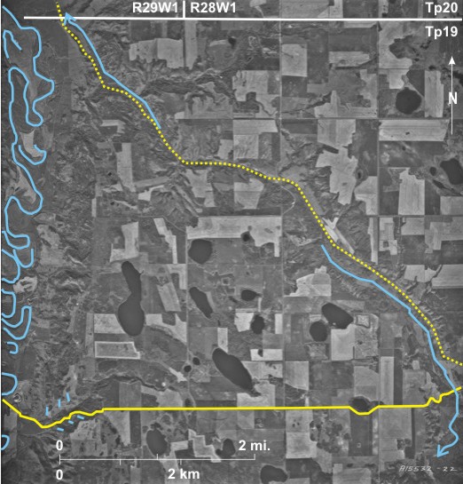
Building railway lines across abandoned lake floors did not present the same topographic challenges as in hilly areas; lines could be constructed more or less in straight lines from point to point. However, once they had been constructed there was the potential problem of blowing snow burying the lines.
Shown here is the CP line 1 on the floor of Glacial Lake Hind leading into Napinka 2. It crosses a small creek 3 draining to the northeast-flowing Souris River 4. In order to alleviate the blowing snow problem, fences/hedges have been built parallel to and on both sides of the line in two locations 5.
Notice also Napinka’s cemetery 6, surrounded by imported coniferous trees 7 (dark tone and triangular shadow shape) and located well outside the settlement.
[[fig. 18.7]]
18.8: Railway Line Abandonment Near Treesbank, 1947
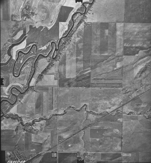
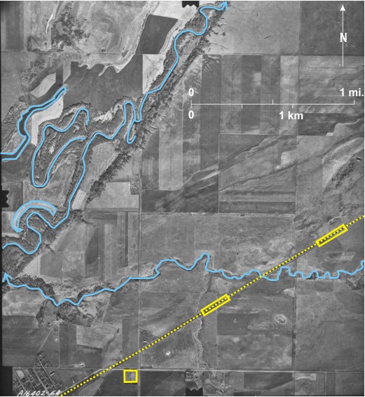
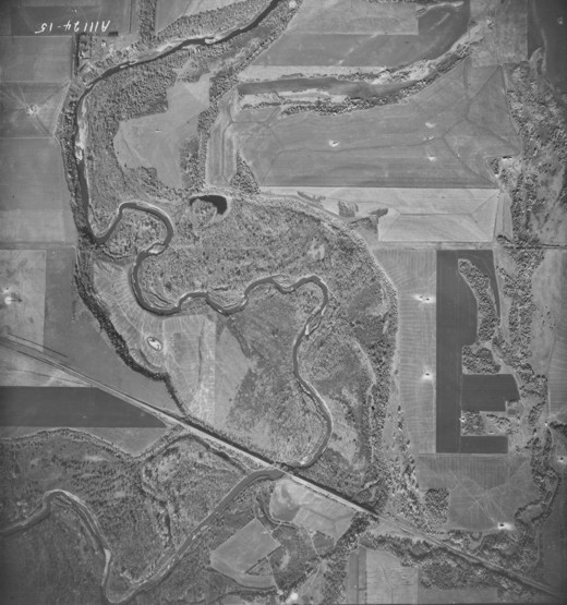
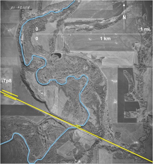
This large-scale photo taken in 1947 shows the CP line 1 between
[[fig. 18.8]]
18.9: Railway Line Abandonment Near Treesbank, 1974
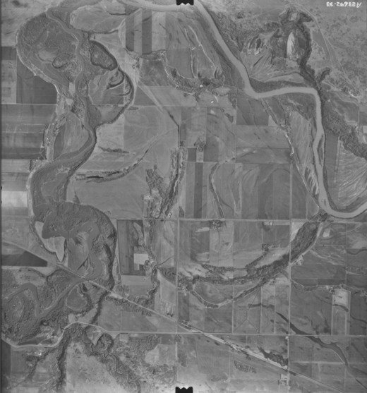
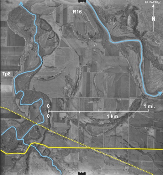
This smaller-scale photo covers a smaller area than figure 18.8. The north-flowing Souris River 1 joins the southeast-flowing
[[fig. 18.9]]
18.10: The End of the Line at Lyleton
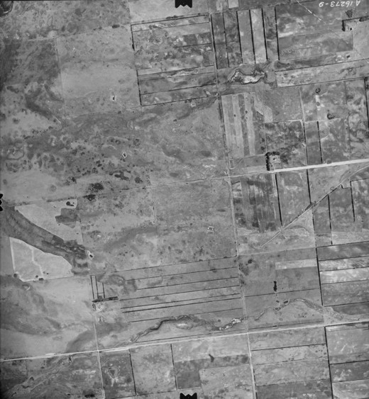
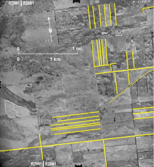
A spur line from a junction at Deloraine used to serve a string of small settlements in the extreme southwest of Manitoba, the most westerly of which was Lyleton (just off the photo to the east). Shown here is the end of this line 1—already abandoned in 1958—just west of Lyleton. Also seen are gravel roads 2 along some section lines.
In this flat, dry area, water supply and wind erosion are serious concerns. The water supply issue is dealt with in part by the construction of numerous dugouts 3 (rectangular, dark-toned areas). In an attempt to control wind erosion, land is divided into small fields 4 often with north/south 5 or east/west 6 field shelterbelts of trees. Two farms are protected by shelterbelts to their north and west 7.
Although flight lines for aerial photography are usually oriented north/south or east/west, perfection is not always achieved. In this case the east/west flight line digressed by several degrees from true, so east/west roads and north/south roads do not parallel the photo borders.
[[fig. 18.10]]
18.11: The End of the Line at Miniota
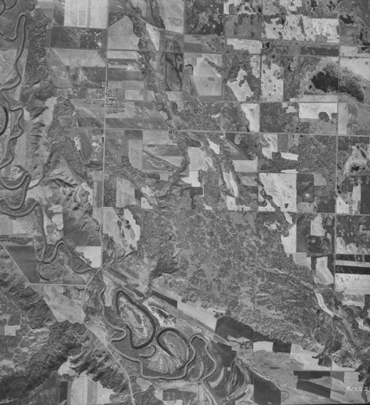
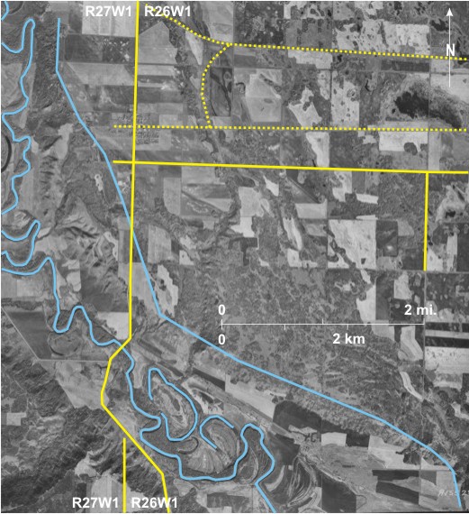
Sometimes a branch line came to an end because it came up against a topographic barrier that was too difficult or too expensive to cross. Here a branch line 1 through
[[fig. 18.11]]
18.12: The End of the Line at Lenore
A branch line extended from Forrest to Lenore through Wheatland, Bradwardine, Harding, and Kenton. “The presence of the
On this photo the line can be seen entering the village, Lenore 1, from the east 2 with a turning spur 3 just to the east of the hamlet. Protective fences have been constructed parallel to the line in several locations 4. At the time the photo was taken, Lenore still boasted a grain elevator 5, identified by its distinctive shadow shape. PR 259 6 bypasses the village to the west, and gravel roads follow some section lines 7.
[[fig.18.12]]
18.13: Rail Yards at Rivers
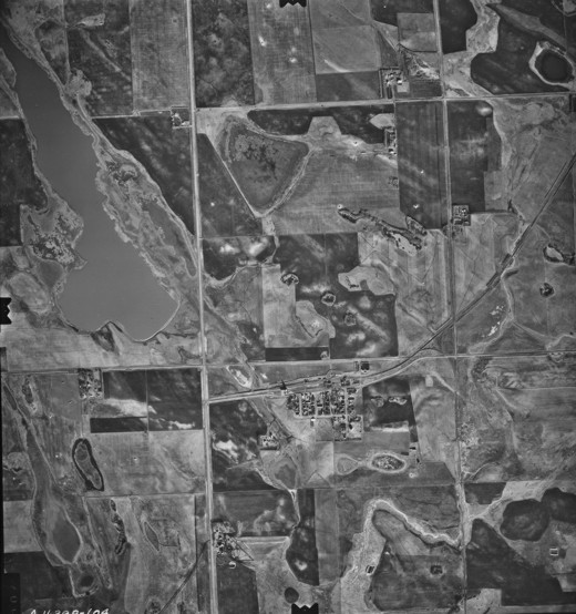
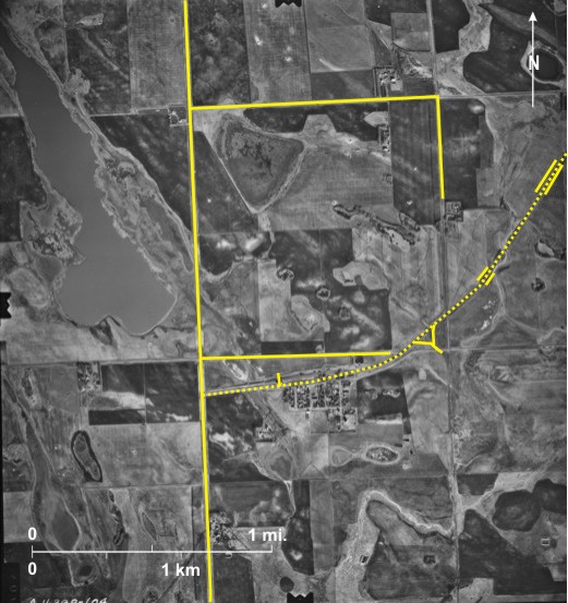
In the heyday of the railway era in southern
PTH 25 12 crosses the Little Saskatchewan River and then runs along the southern edge of town 13. The large building north of the road is the town’s arena 14. To the east of it is the wide main street 15, and east of that PR 250 runs north out of town 16.
Since the photo was taken, a dam has been built across the Little Saskatchewan River near the eastern edge of the photo area 17. The resulting
[[fig. 18.13]]
18.14: Rail Yards at Brandon
[[fig. 18.14]]
18.15: Transport Routes West of Brandon
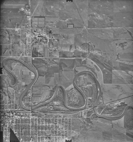
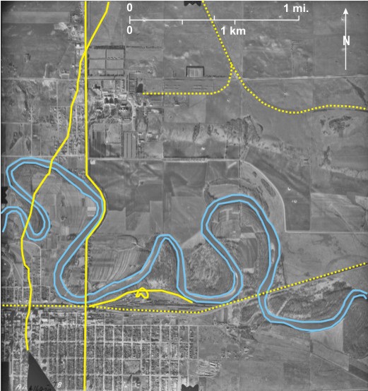
This photo illustrates the abundance of route ways (some abandoned) west of
The CP railway line 3 runs east/west across the centre with another line roughly parallel to it 4. The two join just east of Kemnay 5 and then a line branches off to the southwest 6. In the south is the CN line 7 that is crossed by a long abandoned line 8—almost obliterated in places 9—leading southward.
As for roads, the most obvious one is the Trans-Canada Highway 10 that runs southwest across the Assiniboine Spillway. It is joined west of Kemnay by Highway 1A 11, leading out from
[[fig. 18.15]]
18.16: Railway Line Abandonment Near Bunclody, The 1937 Situation
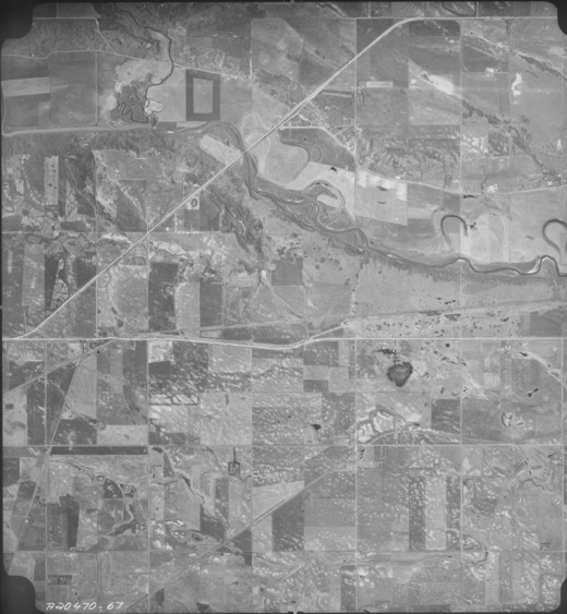
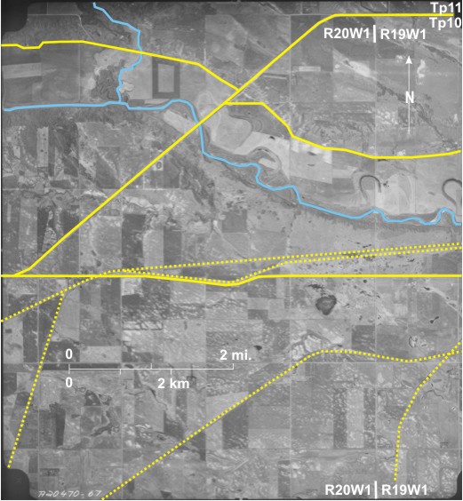
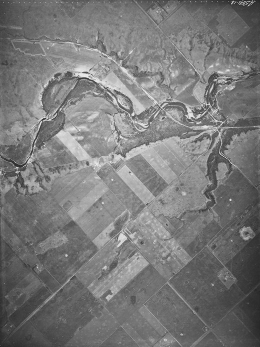
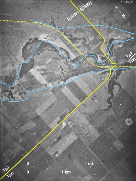
Railway line abandonment began early in southwest
The eastward-flowing Souris River 1 is incised into the floor of the steep-sided 2 glacial spillway. The abandoned settlement of Bunclody 3 was located south of the
In addition to the railway line, the north/south trending PR 348 8 crosses the spillway and the
[[fig. 18.16]]
18.17: Railway Line Abandonment Near Bunclody, The 1967 Situation
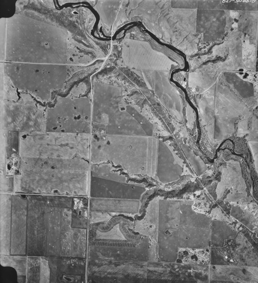
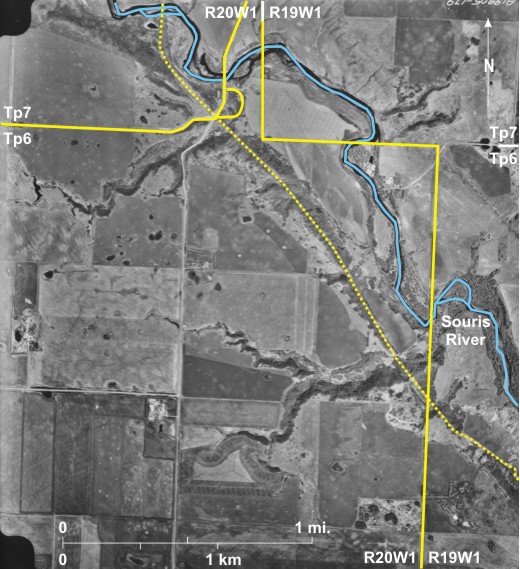
Thirty years later, the railway line is abandoned, probably several years before. However, the route it followed is obvious 1, although the bridge has disappeared 2. PR 348 can be seen more clearly than on the previous photo 3, and a loop that it followed on the south side of the river has been eliminated 4.
[[fig. 18.17]]
18.18: Railway Line Abandonment West of Elm Creek
The area shown is a region of wooded sand dunes, south of
PTH 2 4 is located north of the CP line. It is elevated to prevent snow accumulation that necessitates numerous small bridges 5 or embankments across the ditches on either side of the road.
Note that shadows are thrown slightly south of west 6 indicating that the photo was taken early in the morning.
[[fig. 18.18]]
18.19: An Existing Railway Line and an Abandoned Line Near Minnedosa
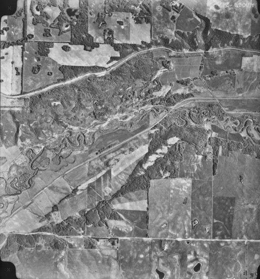
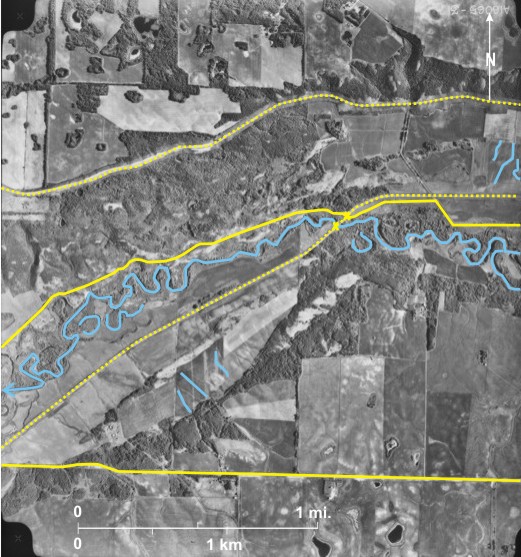
The photo shows the westward-flowing Little Saskatchewan River 1 west of Minnedosa. The Canadian Pacific Railway 2 line out of Minnedosa (off the photo to the east) angles its way up the north side of the little
Note also severe soil erosion on cleared land both south of 8 and north of 9 the river.
[[fig. 18.19]]
18.20: Impressions Left by Abandoned Railway Lines in Southwest Manitoba
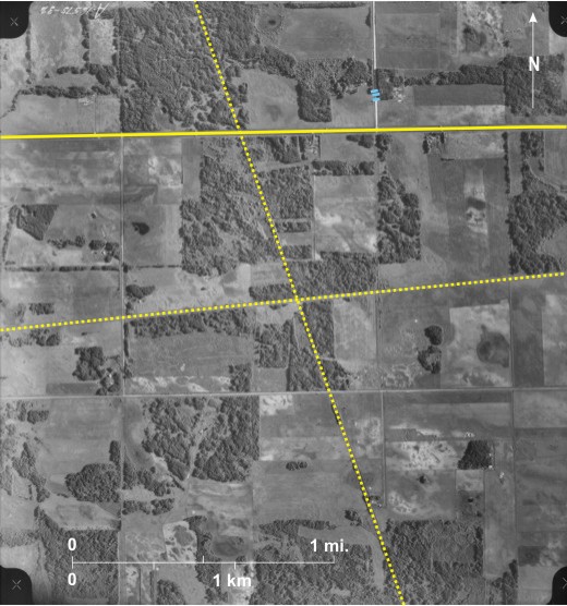
The area shown is northeast of
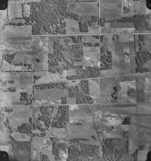
The line running northwest/southeast 3 was abandoned so long ago that it does not appear on a 1:250,000 map of the area compiled in 1963.[ii] The other line, more nearly east/west 4, is mapped as abandoned. Gravel roads follow section lines 5.
[[fig. 18.20]]
18.21: Train and Transformer Station at Rosser
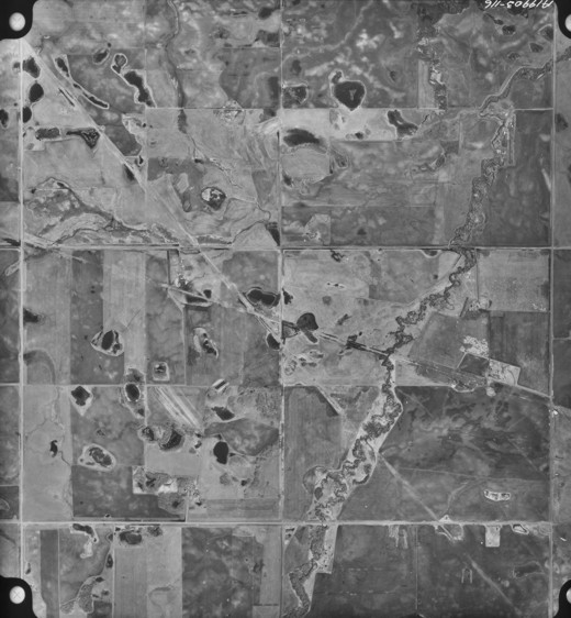
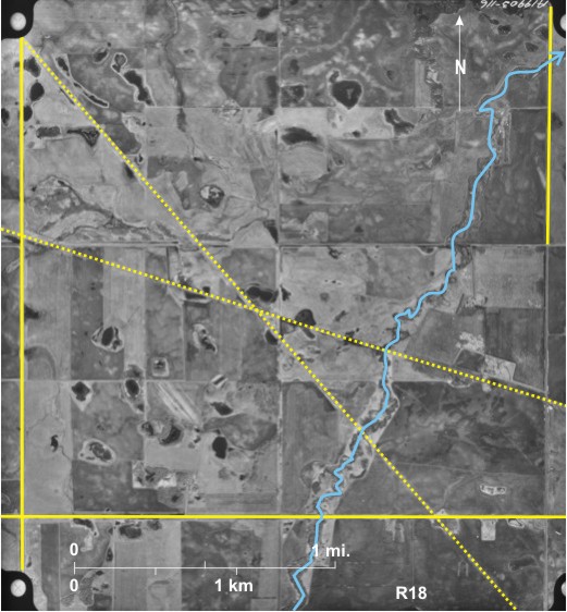
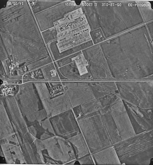
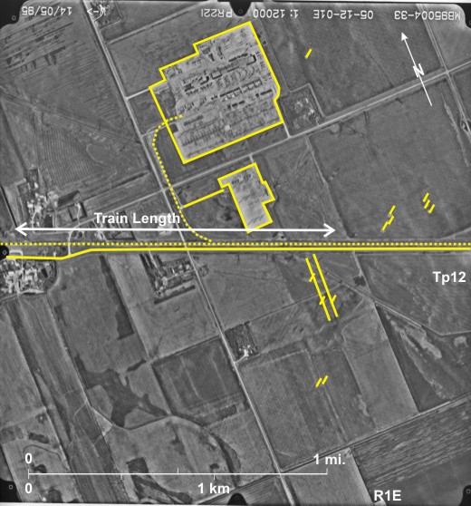
A feature of prairie trains is their enormous length. Shown here is the CP line 1 at Rosser 2, northwest of
Another aspect of transport is the movement of electricity to southern markets from large power stations in northern
[[fig. 18.21]]
18.22: Single Grain Elevator at Mentieth
Grain elevators involved in the storage and transport of grain are integrally associated with railway lines. At the peak of their development there were over 700 elevators across southern
Shown here is a single elevator 1 exhibiting the distinctive shadow shape on the CP line 2 at Mentieth northeast of Hartney. A siding 3 leads from the line to the elevator . Six railcars 4 can be seen, and there may be more hidden by the elevator’s shadow. Near the elevator, the line is protected from snowdrifts by parallel embankments 5.
Note also:
1) Several dugouts 6 in this dry area.
2) The peculiar pattern 7 resulting from a farmer cultivating fields to remove weeds.
3) Shelterbelts can be seen north and west of farm buildings 8.
[[fig. 18.22]]
18.23: Two Grain Elevators at Dalny in the Souris Valley
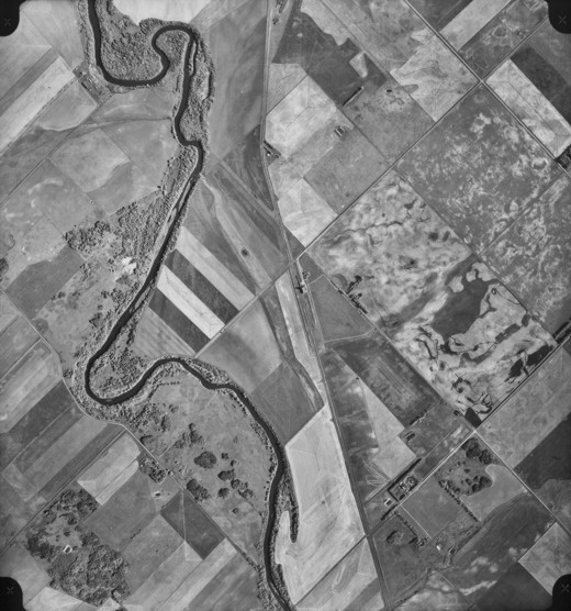
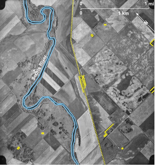
The CP line 1 takes a large southward loop to traverse a gentle slope along the side of the Souris Glacial Spillway, the eastern bank of which 2 can be seen. At the early date when this photo was taken, Dalny warranted two elevators 3, identified by their location next to the railway line and distinctive shadow. An embankment 4 to the north protects the line near the elevators. [[fig. 18.23]]
18.24: Grain Elevators at Brookdale
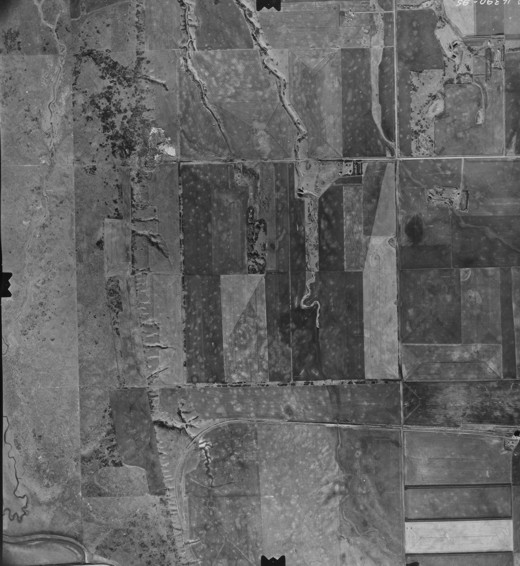
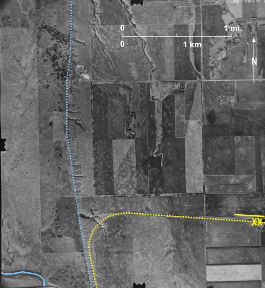
This high oblique photo taken in the early 1990s shows two elevators 1 on the east/west CP line 2 at Brookdale. The late summer photo was taken looking north across ripe grain fields 3 almost ready for harvesting; in fact a field in the right foreground 4 has already been swathed. The large building in the foreground 5 probably houses a hockey rink and a curling rink—on the right 6. It is protected by a shelterbelt of imported coniferous trees 7.
[[fig. 18.24]]
18.25: Grain Elevators at Inglis
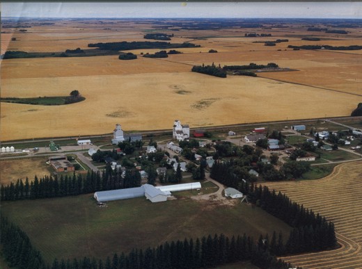
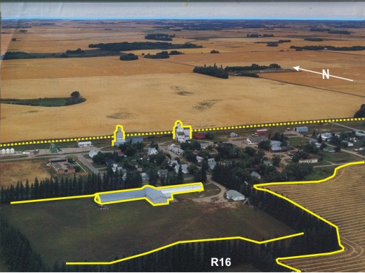
With the replacement of many small, closely-spaced wooden grain elevators by a few massive widely-spaced concrete elevators, it was essential to preserve at least a few of the old elevators as records of their past. This has been done at Inglis 1 at the end of a CP line that ran north from Russell. The line can be seen entering Inglis from the south 2 with turning spur to the east 3. Four elevators 4 identified from their location and shadow shape can be seen east of the village.[i] The two large buildings in the south are hockey 5 and curling rinks 6.
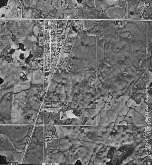
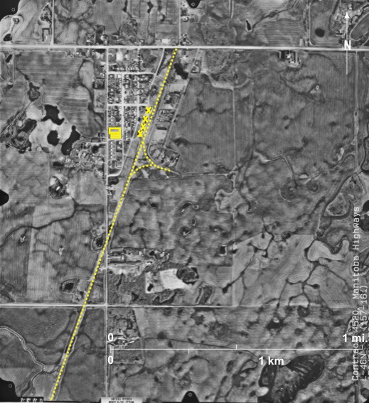
This is the first photo in a contract, details of which are given at the bottom of the photo. Contract 4520 was done for Manitoba Highways. The first line of photos, numbers 157-161 was taken flying north on May 13, 1995. The flight height was 13,049 feet a.s.l. and a camera with a lens of focal length 152.815 mm was used. The area shown is part of section 36, township 22, range 28WI. The scale is 1:12,000 approximately. The highway of interest was PR 592.
[[fig. 18.25]]
18.26: The Trans-Canada Highway West of Brandon
A flurry of road building occurred in
The main east/west highway through
Also seen are several existing and abandoned railway lines: the main CP line 9 runs through Alexander, and a spur line 10 leads southwest crossing the CN line 11. Note also the correction of almost 1 mile (1.6 km) at the boundary between townships 10 and 11 12.
[[fig. 18.26]]
18.27: The Trans-Canada Highway East of Brandon
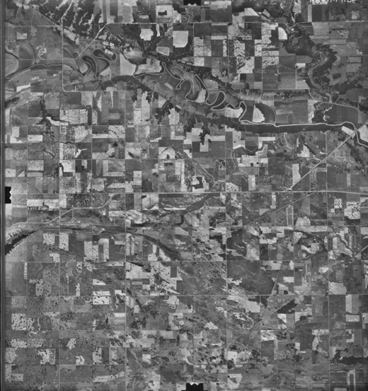
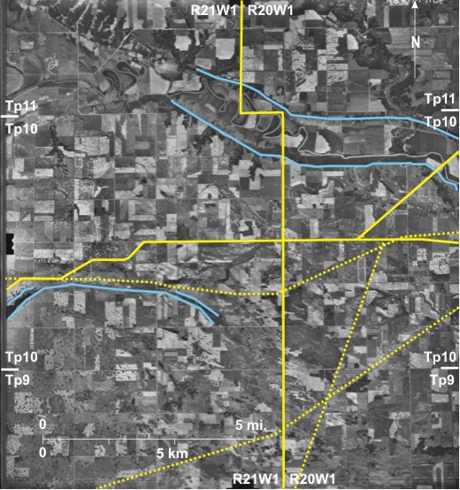
With the exception of a few kilometres west of Virden, the
[[fig. 18.27]]
18.28: The Yellowhead Route Near Russell
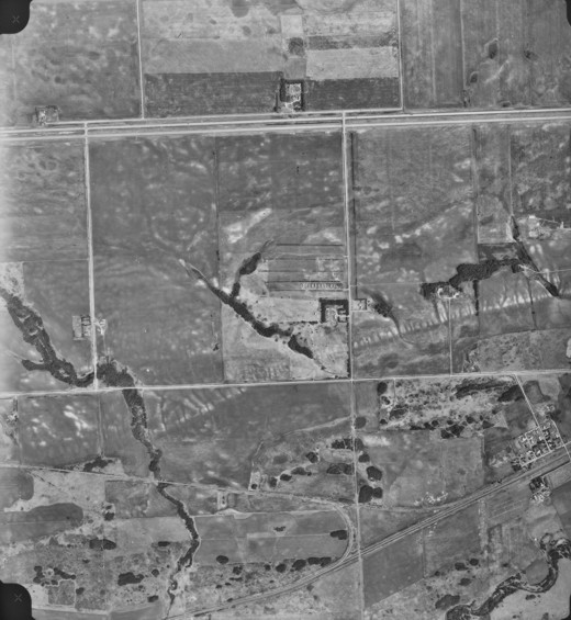
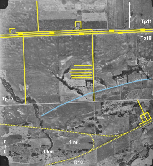
The Yellowhead Route, a more northerly route across Canada than the Trans-Canada Highway, diverges from the latter west of Portage la Prairie, then passes by Neepawa, Minnedosa, and Russell and on into Saskatchewan. Shown here is PTH 45 1 that follows the township line between townships 20 and 21, then bypasses Russell 2 to the south 3 and becomes Highway 16 4 (part of the Yellowhead Route) to the west. PTH 41 5 from the south, bypasses Russell to the west and becomes PTH 83 to the north 6. Both PTH 41 and PTH 83 follow north/south section lines.
Russell’s location at the intersection of north/south and east/west routes has aided its economic development (population of 1428 in 2006).
Also visible are railway lines: the CP line 7 runs through Russell and then north to Inglis; the CN line 8 enters Russell from the east and runs northwest to Shellmouth.
[[fig. 18.28]]
18.29: Highway 2 Near Wawanesa
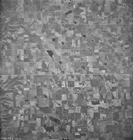
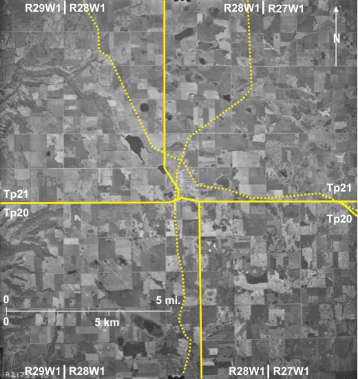
Two other linear features can be seen, one in the north and the other through the centre of the area. The former is only visible in the dark-toned wooded area 16 and is followed by a power line. The latter can be seen crossing wooded areas south of Wawanesa 17 but also across agricultural fields 18. This is the route of an underground oil pipeline. It is visible in the treed areas because trees had to be cut down for a trench to be excavated resulting in a lighter tone. In the agricultural fields the difference in tone results from interference with the topsoil during excavation.
The Souris River 1 flows northeast across the area, encircling Wawanesa 2 and joining the
PTH 2 3, a main east/west road in southern
Several other linear features can be seen. The CN line in the southeast 7 used to wind its way down a meander neck 8 into Wawanesa, across the Souris River 9, up the side of the valley 10, and then northwest 11 to
[[fig.18.29]]
18.30: Highway 2 in Southwest Manitoba
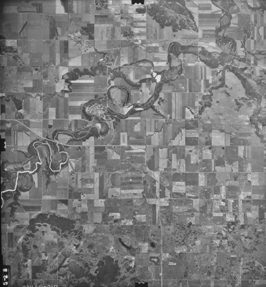
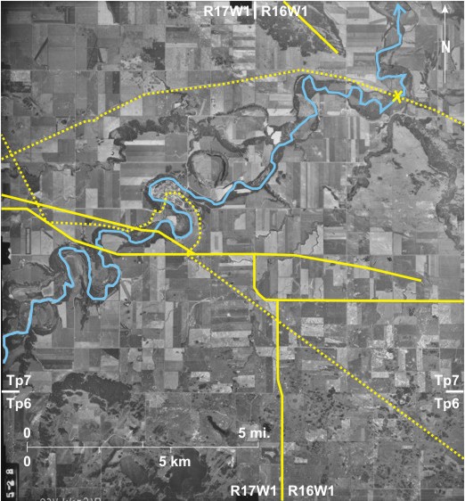
The photo shows the wooded valley of the Souris River 1 in the southeast with the wooded Lauder Sand Hills 2 in the southwest. In the north is Plum Creek 3 that has been straightened in the west 4.
PTH 2 5 runs generally east/west across the area. It follows the township line between townships 7 and 8 in the east before turning south for 2 ½ miles (4 km) 6 before again turning south of west 7 past Deleau 8. PTH 21, a north/south road 9, crosses Plum Creek 10 before joining PTH 2 which it follows west 11 before branching off to the south 12. A bend in the road occurs at the township 6/7 boundary 13. The correction at this township line is almost one mile to the west 14. As it moves north PTH 21 jogs a short distance east 15 to the nearest north/south section line.
Railway lines are also visible. The CP line is visible in the east 16 with a spur leading southwest to Hartney 17. In the west it parallels PTH 2 18 and is most visible where the two routes digress at Deleau 8. Another linear feature roughly parallel to PTH 2 and the CP line can be seen further north 19, visible where it cuts through dark-toned woodland; it is the route followed by a power line.
[[fig. 18.30]]
18.31: Highway 3 at Pilot Mound
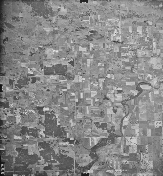
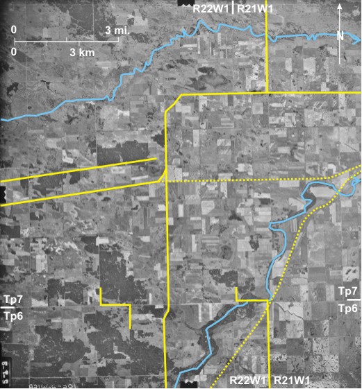
PTH 3 1 is the most southerly east/west route in
[[fig. 18.31]]
18.32: Highway 10 Near Minnedosa
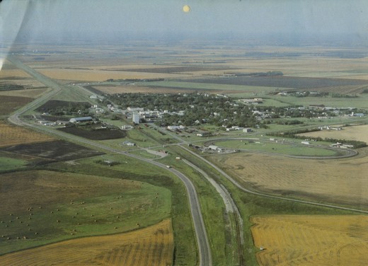
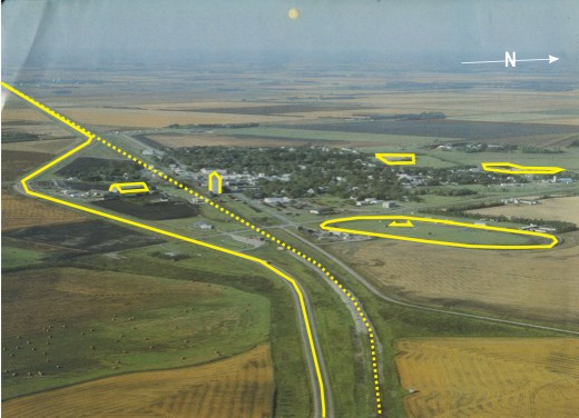
PTH 10 is a major north/south road in
Also visible is the CP line; it enters Minnedosa from the east 16, passes through town 17, and then climbs up the north side of the Little Saskatchewan Valley 18. It then runs parallel to Highway 16 and is only clearly visible where it runs through Basswood 19.
[[fig. 18.32]]
18.33: Highway 10 Near Pine River
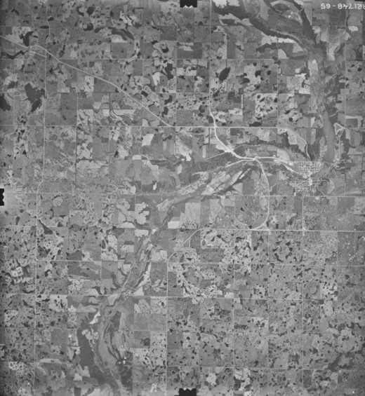
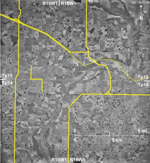
East of Duck Mountain PTH 10 1 follows the general north-northwest/south-southeast trend of the topography resulting from the deposition of strandlines by Lake Agassiz as it retreated eastward from Duck Mountain 2. In the east is low-lying marshy land 3 drained by rivers—Pine River 4 being one of them—that flow east to
[[fig. 18.33]]
18.34: Highway 5 in the South
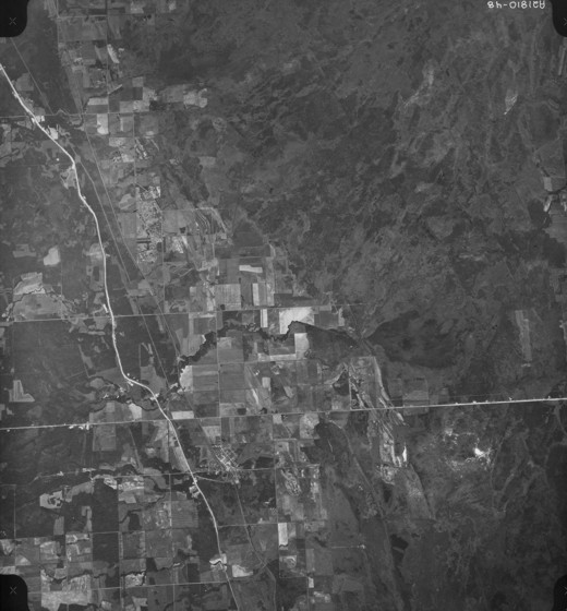
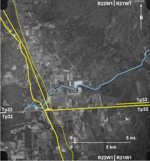
Although roads in southern
Also seen is the CP line 12 through Cartwright and Holmfield leading to Killarney (off the photo to the west). A long abandoned line 13 is barely visible running north-northeast from Holmfield.
[[fig. 18.34]]
18.35: Highway 5 and Other Routes Near McCreary
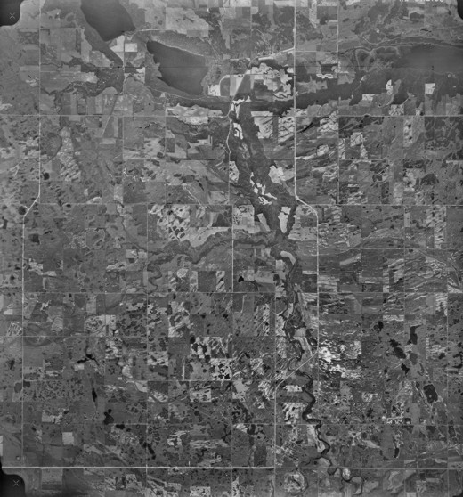
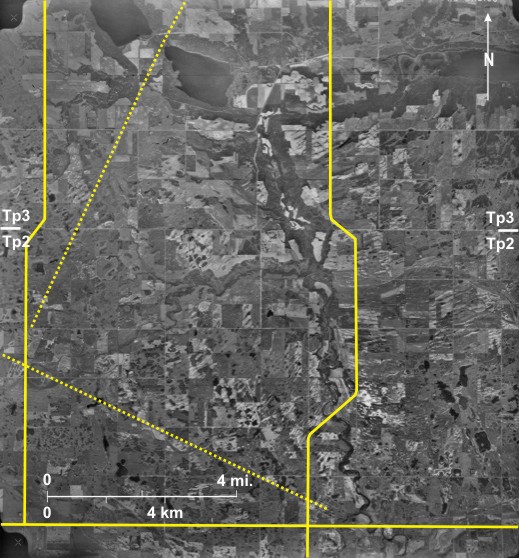
In this area near McCreary, PTH 5 1 is located on the lowland east of
Also visible are two railway lines entering from the south 8 and southeast 9 and joining south of McCreary 10 to continue in a north-northwest direction 11 following the general trend of
Drainage ditches are also prominent linear features 13, generally leading north into
[[fig. 18.35]]
18.36: Power Line in Riding Mountain National Park
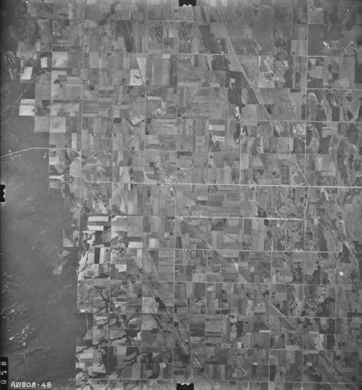
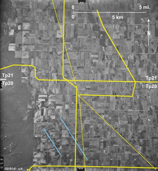
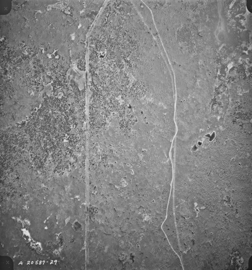
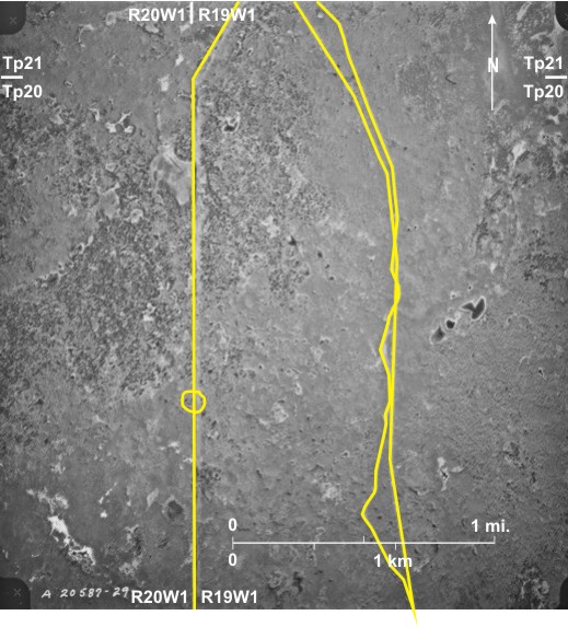
The routes followed by power lines are most easily seen on air photos where they traverse woodland. The cutting down of trees to avoid obstruction leaves a readily identified scar along which the line passes; left of centre on this photo is a north/south power line 1 through Riding Mountain National Park following the range line between ranges 19 and 20WI. The route bends 2 to the east at the junction of townships 20 and 21. Using a magnifying lens with the original photo, one can see poles that carry two lines 3. To the east the very light-toned line 4 is the
[[fig. 18.36]]
18.37: Power Line Near Treesbank
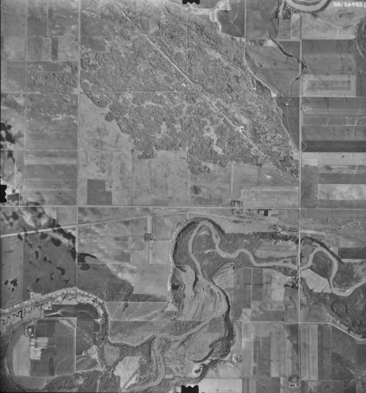
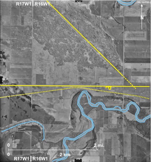
The direction followed by a power line 1 is very obvious on this photo of an area near the junction of the Souris 2 and
[[fig. 18.37]]
18.38: Power Line Near Deleau
Usually the interpreter has to rely on locating a linear clearing in trees in order to determine the direction followed by a power line. This is the case in the northwest 1 and northeast 2 of this area where the route cuts through deciduous woodland. However, by carefully inspecting the area between the woodland areas 3, it is possible to identify not only the poles carrying the lines (from their shadows) 4 but also to see three light-toned strands 5 which are the actual lines.
South of the power line is the CP railway line 6 with sidings 7 at Deleau 8. East of the settlement is a shelterbelt protecting a provincial campsite 9. This is the first photo of a contract, the details of which are given in the bottom right corner 10.
[[fig. 18.38]]
18.39: Transport Routes in Northern Manitoba
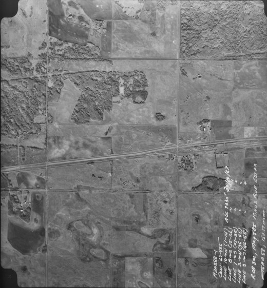
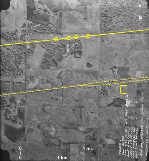
The photo shows an area about 35 miles (56.3 km) southwest of Thompson close to
[[fig. 18.39]]
18.40: Oil Storage and Pipelines in Southwest Manitoba
[[fig. 18.40]]
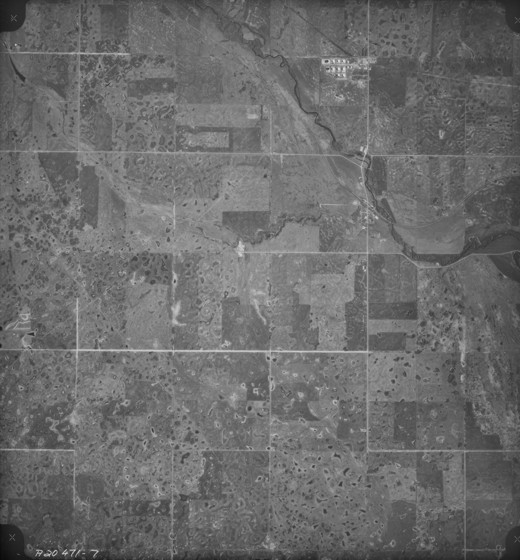
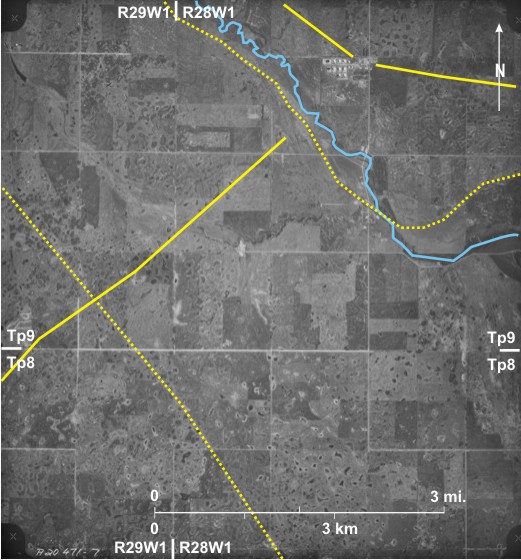
18.41: Route of a Gas Pipeline South of Rapid City
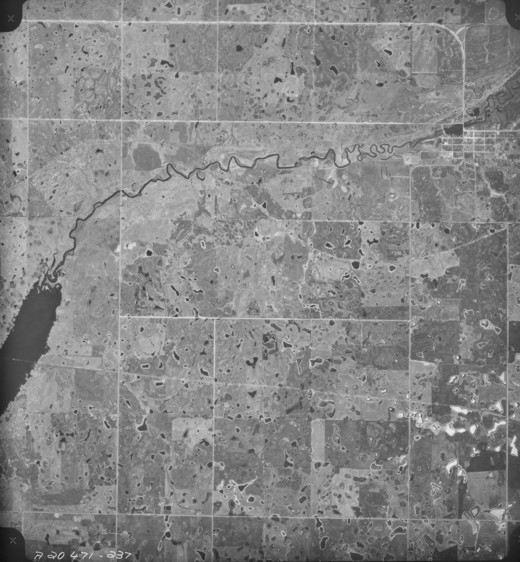
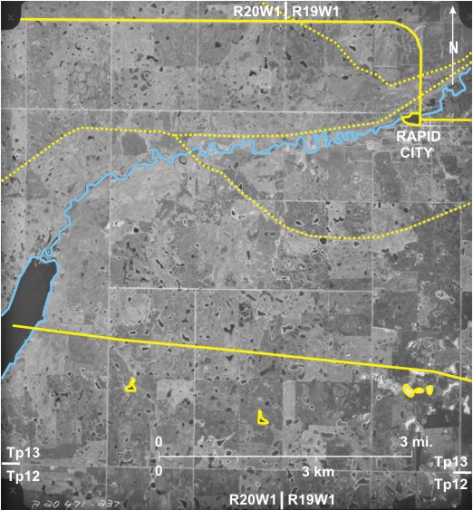
Oil and gas pipelines are visible on air photos because the excavation needed to bury the pipeline rearranges the topsoil and drainage resulting in a different tone than the surroundings. A light-toned line in the south 1 indicates the route of a gas pipeline, even extending into Lake Wahtopanah 2. The line carries gas from
Also seen are three abandoned railway lines: one loops south of Rapid City 3; another runs just north of the Little Saskatchewan River 4; and a third 5 veers off to the northwest. PTH 24 passes through
Note also 1) a small dam on the Little Saskatchewan River 7 that produces a reservoir 8 which is used as a recreation site; and 2) numerous small sloughs in this area underlain by ground moraine, ranging in tone from dark grey 9 to almost white 10, a result of specular reflection.
[[fig. 18.41]]
18.42: Oil Pipeline West of Wawanesa
The oil pipeline route is seen as a straight light-toned line in the south 1. Note the bend in the east 2 so that the line could cross a road at a sharp angle without disturbing too much of the road surface.
Two abandoned railway lines are also very clear: the CN line trending northwest/southeast 3 and the CP line trending northeast/southwest 4 that intersect at Methven Junction 5. A single elevator, identified by its shadow shape 6, is located at Banting on the CP line. PTH 2 7 cuts across the southern edge.
The land shown is flat fertile agricultural land developed on lakebed sediments. By the time the photo was taken (mid-October) crops had been harvested, resulting in light-toned fields with distinctive patterns 8. Some have been cultivated in preparation for next year’s crop, resulting in very dark tones 9. Notice that on this fall photo, deciduous trees along a small creek in the centre have changed colours, resulting in a light tone 10.
[[fig. 18.42]]
18.43: Gas Pipeline South of Hamiota
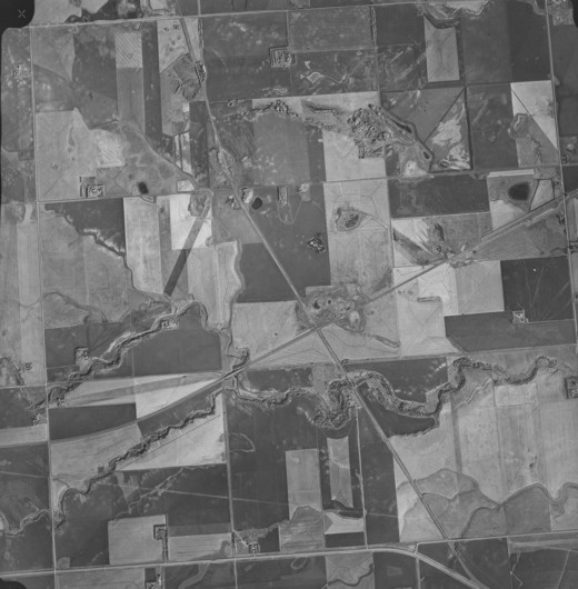
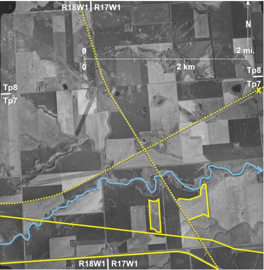
This photo shows the standard checkerboard pattern produced by the sections of the DLS with two prominent east/west lines cutting across the system. In the north 1 is the route of a gas pipeline, its light tone standing out against the darker tone of surrounding soils. Note the bend so that the line crosses the road at a sharp angle 2. In the south is the CN railway line (abandoned) 3 passing south of Oakner in the west 4.
[[fig. 18.43]]
18.44: Gas Pipeline Near Miniota
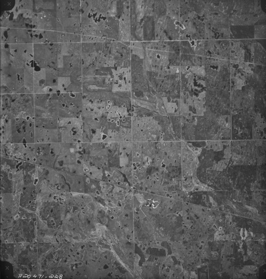
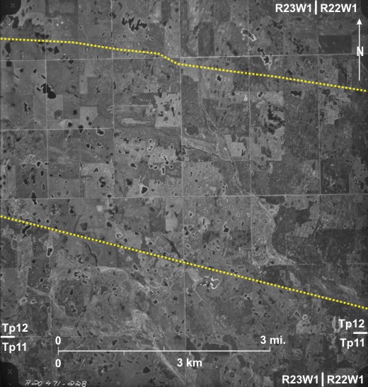
This high-level, small-scale air photo shows a westward extension 1 of the pipeline route shown in figure 18.43. It crosses the Assiniboine Spillway 2 north of Miniota 3 and is visible as a light-toned streak in the west 4. In the east where it runs close to a railway line 5 and a gravel road 6, its location is not so obvious. However, using a magnifying lens on the original photo, one can locate it between the CN line and an east/west gravel road where it shows up as a very light-toned streak 7.
Note also:
1) The CP railway line 8 in the southwest;
2) An east/west railway line 9 that leads west to Miniota cutting through the middle of sections;
3) The north/south PTH 83 10 that runs mainly along the range line between ranges 26 and 27WI except where it angles down the south side of the Assiniboine Spillway 11; and
4) East/west PTH 24 12 joining PTH 83 just south of Miniota.
[[fig. 18.44]]
18.45: Airfield at Hartney
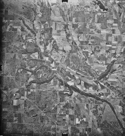
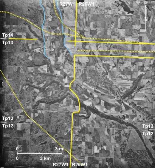
Airfields During the second half of the 20th century, flying became a very important method of transport—both of people and goods—in The airfield 1 is located about 1½ miles (2.4 km) south of Hartney 2 and is reached by a gravel road 3 from PTH 21 4. Runways are approximately 0.5 miles (0.8 km) long. Note also 1) 2) Northeast/southwest CP line passing through Hartney 6; and 3) PTH 21 bypassing Hartney 7 with a jog at the correction line between townships 6 and 7 8. [[fig.18.45]]
18.46: Airfield at Carberry
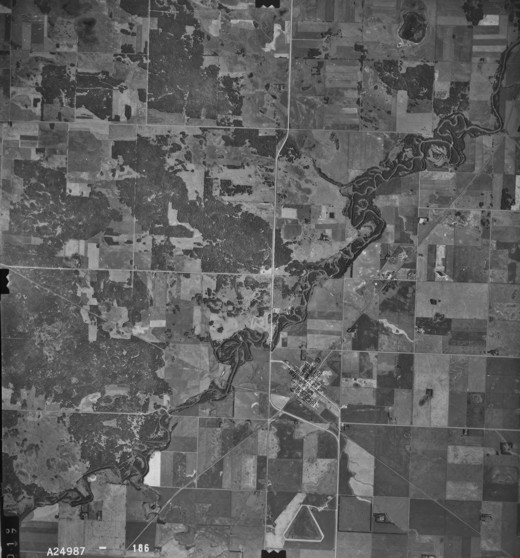
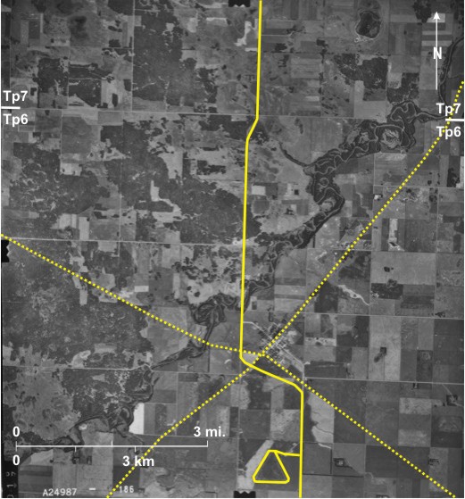
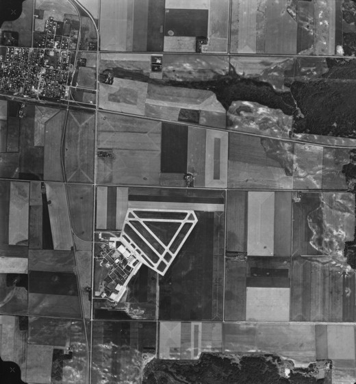
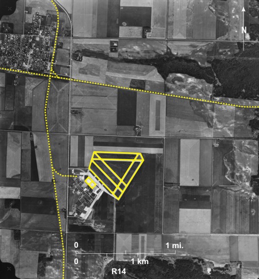
The airfield 1 at Carberry 2 (abandoned in 1960) was located about a mile (1.6 km) south of the town. As at Hartney there are three runway directions, but in this case the east/west runway 3 is in the north (the reverse of the situation at Hartney). Also in this case there are two runways in each direction, ranging in length from 0.5 to 0.6 miles (0.8-0.95 km) long. Various airport-related buildings are seen in the southwest 4. This area is now occupied by McCain Foods Ltd that employs about 500 people (mostly local) and ships millions of tons of potato products all over the world. Potatoes are grown—mostly under irrigation--on the Assiniboine Delta.
Note also the east/west CP line 5 that runs south of Carberry with trucks on a siding 6 and the north/south CN line 7 with a spur leading to the airfield 8.
[[fig. 18.46]]
18.47: Airfield at Souris
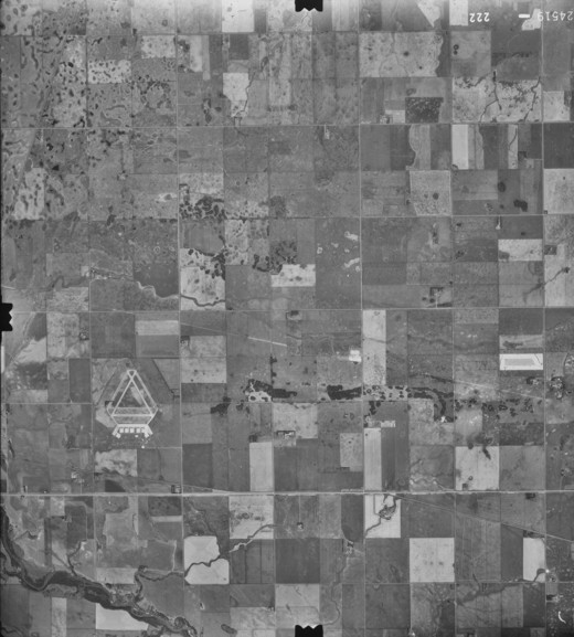
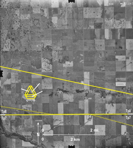
The airfield 1 at
Note also:
PTH 2 4 that follows the township line between townships 7 and 8; the CP line 5 that crosses PTH 2; and the route followed by a trans-continental pipeline 6.
[[fig.18.47]]
18.48: Airfield at Neepawa
The airfield 1 at Neepawa 2 is located about 1.5 miles (2.5 km) west of the town. It too has a triangular shape with three runways 3, the “east/west” one 4 being slightly skewed off the cardinal direction. Runways are 0.5 miles (0.8 kilometres) long. Terminal buildings 5 approached from Highway 16 6 are located to the southeast.
Note also
1) East/west CP railway line 7 with a half-mile long (0.8 km) train on it 8; and
2)
[[fig. 18.48]]
18.49: Location of the Airfield at Rivers
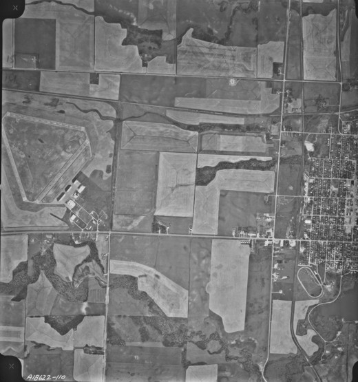
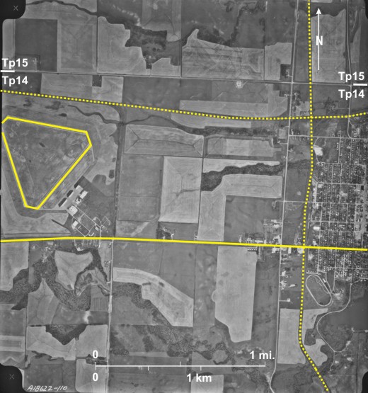
The airfield 1 at Rivers 2 located 2.5 miles (4.0 km) southwest of the town had a different function from those shown in figures 18.45 to 18.48. During World War II, it was one of several airfields across the prairies involved in the Commonwealth Air Training Program. At these fields flyers from the Commonwealth were trained for air service. The flat landscape and abundance of space made the prairies ideal for this function. After the war Rivers remained for several years an RCAF base before it was closed in the early 1960s.
The airfield has a skewed triangular shape much like those shown in figures 18.45 to 18.48 except that two runways, east/west 3 and northwest/southeast 4 are considerably longer at 1.1 miles (1.8 km). Terminal buildings are located to the northeast 5, and beyond them are small buildings 6 that used to house military personnel.
Note also
1) CN line 7 that passes through Rivers;
2) East/west PTH 25 8;
3) North/south PR 250 9 with a curved route 10 down the north side of the Assiniboine Spillway;
4) Dam across the Little Saskatchewan River 11 that produces Lake Wahtopanah 12; and
5) Unusually small fields 13 with north/south shelterbelts south 14 and west 15 of the airfield.
[[fig. 18.49]]
18.50: Rivers Airport
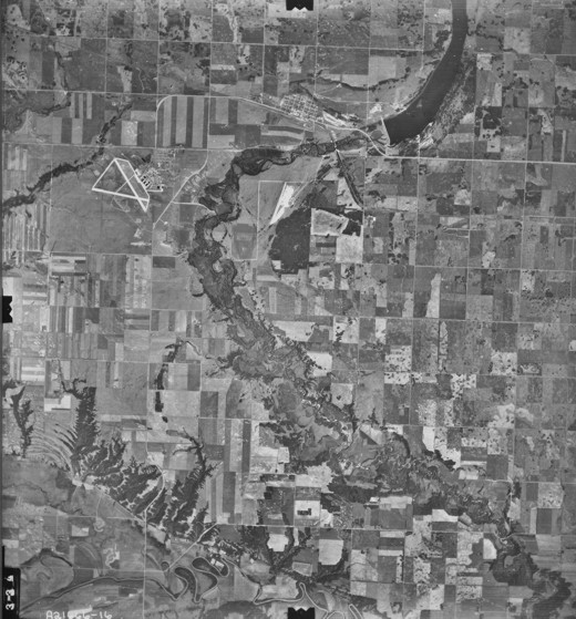
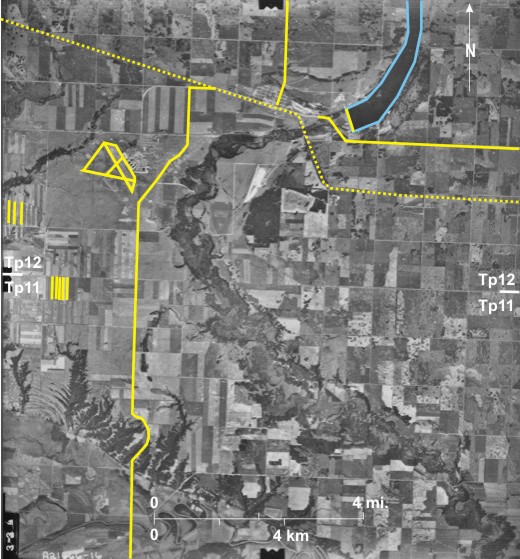
This old (1948) air photo shows part of the Rivers airfield when it was still active. The southeast end of the main runway that ran northwest/southeast is visible 1. Northeast of the runway are several large hangers 2 for storage and repair of planes. An even larger building further east is probably an arena 3. North of this are buildings with an H-shaped plan 4, probably barracks, with numerous small buildings to the north 5, probably single family dwellings.
Note also the following:
1) PTH 25 6 paralleled by a long abandoned railway line 7 on which is an elevator 8 identified by its shadow shape. A spur line 9 leads southwest to sidings 10 with railcars on them 11.
2) This area is northwest of the misfit Little Saskatchewan River 12 with a large valley. The valley side is dissected by numerous gullies 13. Serious soil erosion 14 occurs in some fields cleared for agriculture.
[[fig. 18.50]]
18.51: Airfields Near Brandon
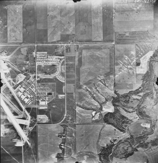
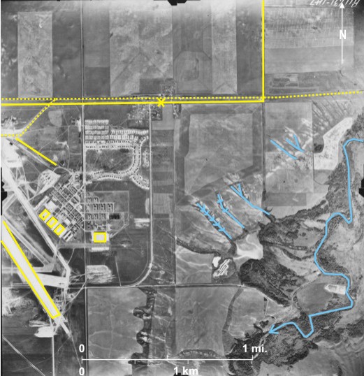
This high-level, small-scale photo shows two airfields north of
Note also:
1) The Assiniboine River 4 leading off to the southeast;
2) The Trans-Canada Highway 5 that in the west runs along the township line between townships 10 and 11, but swings north in the east 6 to avoid Douglas Marsh 7 located in the route of a former Assiniboine distributary cross the Assiniboine Delta;
3) PTH 10 8 that runs north/south with a jog at the 10/11 township line 9;
4) PR 457 10 that heads to Shilo off the photo to the east; and
5) The CP line 11 that runs through Douglas station 12 and into
[[fig. 18.51]]
18.52: Brandon Airport
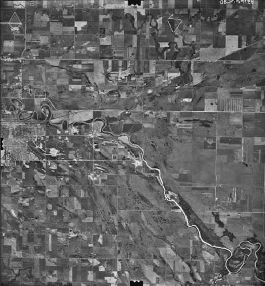
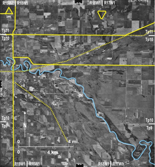
Originally the airport at
Note also the following:
1) At the time of the photo the Trans-Canada Highway 3 was twinned only to just beyond Eighteenth Street 4.
2) An abandoned railway line in the east 9 can be seen;
3) There is a campground 10 for tourists traveling along the
4) A trailer park 11 near the edge of the built-up area of
5) A drive-in cinema 12--one of about 300 that used to exist in
[[fig. 18.52]]
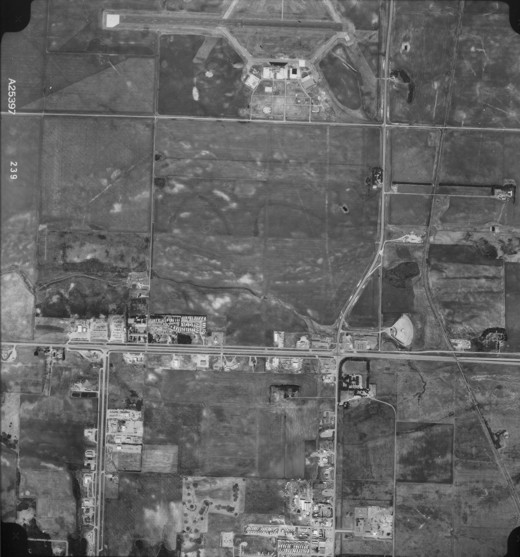
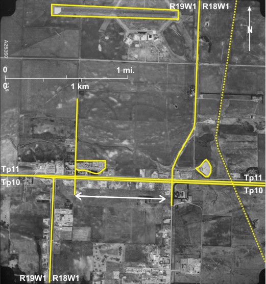
18.53: Airport Near Portage la Prairie
The airport for
[[fig. 18.53]]
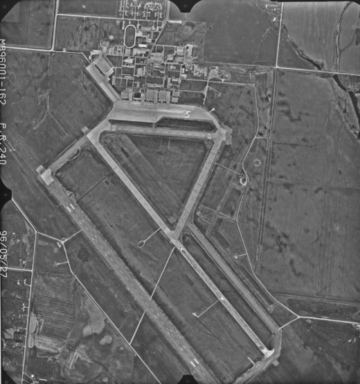
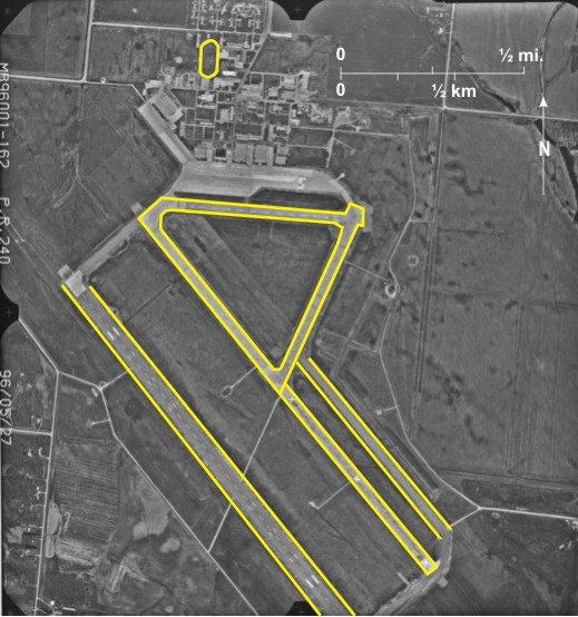
18.54: Airport at The Pas
The airport at The Pas is different from those shown previously (figures 18.45 to 18.53). In this area of central
Note also the sewage lagoon 9 located north of the airport.
[[fig. 18.54]]
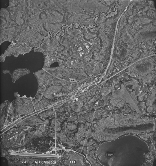
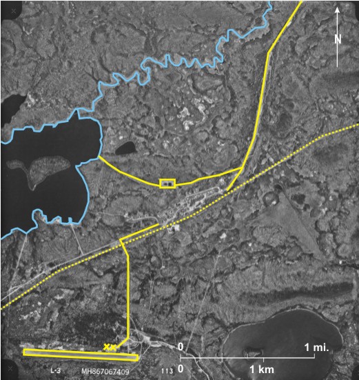
18.55: Airport at Churchill
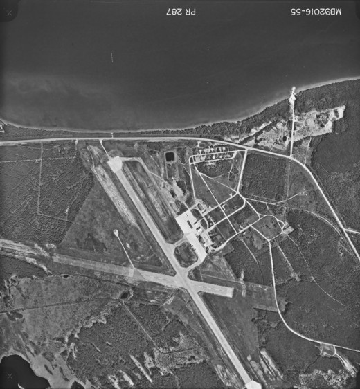
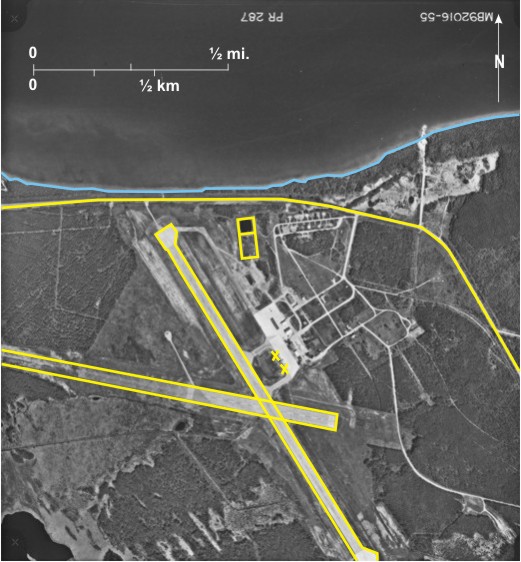
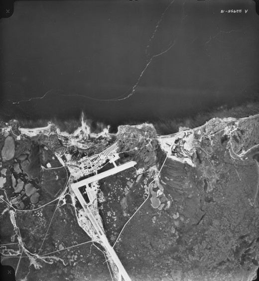
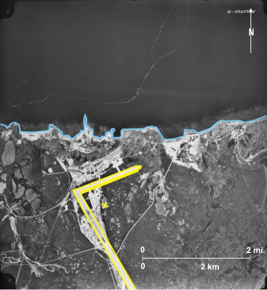
Planes and airports are crucial to the well being of settlements in northern
[[fig. 18.55]]
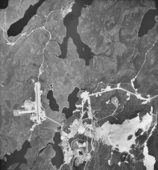
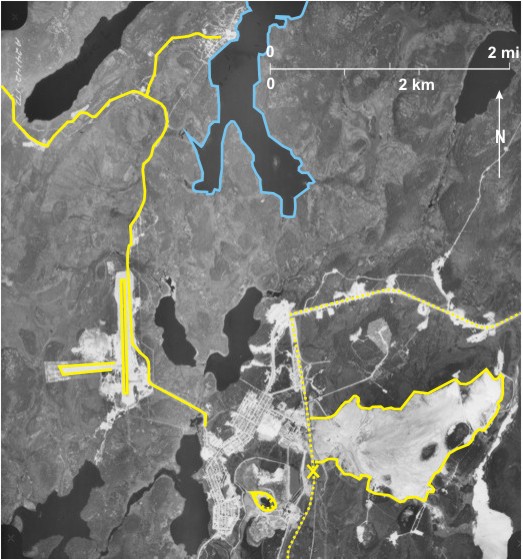
18.56: Airport at Lynn Lake
The airport at
Note also
1) PR 391 7 that leads to Leaf Rapids;
2) A railway line from the south 8 with railcars located on it 9;
3) A large open pit mine in the south 10; and
4) A large waste area 11 east of the built-up area of
[[fig. 18.56]]
18.57: Landing Strip at Shamattawa
Shamattawa First Nation on Gods River 1 in the extreme northeast of
[[fig. 18.57]]
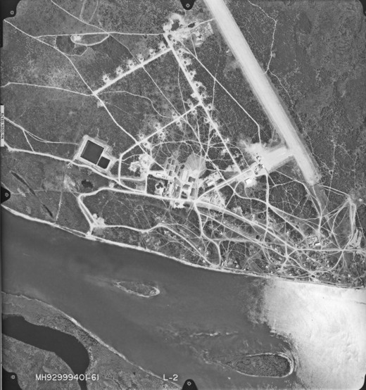
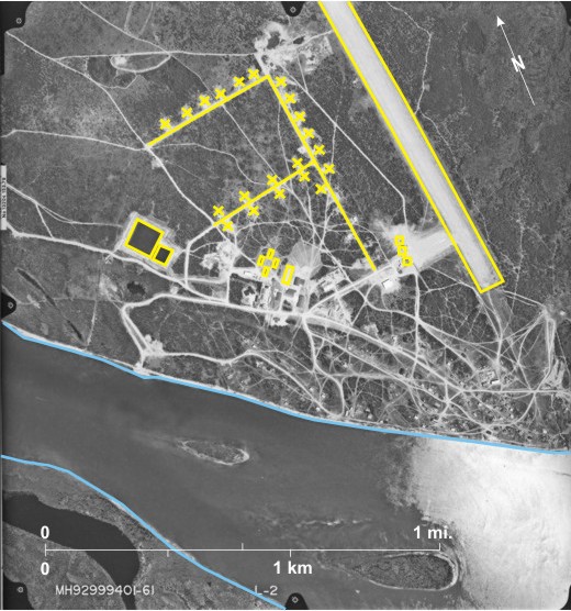
18.58: Landing Strip at Ilford
Ilford 1 is a small community on the Hudson Bay Railway Line that can be seen angling across the southern part of this area 2. It is the location of War Lake First Nation that can be seen north of the line 3. The airstrip in the southwest 4 trending east/west is about 0.8 miles (0.9 km) long. It has two small terminal buildings 5 located to the north and is connected to the community by a road 6. In the northeast is a clearing followed by a hydro line 7 that runs southwest from Kettle Generating Station on the
The lake in the west is
[[fig. 18.58]]
18.59: Location of Winnipeg International Airport
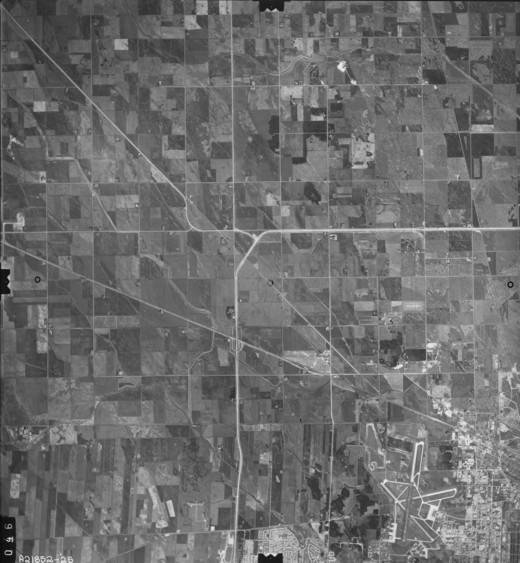
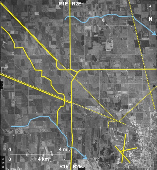
Winnipeg International Airport 1, the only true international airport in
Several roads are obvious:
1) PTH 101, the bypass around
2) PR 221 6, leading west to Rosser;
3) PTH 6 7, leading northwest to the Interlake; and
4) PR 236 8, leading north to Stonewall;
Railway line routes visible are:
1) The CP line 9 paralleling PR 221;
2) The CN line 10 paralleling PTH 6;
3) A CP line in the east 11; and
4) A line crossing the CN line 12, north of
Also creeks have been straightened to improve flow and prevent flooding, giving a linear appearance; for example, Sturgeon Creek 13 is joined by a straightened tributary 14 from the north, and in the north is Grassmere Creek Drain 15.
[[fig. 18.59]]
18.60: Winnipeg Airport at an Early Stage of Development
This low-level photo provides detail of
[[fig. 18.60]]
18.61: Large Scale Image of Winnipeg Airport Today
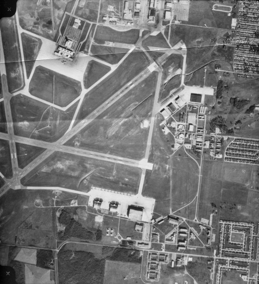
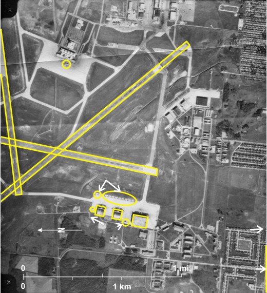
Despite a number of location studies, the position of
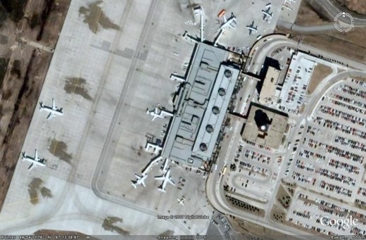
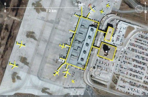
[[fig.18.61]]