Chapter 14: Agriculture
The distribution of agricultural land in south and central
14.1: Distribution of Agricultural Land in Southern Manitoba
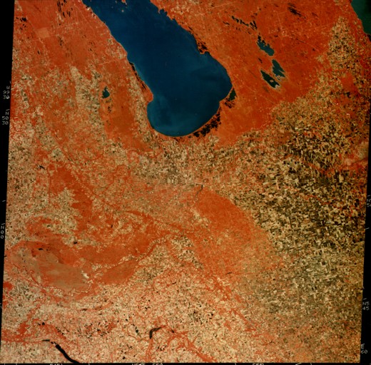
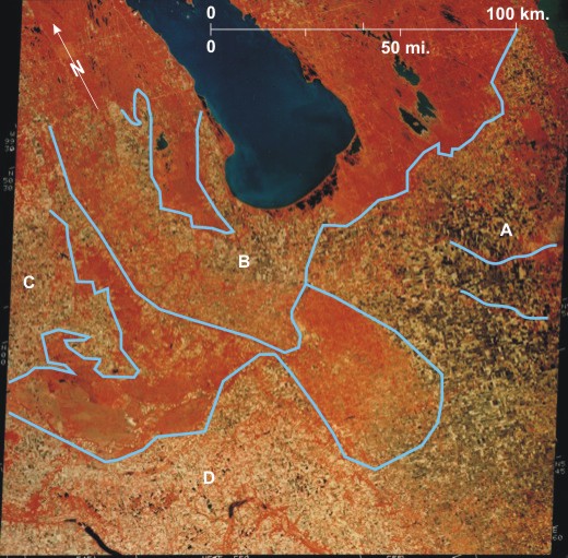
On this fall image (September 18) the colouring has been manipulated so that areas of woodland/grassland that reflect large amounts of infrared radiation appear as red/orange 1. At this date harvesting was probably mainly completed leaving many fields without a vegetation cover and exposing the dark chernozemic soils, particularly in the east 2. In the west 3 and southwest 4 there is a greater incidence of beige/yellow fields that probably have a stubble covering.
Woodland/grassland regions delimit the principal agricultural areas:
A. A large area between
B. West and north of
C. West and southwest of Neepawa 19 is an area bounded to the east by woodland on the
D. South of the Assiniboine Delta and southwest of
[[fig. 14.1]]
14.2: Agricultural Land in Southern Manitoba and Northern North Dakota
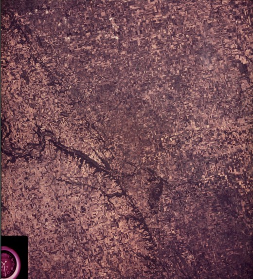
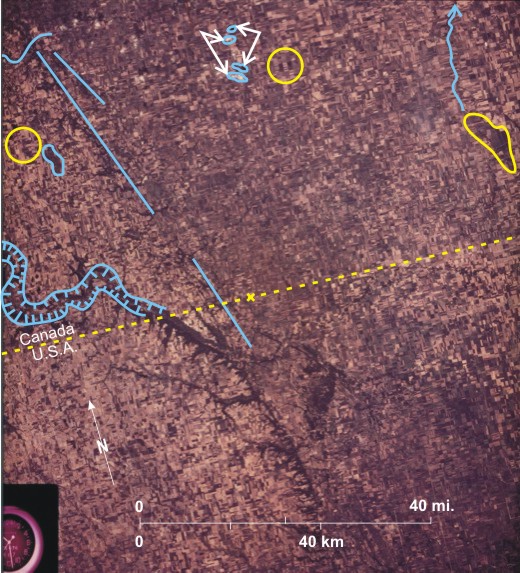
This Skylab[i] photo shows land on either side of the Canada/U.S.A. border 1. This is a true photograph as opposed to the image that appears in figure 14.1. The photograph shows real colours, although they are distorted by the fact that the earth’s surface is being viewed through the whole atmosphere. Within At the date the photo was taken (September 19) the grain harvest was partly completed resulting in beige coloured fields 4—on which there was still some vegetation—to dark-toned fields 5 where the chernozemic soils were exposed. Most of the area is devoted to agriculture with individual rectangular fields being visible 6, but some areas of dark-toned natural vegetation remain: along the eastern edge of the Pembina Hills 7 with some Lake Agassiz strandlines clearly visible 8; along the sides of the Pembina Valley 9 and Lyles Creek 10 further north; in the area around Lizard Lake 11; and in the Roseau River Anishinabe First Nation 12. Some variations are visible within the agricultural area; for example, the area south and west of the Pembina Escarpment 13 is lighter-toned than the land. further east 14, suggesting that there is more grain or stubble left in the fields in the west. Also, there is a darker area in the centre of the photo where fields are smaller 15. Small tufts of clouds can be seen 16 that throw shadows to the northeast 17, indicating that the photo was taken in mid-afternoon when the sun was in the southwest. [[fig. 14.2]]
14.3: Radar Image of Agricultural Southwestern Manitoba
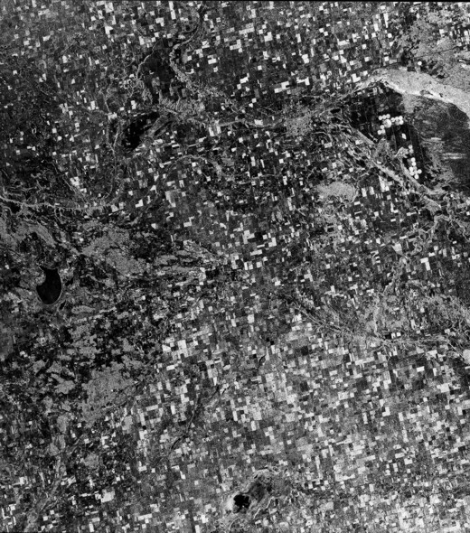
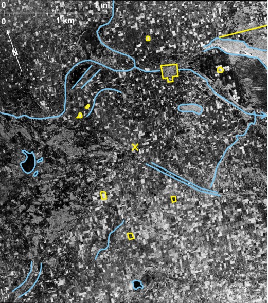
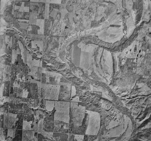
This image is different from those in figures 14.1 and 14.2 in that it has been created using much longer wavelength radiation in the microwave part of the electromagnetic spectrum. This is a C band (3.75-7.5 cm) radar image obtained by the ERS-1 satellite.[i] Radar is an active sensing system; that is, radiation is emitted from a source, and reflected radiation is recorded. This means, of course, that the wavelength of the radiation can be determined. Radar images have some advantages over photographs and other images using the visible part of the spectrum. In the first place they are not dependent on light and can therefore be obtained at any time of day. Also, if the correct wavelength is used, radar can penetrate cloud and atmospheric pollution. Disadvantages included usually reduced resolution, and the fact that for beginners interpretation is more difficult because there is a tendency to regard the images as photographs.
 very bright area.
These principles are illustrated on figure 14.3. The Brandon Hills 1 are light-toned because they are wooded, thus presenting a rough surface, whereas Oak Lake 2, Plum Lakes 3, and that part of Whitewater Lake 4 containing water at the time have smooth surfaces and are dark-toned. The light-toned circular features in the east 5 are center-pivot irrigation areas that have high moisture content. Surrounding these are dark-toned areas 6 with non-irrigated crops that are relatively dry and therefore dark-toned. Most of the center-pivot irrigation systems cover a quarter section, but one covers a whole section 7. North of these is a light-toned area—this is Douglas Marsh 8, a wetland with grasses, sedges, cattails and rushes, the route of a former Assiniboine River distributary. It is light-toned because of the roughness of the vegetation surface and its high moisture content.
The main physical features of southwest
East of the irrigated area are medium-light tones of the dunes on the Assiniboine Delta 19, representing a balance between a rough grass-covered surface producing light tones and dry conditions producing dark tones. A similar situation can be seen surrounding
The extent of agricultural land is indicated by the distribution of rectangular fields in tones ranging from almost black to almost white. The light-toned fields 22 have a rough surface—possibly stubble as this image was obtained on September 17—or wet conditions, or a combination of both. Dark-toned fields 23 are smooth—they do not have a crop covering or they are dry. It is noticeable that there is a greater number of light-toned fields in the south than in the north, possibly because the harvest is more advanced and there are more stubble fields.
Apart from agriculture the only cultural features visible are
[[fig. 14.3]]
14.4: High Level Air Photo of Southwest Manitoba Between Souris and Griswold
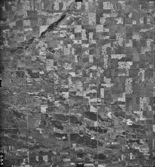
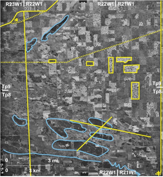
This is the first photograph taken from a plane in this chapter on agriculture; the first three images were all obtained from satellites. Nevertheless, this is a high-level photo with a resulting small scale. It shows the influence of minor landforms and consequently soil variations on land use.
For reference, the Trans-Canada Highway 1 crosses the northwest corner of the photo, as does the CP railway line 2 with the hamlet of Griswold 3 between the two. PTH 21 4 runs southward near Griswold.
Plum Creek 7 meanders across the southern edge of the area with marshy land on either side of it. To the north are the Souris Sand Hills 8 that are mainly wooded (dark-toned). The sand of which they are composed was deposited into Glacial Lake Hind and then blown into dunes when the lake retreated. North again is a ground moraine area exhibiting the characteristic pockmarked appearance 9. Although it is not ideally suited for large-scale grain farming, most of the area has been cleared for agriculture. Light-toned fields 10 have grain crops in them that are close to harvesting or already have been harvested. Some of the dark-toned fields 11 have been left fallow. The linear dark-toned area in the northwest 12 is Alexander Marsh, an old high-level course of the
Two linear features can be seen in the south; both are more obvious when they cross woodland. Running northeast/southwest 13 is a power transmission line and trending west-northwest/east-southeast is the route of an oil pipeline 14. Towards the north is the CN railway line 15.
This agricultural area is very sparsely settled with the only two nucleated settlements being
[[fig. 14.4]]
14.5: An Agricultural Area Northwest of Dauphin
The commonly held perception of
The eastward-flowing woodland-fringed Valley River 8, with several small abandoned channels 9, traverses the southern part. The small settlement of Valley River 10 is located near where PR 362 11 crosses the river.
The photo shows the border between townships 26 and 27 12. This is the boundary between the first and second systems of the DLS with a minor jog between the two systems resulting in a bend on PR 362 13.
[[fig. 14.5]]
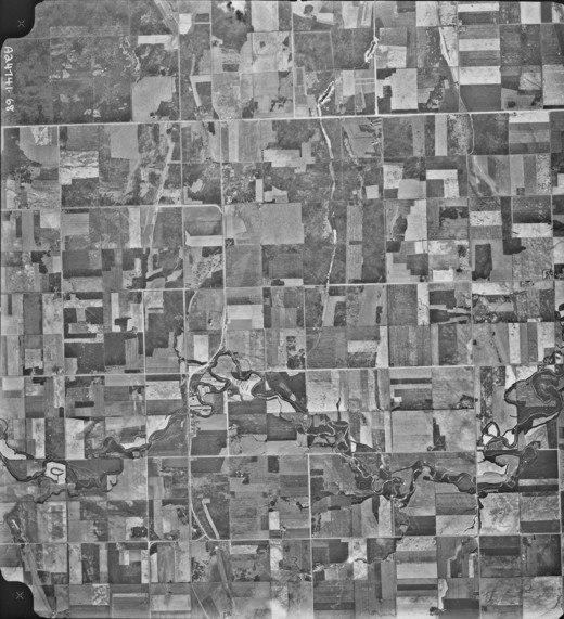
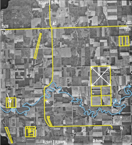
14.6: Agricultural Fields on the Red River Plain
This large-scale photo shows agricultural fields on the upper part of the Lake Agassiz Plain southwest of Carman. Two branches of Tobacco Creek 1, which drains east to the
Parts of nine sections can be seen, and seven of them are divided into quarter sections; in the other two 6 the land division system is disrupted by the existence of the north branch of Tobacco Creek. Despite the fact that the land is generally flat minor variations of relief are picked out by tonal differences. Dark patches represent low-lying wet areas 7, and in some places soil erosion has even occurred 8.
The photograph was taken in late July when most of the grain crops were probably still green, resulting in dark tones. Within quarter sections fields supporting different crops or crops at different stages are identified by slight tonal variations 9. In the southeast one very light-toned field 10 is probably a grain crop that has changed from green to yellow/beige.
Settlement within the area is sparse, with only seven farmsteads 11 visible. One gravel road crosses the area trending east/west 12 with a bend to bypass Tobacco Creek 13.
[[fig. 14.6]]
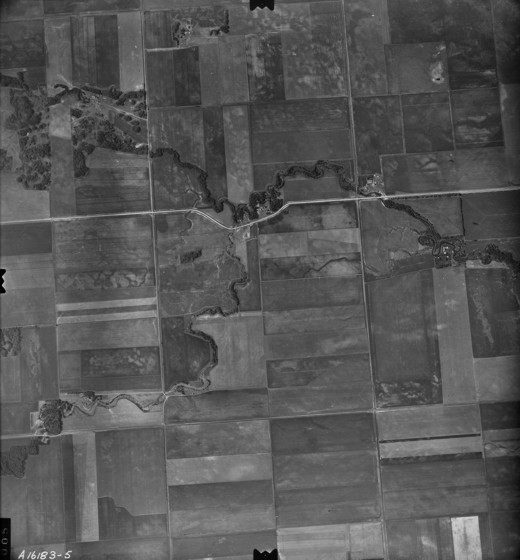
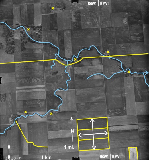
14.7: Agricultural Fields West of Portage la Prairie
Shown on this large-scale photograph are parts of nine sections. Draining northeast across the area is the wooded (dark-toned) course of Willow Bend Creek 1, which eventually enters Lake Manitoba, off the photo to the north. A small tributary enters from the southeast 2, and another small stream drains north to join it 3. The orientation of fields in the northeast 4 suggests the influence of strandlines left as
 and the lines out to the corners are located where the combine turned. Some fields have been left fallow 6. In these and in some cropped fields dark-toned wet patches 7 indicate recent heavy precipitation that may have delayed the harvest. The area is sparsely populated; nine farmsteads 8 can be seen in an area of about six square miles. Crossing the area in the south are three transport lines; the CN railway line 9, the CP line 10, and the Trans-Canada Highway 11 between them. On this old photo the highway is not divided, and the important junction between it and PTH16 12 (The Yellowhead Route) has only one building near it 13.
[[fig. 14.7]]
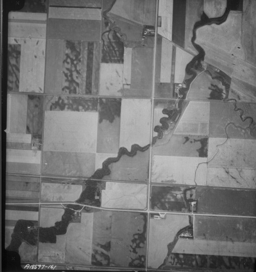
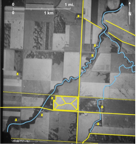
14.8: Harvesting Patterns in Southern Manitoba
 with variations due to field shape 3. Other fields have been combined; the swath has been picked up and thrashed to remove the grain with straw being fed out from the back of the combine. The resulting rows of straw are wider 4 and generally lighter-toned 5 than swaths. In one field 6 the swath has been partly combined; in fact the location of the combine can be seen 7.
This is an area of ground moraine topography with a hummocky surface and several small sloughs 8. A small intermittent stream with wooded banks 9 drains to the south.
Shown here are four full sections with gravel roads along most of the section lines 10. In two cases the division into quarter section is clear 11. The area is sparsely settled with only five farmsteads 12 in an area of just over four square miles. A railway line 13 cuts across the northeast corner.
[[fig. 14.8]]
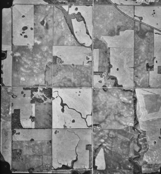
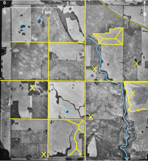
14.9: Harvesting Patterns North of Neepawa
As on the previous photo variations in tone and pattern reflect different stages in processing the crop at harvest time. The area is located east of
Very dark-toned fields 3 have been cultivated, that is; turned over in preparation for next year’s crop. Several fields exhibit the narrow rows 4 typical of swathing, whereas others have wider lighter-toned rows typical of combining 5. In some cases combining is partly completed resulting in fields with some narrow and some wide rows 6, and in one case the combine can be seen 7.
Section lines 8, sometimes followed by gravel roads 9, can be seen as can quarter section lines 10 in some instances. Although settlement is sparse, there are more farmsteads 11—13 in about five square miles—than on figure 14.8. PTH 5 12 and a railway line 13 run north/south through the area. A spur line runs west from the rail line 14. A single grain elevator 15 (identified by its shadow) is located on a siding on the main line with three rail cars on it 16.
[[fig. 14.9]]
14.10: Harvesting Patterns on Ground Moraine North of Rapid City
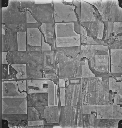
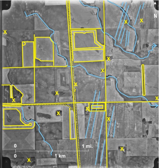
This photo of part of the Minnedosa “pothole” country shows the influence of minor relief features on grain farming. Minor depressions (sloughs), often water-filled 1, inhibit crop growth and harvesting; in an area of less than a half section, bounded by a dashed line 2, there are 45 non-cropped areas (water, marsh, wetland). The distribution of depressions influences the harvesting procedure, resulting in complicated swath line patterns 3.
As on the previous two photos, some land is fallow (mottled tone with light crests 4); some has been swathed (thin rows 5); some has been combined with wide light-toned rows 6 covering almost all the ground surface in some cases 7; and some has been cultivated in preparation for next year’s crop (dark-toned areas 8). The existence of dugouts in fields 9 suggests that some livestock farming is practised in the area.
Section lines, in one case followed by a gravel road 10, can be picked out, but because of the complicated relief, quarter section lines are not so obvious except perhaps in one section 11. Seven farmsteads 12 can be counted in this area of approximately four square miles.
[[fig. 14.10]]
14.11: Haylands Near Oak Lake
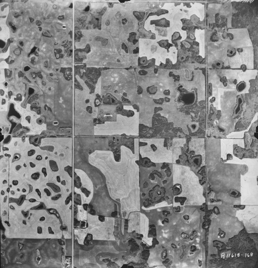
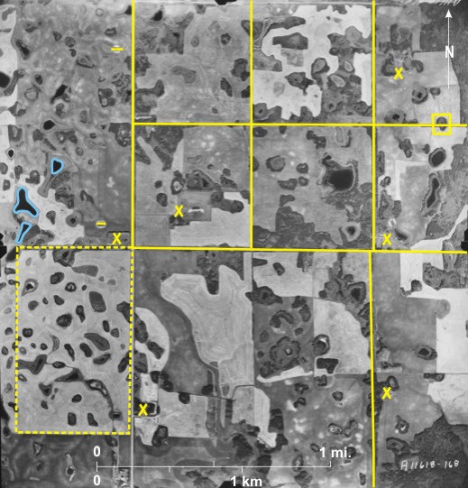
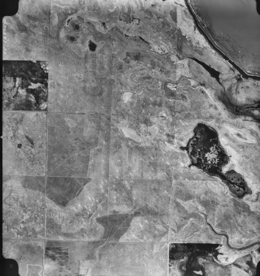
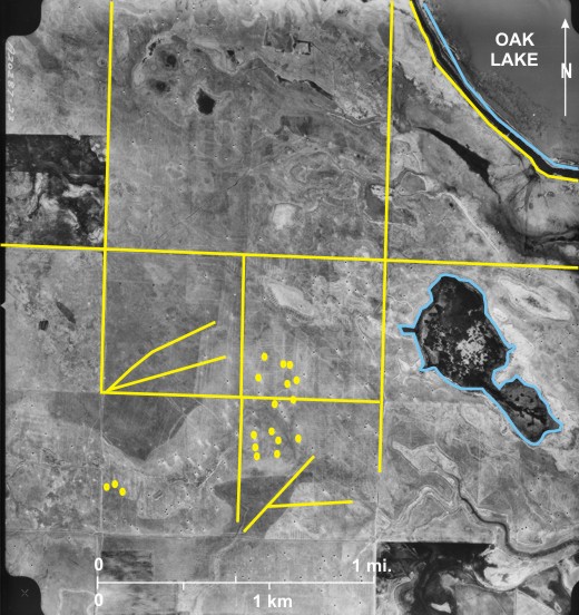
Oak Lake and Plum Lakes are glacial lake remnants in the area formerly occupied by glacial Lake Hind. Land southwest of Oak Lake is very flat with a surface close to the water table resulting in marshy areas 1.
A dike runs along the shore of the lake 2 with a narrow waterway behind 3. Although none of this area is actively cropped for cereals, a slight drop in water table has allowed the land to be used for hay. Lines followed by equipment used when cutting and assembling the hay can be seen criss-crossing the area 4. Small black dots 5 are hay piles throwing shadows due north, indicating that the photo was taken near noon.
Section 6 and quarter section lines 7 are visible, but because of the wet surface there are no settlements in the area.
[[fig. 14.11]]
14.12: Field Patterns Near Eden
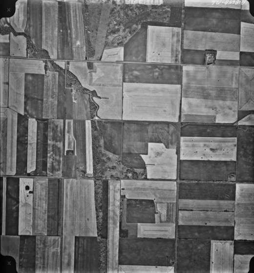
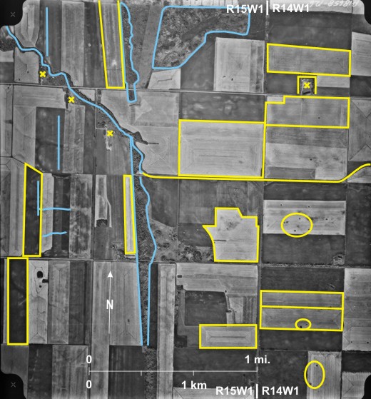
The photo illustrates the influence of minor relief features on the distribution of agricultural land and agricultural practices. To the west is a minor strandline 1that has been left wooded. A small stream in the northwest 2 has been channeled into a ditch in the centre and east 3. The light tone of some of the trees 4—probably aspen (Populus tremuloides)—in a wooded area in the north suggests the photo was taken in the fall. The strandline influences the shape of nearby fields that tend to be long and narrow with a north-northwest/south-southeast trend 5. In fallow fields bald hillcrests 6 delineate other minor strandlines. Land in the western part of the photo appears flat, but there is enough eastward slope to result in soil erosion 7. Perhaps the general north/south orientation of fields is an attempt to control the erosion. In the eastern part of the photo, fields are more regular in shape, if anything, with an east/west alignment 8.
There is no equivalent on this photo to the potholes (sloughs) in figure 14.10, but circular dark-toned areas can be seen in several fields 9. These are bigger than the straw piles in figure 14.11 and are probably stone piles.
The same range of activities can be seen here as in figures 14.8, 14.9, and 14.10. Some fields are fallow (very dark-toned) 10; others have been swathed (light-toned with narrow rows 11); others have been combined (light-toned with wider rows 12); and some are partly swathed and partly combined 13). A field in the northeast has a crosshatched pattern 14 which I cannot explain.
Although most of the area is devoted to crop growth, there are only four farmsteads 15 in the area of about five square miles. One of them has a very well developed shelterbelt with trees on three sides with the fourth open to the road 16.
[[fig. 14.12]]
14.13: Distribution of Farmland in the Little Saskatchewan Valley
The Little Saskatchewan River meanders from northwest to southeast across the area 1. The southwest side of the valley is heavily wooded 2 with generally flat Minnedosa “pothole” country to the south 3. The north wall of the Little Saskatchewan Valley has a deep unexplained embayment 4—surely the tiny, partly channelized 5 stream that drains to the Little Saskatchewan is too small to create something so large. The north valley wall is wooded 6, but it is less uniform than on the south wall. This is a result of the dry microclimate on the south-facing slopes. More woodland exists along the river channel 7.
On the pothole country to the southwest most of the land is cleared for agriculture, as is the floor of the valley away from the channel. Also a small terrace on the east wall of the valley has been cleared 8.
The absence of light-toned fields suggests that the photo was not taken at harvest time (in contrast to figures 14.7, 14.8, 14.9, 14.10, and 14.12). Fallow fields are generally dark-toned 9, but some fields that are not quite so dark 10 probably carry grain crops that are still green.
Some areas are subject to severe soil erosion, as for example along the edge of a low terrace north of the Little Saskatchewan where erosion has reached the gullying stage 11. Further east a small gully has been eroded 12 and the eroded material deposited in an alluvial fan 13. Further north several small channels can be seen in the fields 14. Although the erosion seems severe, it has been controlled because the area is still cropped, often with a combination of flax and canola resulting in a spectacular summer display of pale blue and yellow.[i]
PTH 10 between Brandon and Dauphin crosses the area from south to north 15. The varied nature of the topography makes it difficult to discern sections and quarter sections, but one quarter section can be seen in the northeast 16. A total of seven farmsteads can be seen 17.
[[fig. 14.13]]
14.14: Stubble Burning Near Minnedosa
This photo shows part of the Minnedosa “pothole” country west of Minnedosa. Numerous depressions, some water-filled (the largest is St. James Slough) 1and others covered by marshes 2 and trees 3 make large-scale grain farming with large machinery difficult.
Much of the land has been left fallow 4, or crops have been removed. These areas are dark-toned with light-toned crests 5. Harvesting has been completed, leaving behind various pieces of photo evidence. In the east, lines along which stooks were deposited can be seen 6 as well as straw piles 7. This very old method of harvesting is no longer practised. Prevailing northwest winds have blown loose straw to the southeast, resulting in light-toned areas near the piles 8. Fields in the west are very light-toned 9, resulting from wide rows of straw left after combining.
At the time the photo was taken, a common practice was to burn stubble in the fall to make it easier to work the land in the spring. Irregular dark-toned patches resulting from stubble burning can be seen 10.
Section 11 and quarter section lines 12 can be seen with PR 355 13—almost flooded at this time 14—following a section line, the northern boundary of Township 14. This is a correction line with a westward jog of almost a mile (1.6 km) 15.
[[fig. 14.14]]
14.15: Harvesting Patterns West of Souris
On this fall photo the Souris River 1 runs from west to east. As is usual in southwestern
There are eight farmsteads 16 in this area of about six square miles, several with well-developed shelterbelts to north and west 17. The CP railway line 18 runs across the northern part with a protection fence to the north of it 19, fortified by trees near a farm 20.
[[fig. 14.15]]
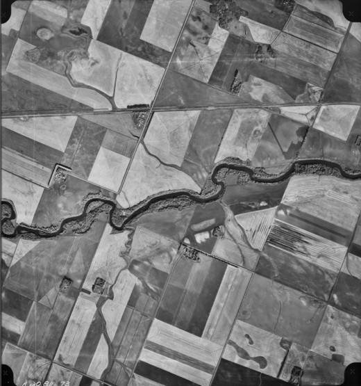
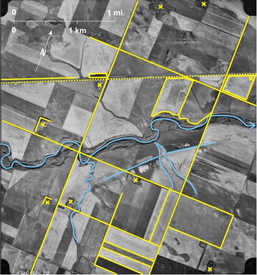
14.16: Stages of Harvesting North of Minnedosa
 or variations depending on the shape of the field 3. In other fields the swathed rows have been combined, resulting in wider rows of straw 4 which sometimes cover almost all the land surface resulting in a very light tone 5. In two cases fields have been partly swathed 6 and in both cases two machines doing the swathing can be seen 7. In another case 8 a field has been partly combined; in this case a combine and a smaller truck that receives the grain can be seen 9.
[[fig. 14.16]]
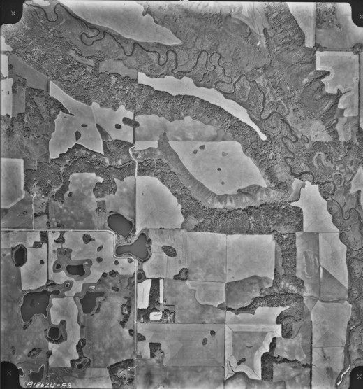
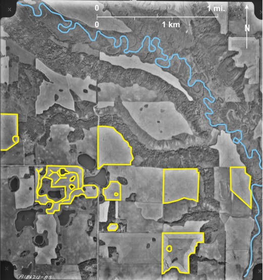
14.17: Reclaimed Agricultural Land Southwest of The Pas
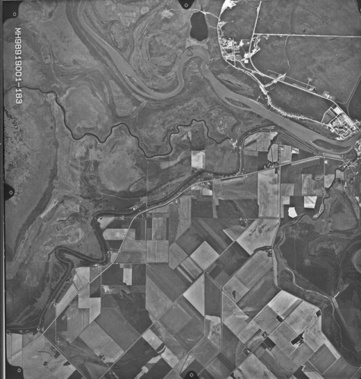
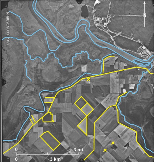
The photograph shows part of the Pasquia settlement where dikes 1 have been built on part of the Saskatchewan Delta and the reclaimed land surveyed into lots for agricultural use, the furthest north in
In the north is the wide, light-toned, sediment-laden Saskatchewan River 2 flowing eastward towards
Land between the
Fields in the reclaimed area have various covers. Some fields are fallow (very dark-toned) 10, others have crops that are still green (not quite so dark-toned) 11, and in others grain that has turned colour is being grown (light-toned) 12. Land north of the
PR 283 15 parallels the
[[fig. 14.17]]
14.18: Reclaimed Slough East of Somerset
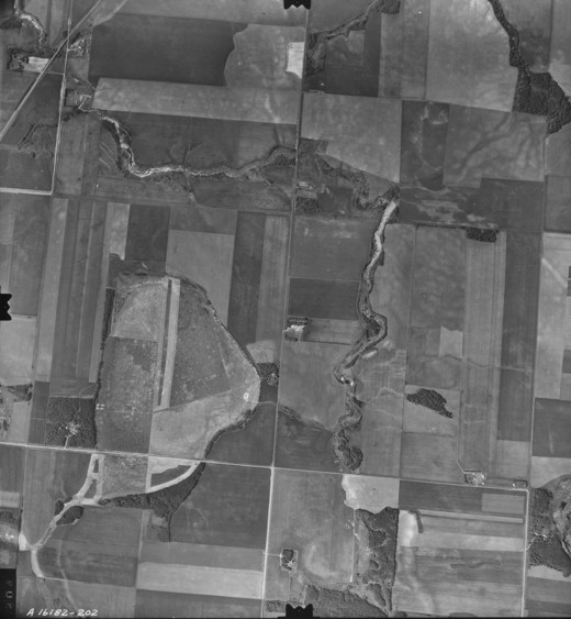
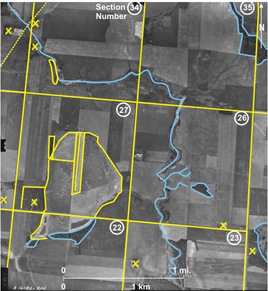
This photograph shows part of the end moraine covering
Most of the land is cropped except for some woodland around the reclaimed slough 6, along the drainage channel 7, and in a few other areas 8. Despite the relative flatness of the area, some soil erosion can be seen 9. The existence of many stone piles in the northeast 10 suggests that although the land is good for arable farming, it is not perfect.
Gravel roads follow section lines 11, and a railway line 12 cuts across the northeast corner. There are eight farmsteads 13 in this area of about six square miles.
[[fig. 14.18]]
14.19: Old Harvesting Techniques Near Treesbank
The deep, wooded valley of the northward-flowing Souris River 1 can be seen in the west. The CP railway line 2 crosses the
Most of the land east of the
Fields are in different stages. In many cases lines along which stooks were placed can be seen 5 along with large straw piles 6. Loose straw has been blown from the piles in a generally southward direction 7. Another field that has been combined 8 has had some of the remaining stubble burned 9. In other fields there is no indication of a crop 10 and one—very dark-toned—11 has been cultivated in preparation for next year’s crop.
Although section lines can be seen 12, there are no gravel roads, and only two farmsteads 13 can be seen in the area of about six square miles.
[[fig. 14.19]]
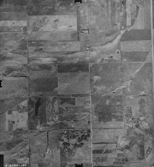
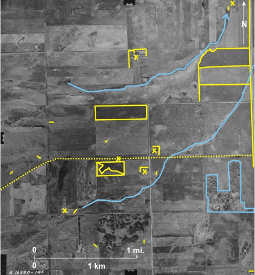
14.20: Dryland Farming Near Lyleton
This area in the extreme southwest of
Indistinct drainage channels 1 lead to the northeast; eventually to Gainsborough Creek that flows to the
In this dry environment dugouts are a prominent feature of the landscape; those in the middle of fields 8 are for livestock use, but those near farmsteads 9 are for domestic use. Farmsteads are few; only five 10 are located in this area of about six square miles. Most have well-developed shelterbelts 11.
PTH 83 runs north/south along the eastern edge 12 and the CP line 13, which ends at Lyleton just off the photo to the west, runs east/west. A single grain elevator (identified from its shadow shape) exists at Cameron 14.
[[fig. 14.20]]
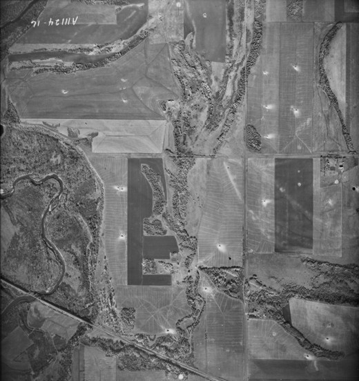
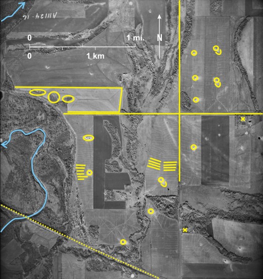
14.21: Field Shelterbelts Near Lyleton
During the drought of the 1930s this dry area of southwest
This high-level photo shows the density of belts in townships 1 and 2, range 28W1 around Lyleton 1. The belts harmonize with the DLS, trending east/west 2 or north/south 3. The photograph straddles the U.S.A./Canada border 4. Although essentially the same land division system exists on either side of the border, the two systems do not coincide exactly. In the extreme north of North Dakota is a tier of part sections 5, and north/south section lines are not continuous at the border 6 resulting in a jog on the north/south PR 256 7. Two small creeks traverse the area from west to east; Antler Creek in the south 8 is the more prominent of the two because of its dark-toned wooded banks. This creek and Gainsborough Creek 9 in the north flow east to the
[[fig. 14.21]]

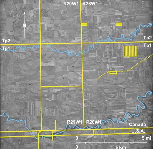
14.22: Irrigation on the Assiniboine Delta, East of Brandon
This near real-colour satellite image shows part of the upper Assiniboine Delta east of
The most obvious features northwest of the
Almost black areas in the northwest 13 and east 14 are sewage lagoons for Brandon (just off the image to the west) and Shilo (just off the image to the east) respectively. Gravel roads mainly follow section lines 15, but the northwest/southeast linear feature in the northeast 16 is PR 340 leading to Shilo. A gas pipeline parallels the road.
[[fig. 14.22]]
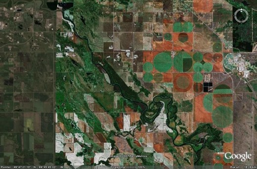
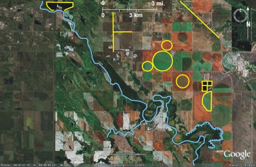
14.23: Irrigation Systems Near Douglas
Irrigation in
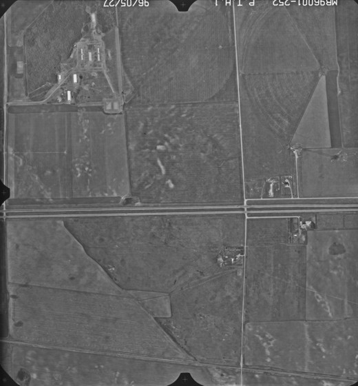
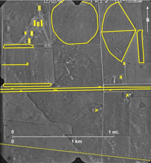
Shown here is part of the Assiniboine Delta surface north of Shilo. The divided Trans-Canada Highway 1 crosses the centre of the area. A truck 2 and a car 3 can be seen proceeding west on the northern lane, and two trucks 4 and a car 5 can be seen proceeding east on the southern lane, a remarkably low density of traffic compared with a similar highway in southern
North of the Trans-
The photograph was taken in the spring so crops will just have been planted. Consequently, many of the fields are the characteristic dark tone of bare fields. In several cases fields are very dark-toned where cultivation has occurred 12. In the case of the half section operation, the fields display five different tones and textures indicating different uses.
The settlement in the northwest is probably a Hutterite Colony 13 with barns, storage sheds, and residential buildings. In addition four farmsteads occur near the Trans-Canada Highway 14.
[[fig. 14.23]]
14.24: Field Patterns and Farming Activity East of Portage la Prairie
A combination of good soils, greater precipitation than the extreme southwest of the province, plus the availability of irrigation water both from surface and underground sources results in more intensive farming here than in the southwest.
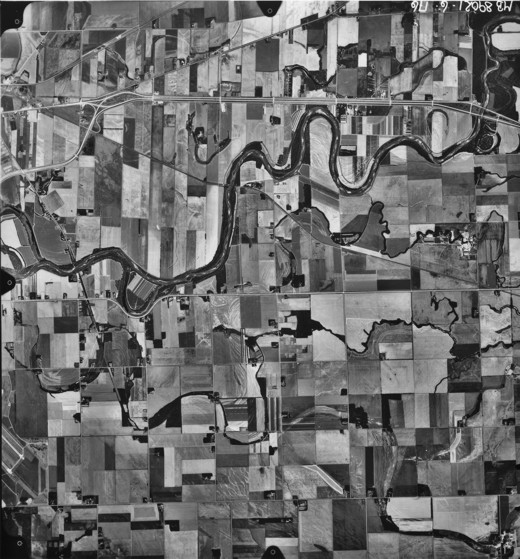
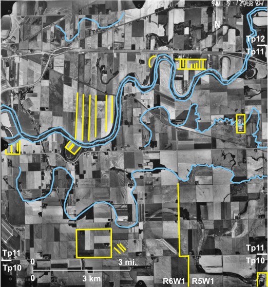
The influence of the long lot system is clearly seen along the eastward-flowing Assiniboine River 1, particularly to the north. Here the system results in a series of narrow strips 2 running back from the river. Superimposed on these are very small fields 3 in which intensive farming of fruits—especially strawberries[i]—and vegetables occurs, often using irrigation water taken from the Assiniboine River.[ii] Also north of the river irrigation water is obtained from palaeochannels of the
South of the river very small fields can be observed at several locations 5 suggesting intensive fruit or vegetable farming under irrigation, sometimes with the Assiniboine as source. However, during the early 1980s diversions of water into the Elm 6,
In the south the influence of the DLS on field size and shape can be seen, but even here sections are divided into several fields 12, in marked contrast to the situation in figure 14.20 in the dry southwest. The correction line between townships 10 and 11 is indicated by road jogs 13. Although the land here is very flat, evidence of soil erosion can be seen in at least one location 14.
[[fig. 14.24]]
14.25: The Frank Skinner Arboretum North of Russell
The Shell River 1 meanders southward in the eastern part of the photo on its way to the
In the southern part of sections 3 and 4, township 24, range 28WI are small fields, hedges, and patches of woodland 8. This is the Frank Skinner Arboretum. It was established by Frank Skinner, pioneer horticulturist, who, over decades, gathered and planted seeds from around the world and nurtured them to full maturity, despite a harsh prairie climate. “Today, this Provincial Historic Site contains nearly 250 plant species introduced to
[[fig. 14.25]]
14.26: Infrared Photo of Agriculture Near Carberry
This large-scale image illustrates the usefulness of colour infrared photographs in the study of vegetation and agriculture. It shows clearly the influence of soil and drainage conditions on crop growth as well as the influence of farm practices on crops. The photo covers four complete quarter sections near Carberry as well as parts of quarter sections to the north, south, east, and west. To the south 1, west 2, and northwest 3 are areas of deciduous woodland—red with mottled texture and rounded shadows. Trees in the southeast are darker 4 and may be under some form of stress, possibly too little water. A light-toned gravel road 5 crosses the area from north to south and is joined by a gravel road from the east 6. Three groups of farm building can be seen 7, the two in the centre being protected by large north/south shelter belts 8 composed of deciduous trees, although a few coniferous trees are identifiable by their pointed shadows 9.
The mottled appearance of several fields 10 indicates that the area is underlain by sandy soils with variable water-retaining ability. Cropping is practised over much of the area with varying degrees of success. In this summer image most crops are at the mid-point of their growth cycle. For ease of identification letters are used to designate fields:
a) the outer part of this field has been cut, probably for hay.
b) this one shows variations in crop growth due to soil differences; higher dry areas support only a poor crop in areas that are yellowish in colour. In the northeast an area of darker red indicates a good crop with east/west rows 11.
The northeastern quarter section is divided into five north/south trending fields:
c) the major variation in crop growth results from soil differences; higher dryer areas particularly in the south support only a thin crop.
d) the bright red of this field indicates a healthy crop, but with poor patches (soil-related) in the north and south.
e) the dark green of this field is indicative of fallow.
f) the faint red colour indicates that there is a thin plant cover.
g) this field is similar to d); a healthy crop is growing with north/south rows and a few poorer patches in the centre.
The southeastern quarter section is divided into three north/south trending fields.
h) patches of poor growth in the south are soil-related, whereas in the centre and north pink flecks may result from the yellow blossoms of wild mustard that was missed during spraying operations
i) this field displays three variations.[i]; pink north/south rows with gaps between them; probably a row crop of corn that has not yet closed allowing reflection from the soil between the rows;[ii] yellow/green patches in the north, south and east resulting from soil variations, probably higher, dryer areas supporting a poorer crop; and [iii] bright red circular patches are weeds, probably Canada Thistle.
j) this field is similar to f). The red colour suggests a plant cover; also seen are lighter patches (higher, drier) and dark areas (lower, wetter).
The southwestern quarter section is divided into irregularly shaped fields, a function of topographic variations:
k) and l) are essentially the same, a faint red indicating a thin plant cover interrupted by many whitish patches of higher, drier land with poor plant growth.
m) this one exhibits the dark green indicative of fallow.
n) the northernmost field is mainly bright red, similar to d). The crop is growing better in the centre than to the east and west where soil deficiencies result in poor growth.
o) this is an irregularly shaped area between cropped fields, probably a belt that has been left in pasture.
[[fig. 14.26]]
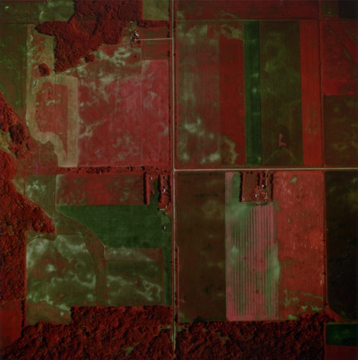
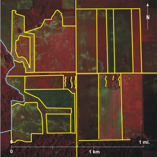
14.27: Agriculture Near Deerwood
This colour infrared photo shows one whole section of land (section 7, township 5, range 7WI) at the foot of
For ease of identification letters are used to designate fields.
a), b), and c) these fields have been left fallow; dark green areas are low-lying and wetter, whereas light tones indicate higher, drier areas.
d), e), f), g), h), and i) are all similar in appearance: a patchy crop is growing on all of them. The light pink northeast/southwest streaks in field f) 9 are areas missed by crop treatment, possibly addition of fertilizer. Such misses used to occur in 1979 when the photo was taken, but would not happen now with modern GPS systems in place.
j), k), and l) exhibit rows of a cut crop; the circular red patches in l) 10 are probably weeds.
m) this large field is in pasture, an interpretation supported by the existence of dugouts (black) in the northwest 11 and centre 12.
n) the dark red indicates a healthy crop, probably a cereal, with a poor patch in the south 13.
o) the field exhibits the characteristic pattern of a field that has been cut.
p) is similar in general appearance to n), with some light pink streaks 14, missed during spraying. There is a distinct variation in this field; the western two-thirds has a much lower and less healthy plant population. This is often due to scleratina wilt that may occur with too tight a crop rotation.[i]
q) the light pink of this field is characteristic of sunflowers. The crop is tall, indicated by the shadow thrown along the western edge of the cut area 15.
r) a field in which some large areas 16 that are light pink have been missed during spraying. This is a remarkable example of sprayer miss. The plants giving the pink appearance are wild mustard. Properly used, a GPS guidance system would eliminate this problem.[ii]
s), t), and u) the three fields may be supporting the same crop but with different levels of success because of treatment. One field, t, seems to be the best, but even it has variations between north/south rows 17. This variation is more marked in u 18 and even more so in s 19 where there may have been some malfunction in seeding.
v) This large field shows one distinct line of stronger growth 20, probably a result of stronger soil fertility.[iii]
The ability of the interpreter to identify and explain the variations discussed enables the farmer to better plan sowing and treatment procedures and to plan for and cope with soil and drainage variations in fields.
[[fig. 14.27]]
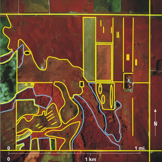
14.28: Agriculture Near a Large Slough in Southwest Manitoba
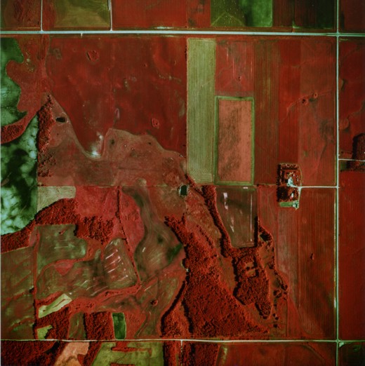
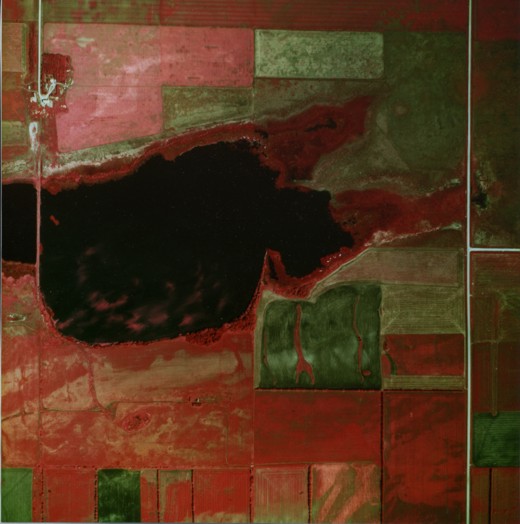
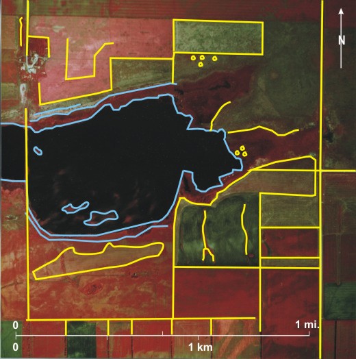
This large-scale colour infrared photo shows the whole of one section fringed by parts of other sections to north, south, east, and west. A light-coloured north/south gravel road 1 can be seen in the east with another gravel road leading off to the east 2. In the northwest another gravel road 3 leads to a group of farm buildings 4 protected by thick shelterbelts of deciduous trees to the north 5 and west 6.
Much of the western centre is occupied by a large slough 7. Water that reflects little infrared radiation appears black, but in the south are red swirls 8 caused by algae growth at, or close to, the water surface. A patch of more dense vegetation is seen in the west 9. A road crosses the western end of the slough 10, but by the time the photo was taken it was little used, indicated by pink vegetation on its surface. The slough is ringed by emergent vegetation 11—marshes and willows (Salix spp), the latter having a mottled texture 12. In the east several hummocks casting rounded shadows 13 are muskrat dens. Light-toned linear areas back from the shore 14 are salt deposits resulting from evaporation. In this hot dry windswept area, shelterbelts have been planted between fields, especially in the south 15.
For ease of identification letters designate individual fields:
a) this is a large field with a pink colour characteristic of canola. A central lighter area 16 may be the result of a delay of a few days when seeding.[i]
b) and c) these fields are fallow with considerable weed growth; rounded patches of weeds 17 are located south of field c).
d) the crop growing in this field has been cut along the edges 18.
e) the distinctive pattern in this field indicates that a crop has been cut.
f) the bright red of this field indicates a healthy crop, some of which has been cut in the south 19.
g) the dark green of this field indicates fallow with red vegetation existing along drainage rills 20 leading to the slough.
h) and i) both fields support a healthy crop with dark-toned patches indicating some form of stress 21.
j) this large field supports a very variable crop; the light-coloured linear area 22 that extends into field g) may indicate a former shoreline of the slough.
Fields in the section to the south are separated by north/south field shelterbelts of deciduous trees 23.
[[fig. 14.28]]
14.29: The Experimental Farm at Brandon
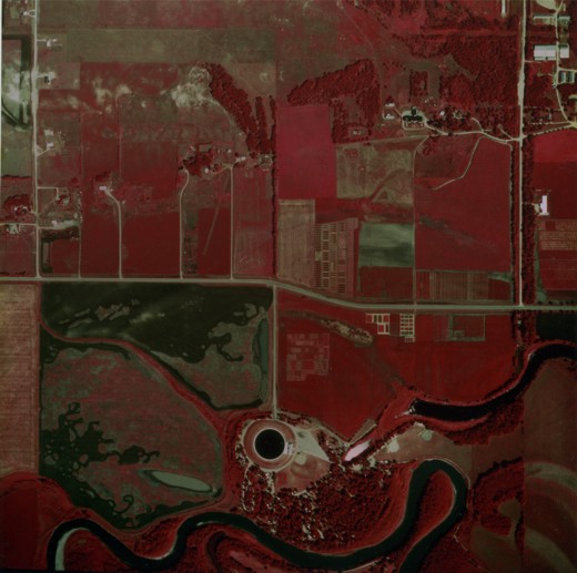
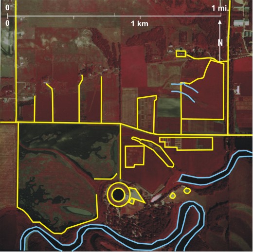
This colour infrared photograph shows an area of about one square mile (one section) extending from the eastward-flowing Assiniboine River 1 in the south, northward across the floor of the
Numerous small experimental plots can be seen on both sides of Grand Valley Road 11 as well as larger fields occupied by uniformly healthy crops (fairly uniform bright red) 12. However, even under controlled conditions topographic 13 and drainage 14 variations produce differences in the crops. A large field in the southwest 15 has been left fallow but has been overgrown by weeds, producing pink colouration 16. The weeds have been removed in some parts by cultivation producing some intricate patterns 17 of dark green/black.
Water reflects little infrared radiation. Therefore the
[[fig. 14.29]]
14.29: Delete this figure
delete
14.30: The Experimental Farm at Morden
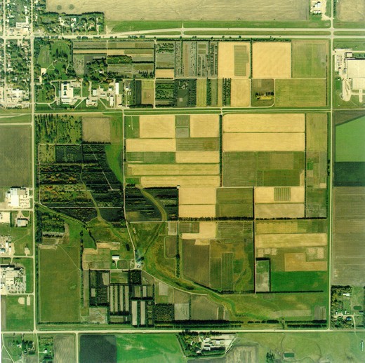
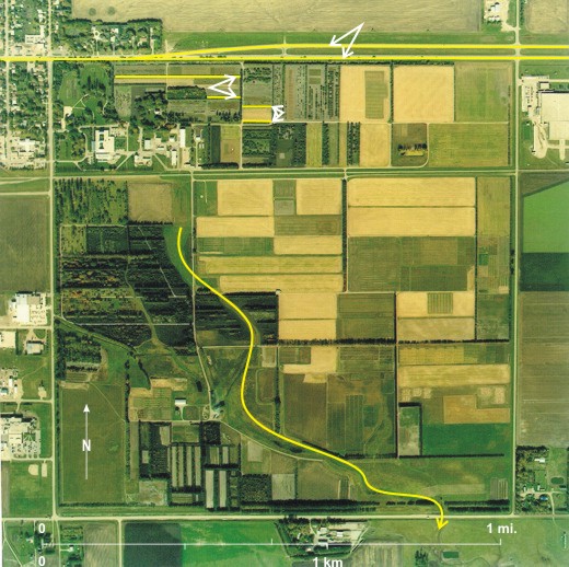
The experimental farm at Morden (official name: Agriculture and Agri-Food Canada Research Station) is one of three federally run experimental farms in
[[fig. 14.30]]
14.30: Delete this figure
Delete