Chapter 13: Mining and Oil Extraction
Most hard rock mining in Manitoba takes place in the north, giving rise to mining towns, some of which (with their associated mines) are shown in Chapter 11: Northern Settlements. Some bedrock is/was exploited in quarries in the south (at Stonewall and Garson). However, “aggregate resources”—mainly gravel and sand—are distributed throughout the province. “The extensive natural deposits of sand and gravel throughout Manitoba are generally related to processes associated with the deglaciation of Manitoba at the end of the last Ice Age…. During deglaciation, sand and gravel accumulated in moraines, eskers, delta complexes, and beach deposits, and along meltwater channels.”[i] For example, the Birds Hill esker-delta complex (figure 3.64) northeast of Winnipeg is the main source of sand and gravel for the city. Oil extraction, confined to the southwest, is detected by surface indicators—pumpheads (grass hoppers), storage tanks, and pipelines. Examples of some of the locations are shown in the following figures.
13.1: Sand/Gravel Pits in a River Terrace, Little Saskatchewan Valley
The valley of the Little Saskatchewan River 1 used to carry large quantities of melt water from
Other features of note on this photo are a) the Little Saskatchewan River with many abandoned channels 4, one of which has a dam across it 5; b) two fields partly combined 6, and in one, the combine and associated truck to receive the grain can be seen 7; c) a cemetery far removed from any settlement 8—Strathclair, six miles to the south is the nearest; and d) burned stubble in the northwest 9.
[[fig. 13.1]]
13.2: Sand/Gravel Pits in a River Terrace in the Little Saskatchewan Valley
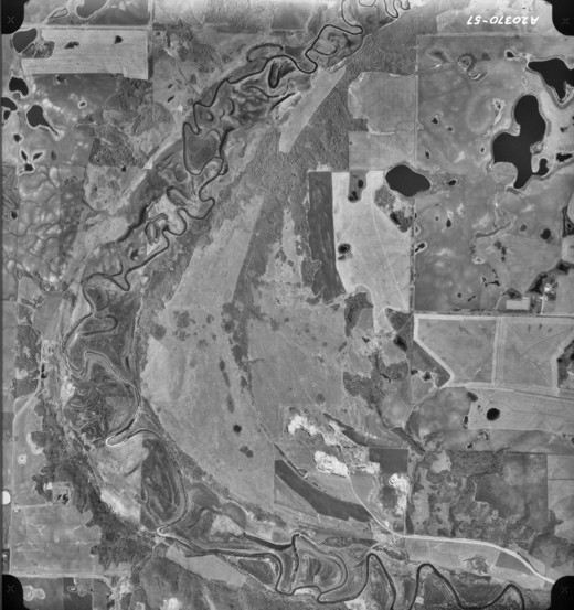
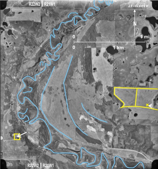
The westward migration of the enlarged post-glacial channel of the Little Saskatchewan River 1 has left behind terraces on the east side of the river 2. The sand/gravel in one of these is exploited in three pits; the southern two 3 with an approaching road 4 seem to be more in use than the northern one 5. Also near the northern edge of the photo, four pits can be seen close to and on either side of the river channel 6 and close to the present river level.
Other items to note on this photo are a) the meandering Little Saskatchewan River with cutoffs of various ages 7; b) the west side of the valley with east and north facing slopes, heavily-wooded 8, compared with the sparsely-wooded east site 9 with dry west and south-facing sites; and c) harvesting underway with some swathed fields 10 with narrow rows and some combined fields with wide rows 11 (In two cases 12 fields are partly combined with the combine visible in one of them 13.). The topography makes it difficult to discern section and quarter section lines.
[[fig. 13.2]]
13.3: Sand/Gravel Pits East of Rapid City
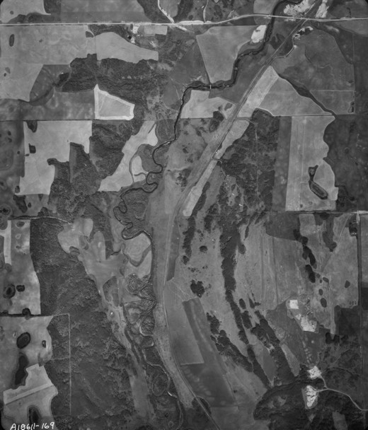
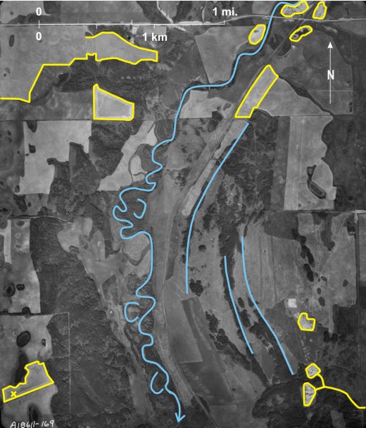
The photograph shows the valley of the Little Saskatchewan River 1 in the north with an area covered by ground moraine in the south. The photo shows four areas where sand/gravel is—or has been—exploited. Three of these areas 2 are probably on terraces of the Little Saskatchewan Valley, but the easternmost, the highest, exploits an esker-like feature 3. There are in fact four separate pits in this area, strung out in a north-northeast/south-southwest line. The southernmost pit 4 is overgrown but the other three—light-toned—pits 5 are in use, served by a road 6 that runs to PTH 24.
Other features to note on this photo are a) the Little Saskatchewan River with numerous cutoffs 7; b) PTH 24 8 connecting Rapid City (to the west) and Minnedosa (to the north); c) three railway lines (In the north are a CP line 9 and a CN line 10 that cross just east of the Little Saskatchewan River 11.; both are now abandoned. In the south is another CP line 12); and d) a cemetery 13 with a surrounding hedge of coniferous trees 14. Small white specks 15 are headstones and graves. The cemetery is that of
[[fig. 13.3]]
13.4: Sand/Gravel Pits in the Assiniboine Valley
On this photo of the extreme west of
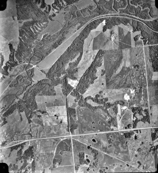
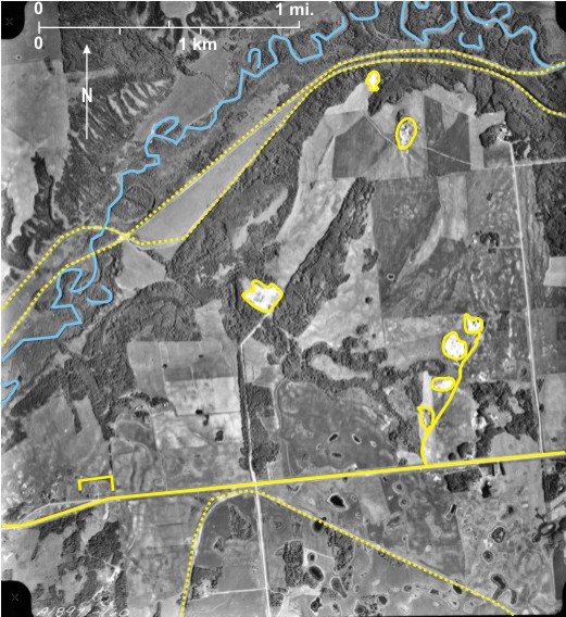
A large pit (light-toned) 4 is located on the north side of a west bank tributary of the
Other features to note on this photo are a) the meandering Assiniboine River with clearly defined scroll bars 11 and cutoffs 12; b) the west wall of the spillway, heavily wooded 13, with the drier east wall mainly grass-covered 14 with occasional patches of trees 15; c) a road out of the Assiniboine Valley (PR 579) with a hairpin bend 16—unusual in southern Manitoba; d) the Manitoba/Saskatchewan border near the western edge of the photo marked by a dashed line, but there is no ground expression of its existence; and e) a small cluster of buildings 17, all that remains of Millwood. In the past Millwood had a sawmill, a gristmill, and an elevator with 40,000-bushel capacity: “Farmers from as far away as 80 km [50 miles] hauled their grain to the flour mill.”[i] Another local industry was ice cut from the river and used in iceboxes before refrigerators became the norm. “In 1915, 600 railway cars were loaded with ice shortly after though the company’s [Arctic Ice Company of
[[fig. 13.4]]
13.5: Sand/Gravel Pit on the Assiniboine Delta
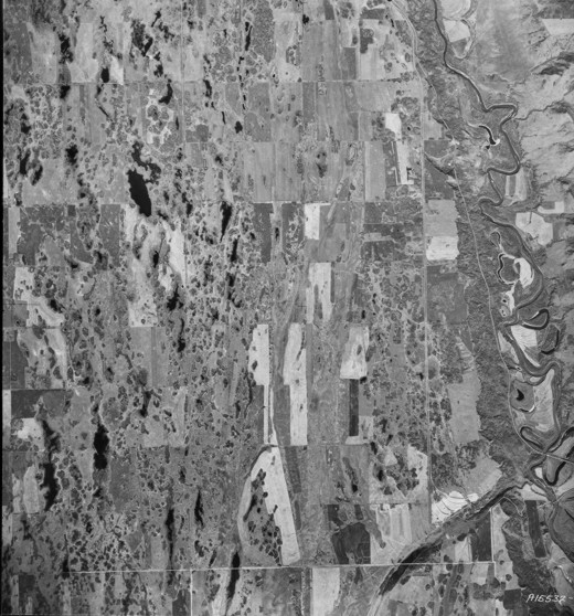
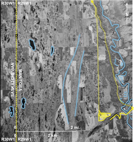
The Assiniboine Delta deposited into the west side of glacial
Other points to note on this photo are a) PTH 34 5 between Holland (to the south) and Austin (to the north) is cut into the sands of the delta 6; b) delta sands have been blown into dunes north of the river 7; these are now stabilized by a mixture of grasses (light-toned) 8, deciduous woodland (dark-toned) 9 and coniferous trees (identified by their triangular shadow) 10; c) the south side (north-facing side) of the Assiniboine Valley is heavily wooded by deciduous trees (dark-toned with rounded crowns) 11; d) fields that have been cleared for agriculture are medium-dark toned 12, indicating that the crops in them are still green and that the date of the photo is pre-harvest; and e) one field is in the process of being cultivated 13; the cultivated part of the field is darker-toned 14, and by using a magnifying glass with the original photo, the machine doing the cultivating can be seen 15.
[[fig. 13.5]]
13.6: Sand/Gravel Pits in the Upper Part of the Assiniboine Delta East of Brandon
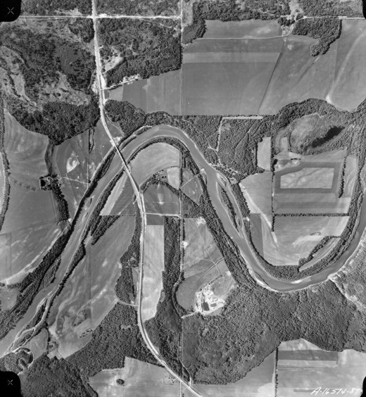
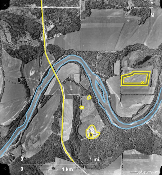
The area is located three miles (5 km) east of the built-up area of
Several other items can be seen on the photo. The land surface is very dry because of the permeability of the underlying sediments. This results in sparse patchy natural vegetation in the form of clumps of trees (dark-toned) 15. The land is used to graze cattle, evidenced by the abundance of dugouts 16. The only evidence of crop growth is in the southeast where cut lines are seen 17, possibly of hay. There is little evidence of human occupation; only three groups of buildings can be seen 18, that in the extreme northeast is associated with an industry. Gravel roads run along some section lines 19, and in one place quarter sections can be identified on the basis of land use differences 20. In the southwest is the route of a long-abandoned railway line 21.
[[fig. 13.6]]
13.7: Sand/Gravel Pits in Lake Agassiz Strandlines
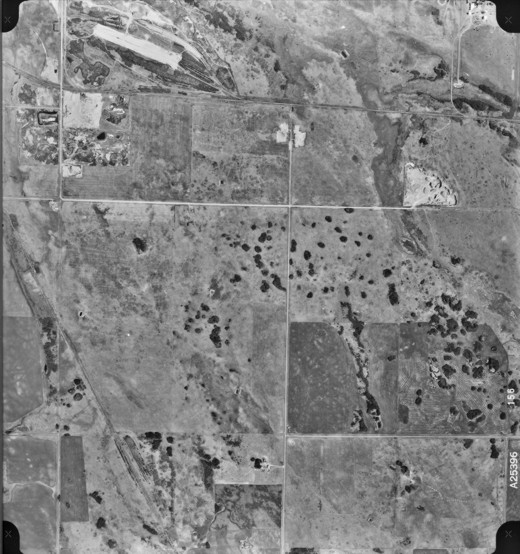
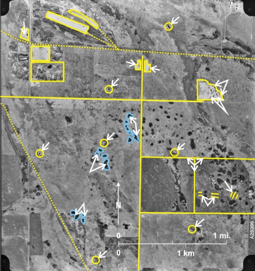
The enormous glacial
On this photo a prominent strandline extends northwest/southeast 1 and is followed by a secondary gravel 2 road, its direction being a rarity in southern
Other points to note on this photo are: a) the CN railway line in the south 6; b) the mottled surface of fields underlain by sandy soils 7; and c) some cultivated fields, resulting in a very dark tone 8.
[[fig. 13.7]]
13.8: Sand/Gravel Pits in Lake Agassiz Strandlines Northwest of Miami
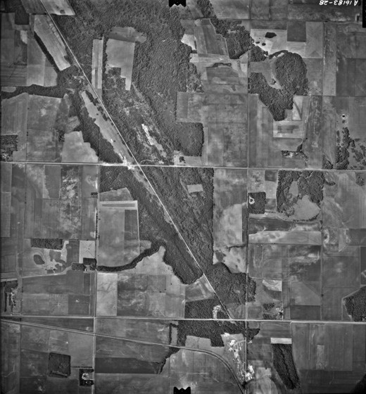
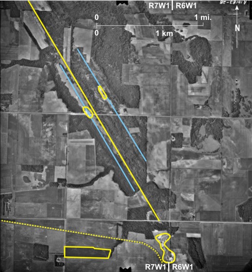
Two prominent
Also noticeable on this photo are: a) the wooded eastern escarpment of Pembina Hills 7; b) the headwaters of the eastward-flowing Tobacco Creek 8; and c) a loop followed by the CN line 9 as it climbs up the Pembina Escarpment from Miami to Deerwood.
[[fig. 13.8]]
13.9: Quarries at Stonewall
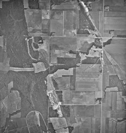
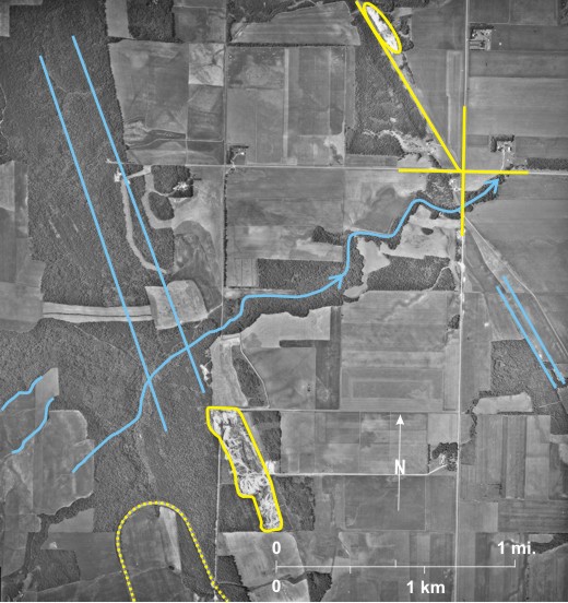
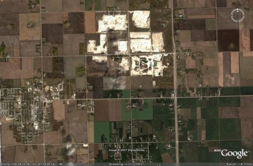
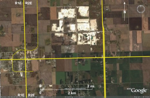
Quarrying of Ordovician aged limestone began in the Stonewall area in the 1800s. After being blasted from the ground, the limestone was broken down into small pieces that were heated in kilns to produce quick lime (calcium oxide). In the 1960s Stonewall began to move away from its dependence on limestone, but the heritage is preserved in prominent limestone buildings along
Most of the town of
[[fig. 13.9]]
13.10: Quarry at Garson
“The distinctive mottled pattern of the fossil-bearing Tyndall stone, an Ordovician dolomitic limestone, makes it Manitoba’s best known building stone…the name ‘Tyndall stone’ is derived from the name of the railway shipping point, approximately 3 km east of Garson, from which the quarried material was originally shipped.”[i] Shown on the photo is the small community of Garson 1 with PTH 44 2 bypassing it to the north; note that there is no sign of a railway line. The quarries 3 are located east of the community; the large grey building 4 is a shed in which the stone is prepared for market. Piles of stone are located around the building. “The Tyndall stone deposit lies in layers or beds, with the top layer located eight to fourteen feet below the ground level;”[ii] hence, the quarries are shallow with no very obvious backwall. Disused quarries, north of the existing quarry, are filled with water 5.
“Tyndall stone was first used in the construction of Lower Fort Garry in 1832”, later it was used in “St. Andrews Anglican Church, the oldest active stone church in western Canada, built in 1845.”[iii] It has also been used in many other prominent government, commercial and educational buildings including the
In addition to the quarry other things to note are that:
1) roads run north/south 6 and east/west 7 in Garson harmonizing with the DLS system, and
2) the large grey building in the north is probably an arena 8.
[[fig. 13.10]]
13.11: Gravel Pits and Oil Extraction West of Virden
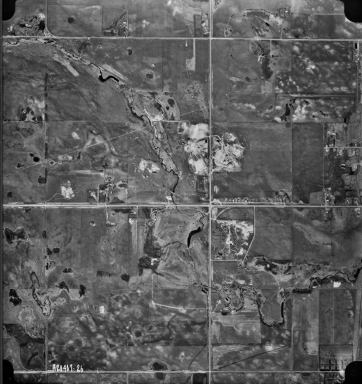
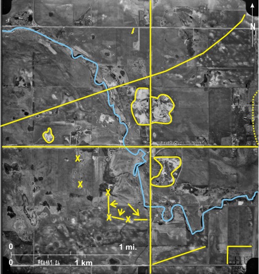
The photo shows topography west of Virden, the edges of which—fringed by the north/south CN line 1—can be seen at the right-hand edge of the photo. The small stream Bosshill Creek 2, tributary to the
Virden is the centre of
Other features to note on this photo are: a) a nine-hole golf course with dark-toned greens 14; b) Virden’s cemetery near the southern edge 15; c) light-toned crests in fallow fields with sandy soils 16; d) some cultivated fields resulting in dark tones 17; and e) a radio tower with a shadow falling to the northeast 18 indicating the photo was taken in the afternoon.
[[fig. 13.11]]
13.12: Oil Storage Facility at Cromer South of Virden
Other items to note on this photo are: a) Pipestone Creek 8 now very small but once larger as indicated by water-marked areas 9 on both sides of the present channel; b) the small hamlet of Cromer 10 just south of Pipestone Creek; c) the CN railway line roughly paralleling Pipestone Creek 11; d) a long abandoned railway line running northwest/southeast 12; e) gravel roads including PR 355 13 following some section lines; and f) extensive areas of pitted ground moraine 14.
[[fig. 13.12]]
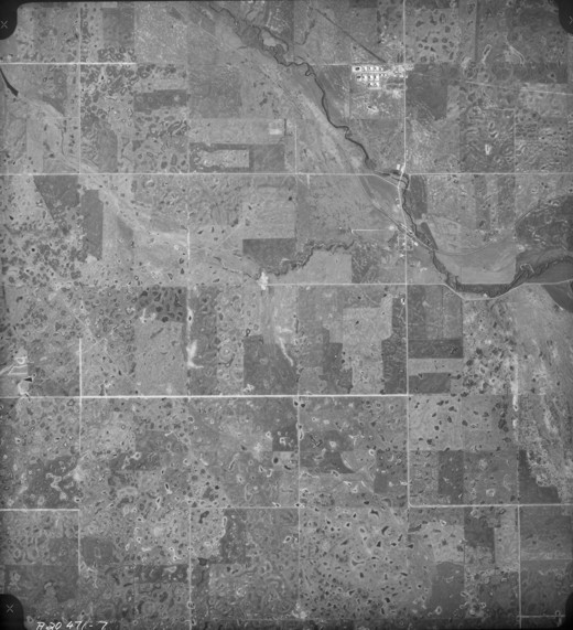
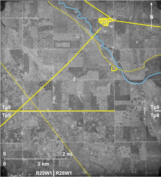
13.13: Enbridge Oil Storage Facility Near Gretna: Small-scale Satellite Image
The Enbridge oil pipeline runs between
Also shown is the international border 6. Note that although Canada and the United States have the same land division system, the two systems do not coincide, resulting in a jog 7 of a north/south road (18 in the U.S.A. 8 and PTH 30 9 in Canada). The sections of the DLS system are obvious 10 with gravel roads along some section lines 11. Quarter sections are usually picked out on the basis of land use differences 12, although most sections in this agriculturally rich area are divided into many fields 13.
[[fig. 13.13]]
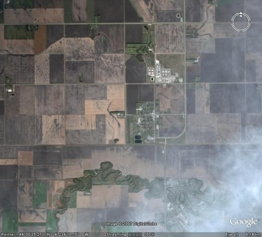
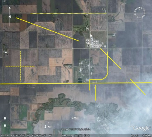
13.14: Enbridge Oil Storage Facility Near Gretna: Large-scale Air Photo
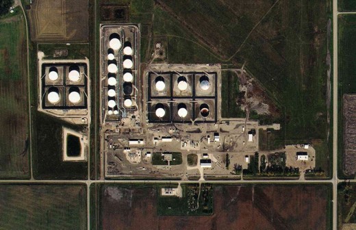
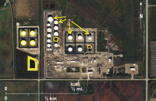
This air photo shows detail of the storage facility. In the west are four large tanks 1 with a pond 2 to the south. In the east are at least 18 tanks 3; those painted white are easily picked out, but a black-painted tank 4 is not so obvious. Shadows fall almost due north 5 indicating that the photo was taken near noon.
[[fig. 13.14]]