Chapter 10: First Nations Settlements
The two driving forces influencing the layout of settlements in southern
10.1: The Location of St. Theresa Point
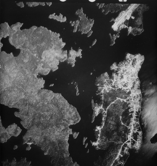
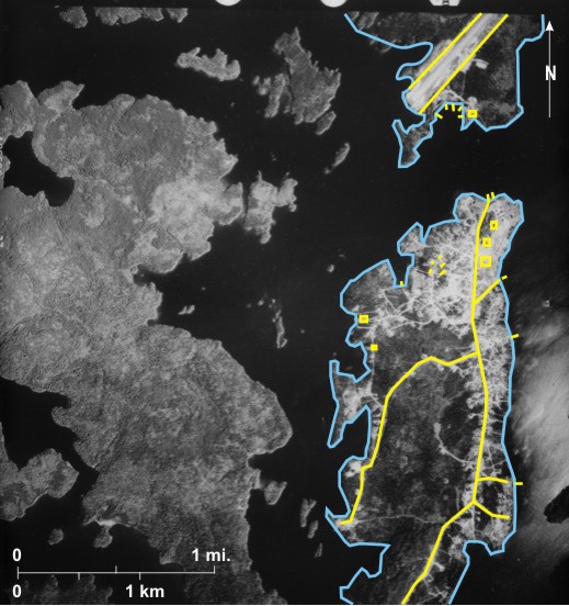
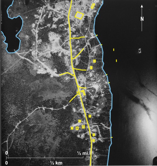
The St. Theresa Point First Nation is one of three—St. Theresa Point, Wasagamack, and Garden Hill—located at the west end of Island Lake in northeastern Manitoba, about 470 air kilometers northeast of Winnipeg. The landform,
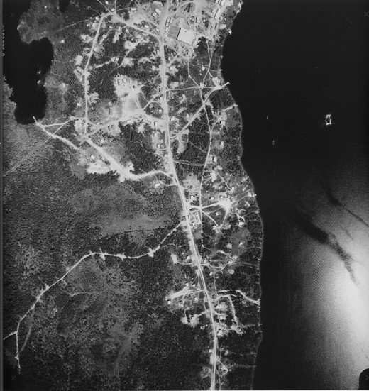
This medium-scale photo shows the St. Theresa Point First Nation. Which “is not on the
There are also dock facilities for floatplanes and “in mid-winter months the reserve is also accessible by winter roads constructed across the lake from Garden Hill and then south along the eastern shore of
In 2006 the population was 2,632. The photo shows clearly the absence of any road pattern. One roughly north/south road 4 runs along the peninsula with side roads 5 off to the coast where jetties are located 6. Those in the north 7 serve boats traveling across the strip of water separating
This area is located in the
[[fig. 10.1]]
10.2: The Central Section of St. Theresa Point
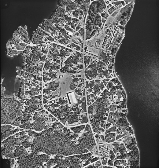
This large-scale photo shows the central part of the St. Theresa Point First Nation. It was taken at an earlier date than figure 10.1, a point that is made obvious by inspection of the peninsula 1. In this photo there are only two small clearings, but on figure 10.1 several houses can be seen. The larger scale of this image enables identification of more detail than on 10.1 For example, several jetties can be identified 2, and in at least three cases, small boats can be seen beside them 3. Also two small boats can be seen offshore in the northeast 4. The main north/south road 5 with numerous side roads 6 can be identified, as can numerous rectangular dwellings 7. In the north is a cluster of larger buildings 8, one of which 9 seems to be in the process of construction. Nearer the centre of the photo are several long narrow objects on both sides of the road 10 which may be storage tanks for diesel fuel. Note specular reflection from the water surface in the southeast 11.
[[fig.10.2]]
10.3: St. Theresa Point, Northern Section
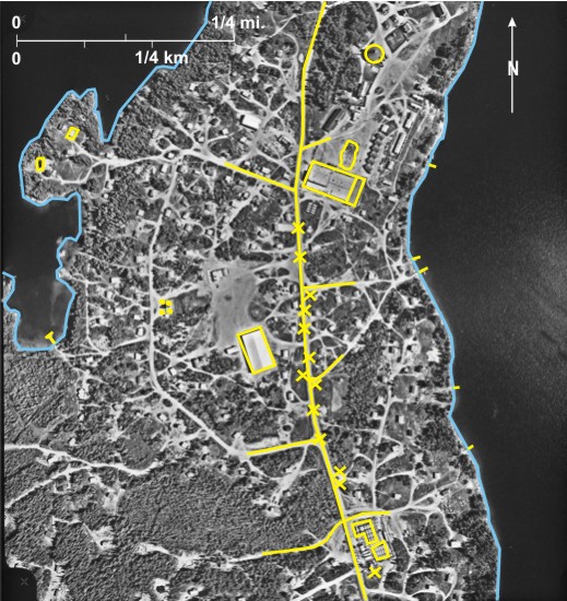
This very large-scale image was obtained after the photo in figure 10.2. Given the large scale of the photo much detail can be identified. For example individual dwellings 1 can be identified on what was an uninhabited peninsula in figure 10.2 Also the main north/south road 2 with side roads leading from it 3 can be identified; in 1992 there were approximately 6.7 km of internal roads on the point.[i] The scale is large enough that several trucks 4 can be seen on the road. Jetties are located around the coast 5; that in the west has at least four boats moored at it 6.
The large building under construction in figure 10.2 is now complete 7; the nearby hockey rink 8 suggests that it might be a school. North of this are several large buildings, one with a pointed roof 9 that may be the band office. In the centre of the photo a large building has been constructed 10 on what was wooded land in figure 10.2
Scattered throughout the photo near large buildings are cylindrical structures, some vertical 11 and some horizontal 12, with a large cluster in the southeast 13. These are probably diesel storage tanks; the large cluster has near it several large poles 14 indicated by their shadow.
The fact that shadows fall just north of west indicates that this is an early morning photo.
[[fig. 10.3]]
10.4: Norway House
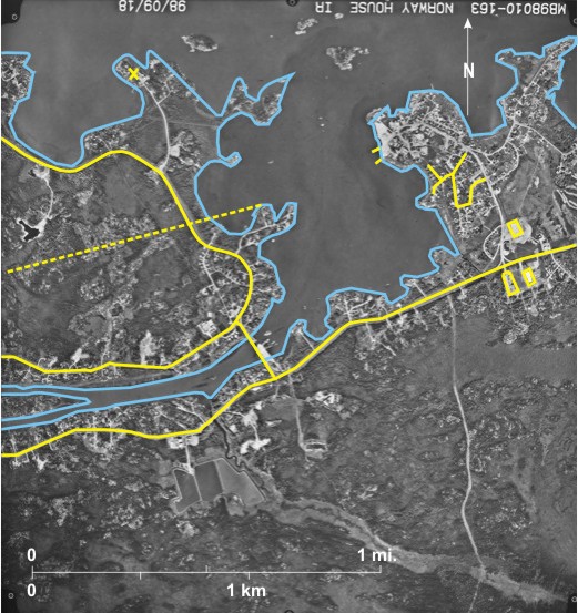
The Norway House Cree Nation (population 4,071 in 2006) is located at the northern end of
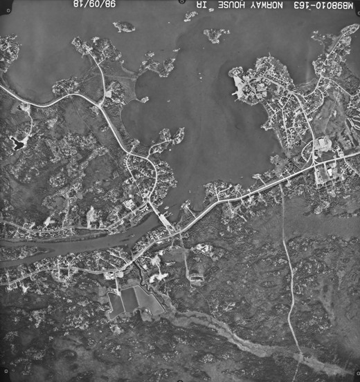
As is characteristic of First Nations reserves, there is no real road pattern. Some individual dwellings are located in a bend of PR 373 8. Also numerous dwellings are located on short side streets off Walter Margaret Road 9 and Paupanekis Road 10 and the northern part of PR 373 11.
In the north is the settlement of Rossville 12. Dwellings are located along roads that have a haphazard arrangement 13. There are also two large buildings, one of which is the Norway House Cree Nation office 14 and the other probably a school 15. Other large buildings at the end of a peninsula 16 are probably associated with the numerous jetties 17 in the area. The RCMP office is located on another peninsula 18 outside the First Nation.
[[fig.10.4]]
10.5: Cross Lake First Nation
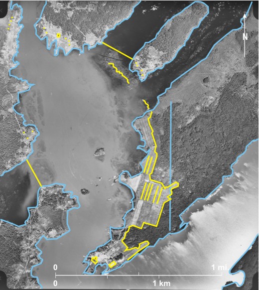
The Cross Lake First Nation along with Norway House and the First Nations of Island Lake is one of the larger First Nations in terms of population (3,854 in 2006) in northern
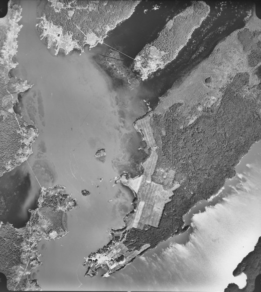
The photograph shows part of the First Nation located on either side of a channel between
Tonal variations in the water suggest that the water level has risen, flooding areas previously above water 16. A north/south linear feature 17 is probably the route of a hydro line, but the function and origin of light-toned squiggly lines 18 is unknown.
[[fig.10.5]]
10.6: Part of South Indian Lake
The First Nations settlement of South Indian Lake (population 857 in 2006) is located at the south end of Southern Indian Lake on the east side of a channel leading to South Bay 1. The photo shows the central part of the isolated settlement. It is, however, served by a ferry which travels south across South Bay to link with a gravel road which in turn leads to Leaf Rapids on PR 391 (between Thompson and Lynn Lake). It is also served by floatplanes. On the photo two large jetties can be seen 2 that may serve as terminals for these services. Other smaller jetties 3 also occur especially in the north.
The buildings of the settlement are strung out along a road that roughly parallels the lakeshore 4. Two residential bays are seen in the south 5 with more residences along side roads in the north 6. Also in the north are several large buildings, one of which may be a school 7 with a hockey rink 8 nearby.
The small island in the west 9 has a clearing 10 along which a hydro line runs. Its continuation on the mainland is not obvious but the shadows of hydro poles 11 can be seen in several locations. Although there are several roads, only one vehicle 12 can be located. The settlement lies within the northern coniferous forest zone.[i] Coniferous trees can be identified by the shape of their shadows in locations along the shore 13.
[[fig. 10.6]]
10.7: Oxford House
The Bunibonibee Cree Nation (population 1,947 in 2006) lies at the northeast end of
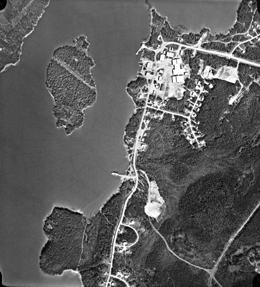
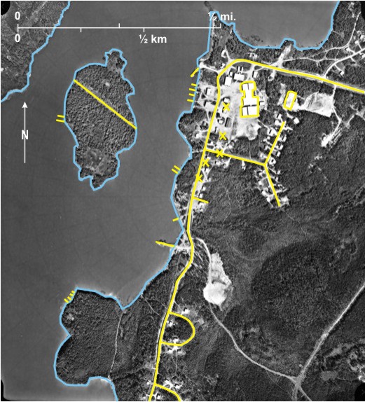
The photo shows the essential elements of many northern reserves: settlement strung out along a road parallel to the shore 4 with a nearby gravel landing strip 5. The northeast/southwest strip about 5,000 feet (1,524 m) long is not well-oriented given the frequency of northwest winds in this area, but it is probably all that was possible given the lay of the land and water. Oxford House is also served by floatplanes and by winter roads that link it to
Tracing the settlement from south to north there is first a cluster of residences at Hyers Point 6 followed by a gap to the east 7; then a string of settlements between the lake shore and the road 8 with a large building—possibly a school 9—at the south end. Numerous paths lead down to the lakeshore from the residences 10. In the north the road veers away from the lakeshore with numerous residences along it 11.
This northern part of
[[fig.10.7]]
10.8: Red Sucker Lake
This very large-scale photo shows part of the small Red Sucker Lake First Nation (population 845 in 2006) located in northeastern
As is usually the case with northern First Nations settlements, a landing strip—about 2,000 feet (609 m) of which are shown—is located just outside the community 2. The strip is oriented east/west; just to the south of it is a turning circle 3 for planes in front of a terminal building 4, and to the east are fuel storage tanks 5. The community is also served by floatplanes and by a winter road to
[[fig.10.8]]
10.9: Brochet
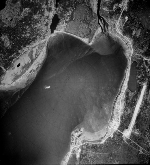
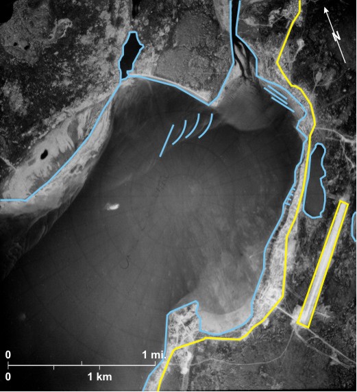
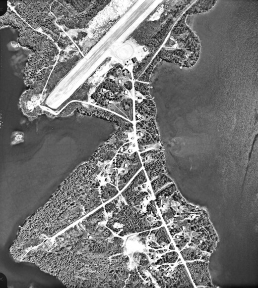
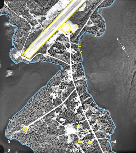
The photo shows the small isolated community of Brochet of the Barren Lands First Nation (population 306 in 2006) located at the north end of Brochet Bay 1, a branch of
The community is located near the northern edge of the
[[fig. 10.9]]
10.10: Brochet in 2006
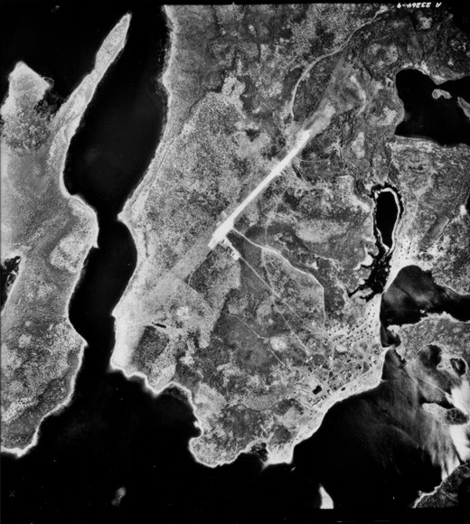
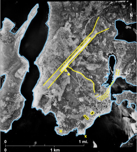
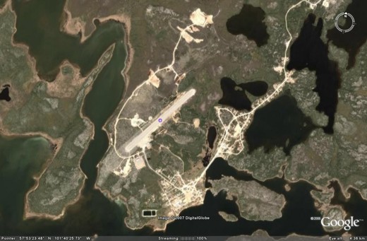
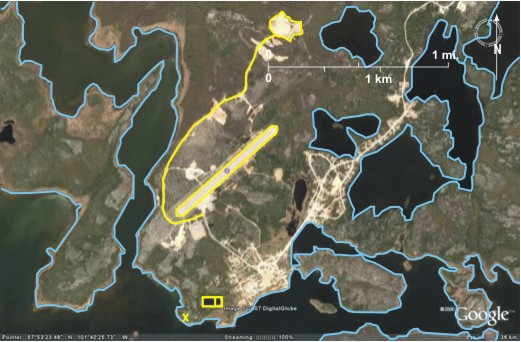
This satellite image obtained from Google Earth in 2006 enables assessment of changes that have taken place since the photo in 10.9 was taken in 1973. The most obvious changes are:
1. More roads can be seen in the main part of the settlement 1.
2. Sewage lagoons 2 are now located south of the settlement.
3. There are more roads and houses in the northern part of the settlement 3.
4. A road runs west 4 and north 5 of the runway leading to a clearing 6 in the north.
5. The runway has been lengthened slightly in the north 7, but the fan-shaped clearing seen on 10.9 (#13) has disappeared.
[[fig.10.10]]
10.11: The Peguis First Nation
The photograph shows part of the First Nation (population 2,513 in 2006), the largest in
PR 224 5 runs roughly parallel to the river with a cluster of settlements in Peguis 6. Planted deciduous trees shelter a central area 7. Most of the buildings are too large to be individual residences; this is probably the administrative centre of the large First Nation 8. Smaller individual residences are scattered along the river 9 and PR 224 10. A large racetrack 11 with associated buildings 12 can be seen in the south. Surprisingly a second road parallels the west bank of the river 13 with individual residences between it and the river 14.
The
[[fig. 10.11]]
10.12: The Fisher River First Nation
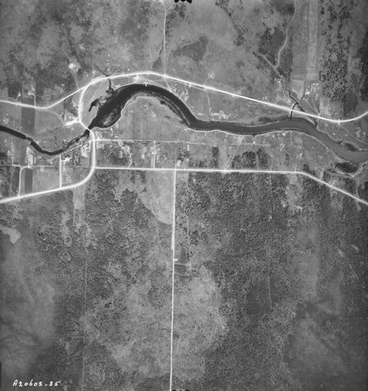
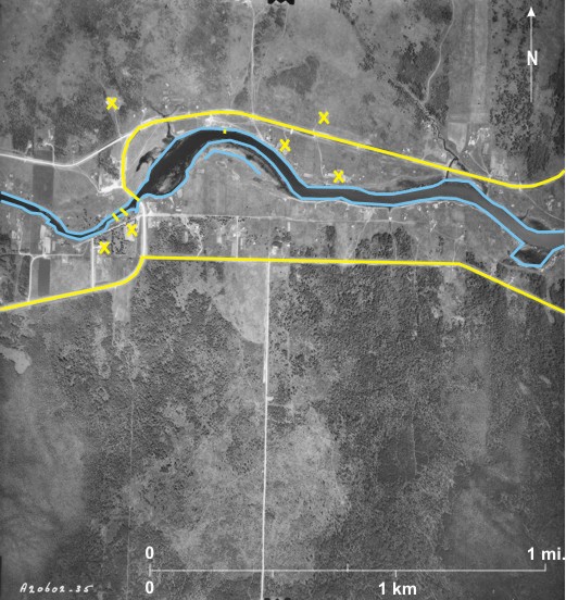
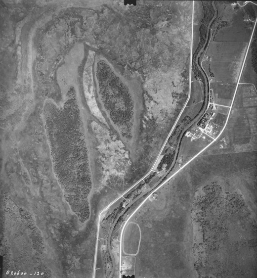
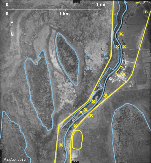
The First Nation (population 1,173 in 2006) is located on either side of the eastward-flowing Fisher River 1 where it enters
The photo shows part of the reserve just above
Settlement in the area is very dispersed; there is no obvious centre, although some large buildings occur west of the bridge 8. Individual dwellings 9 occur on both sides of PR 224 10 in the north, and a jetty is seen in one location 11. South of the river, dwellings occur between a gravel road 12 and the river.
The stretch of river below the bridge is affected by water level fluctuations in
[[fig. 10.12]]